Electronic Map of the Railway Traction Network

Electronic Map of the Railway Traction Network

Case studies

Electronic Map of the Railway Traction Network

Client

Industry

Energy & Utilities

Region

Polska / Europa

Technology

ESRI ArcGIS Maps SDK for JS, C# .Net, C# .Net Framework React, Angular, Xamarin, Microsoft SQL

Overview

Client: PKP Energetyka / PGE Energetyka Kolejowa

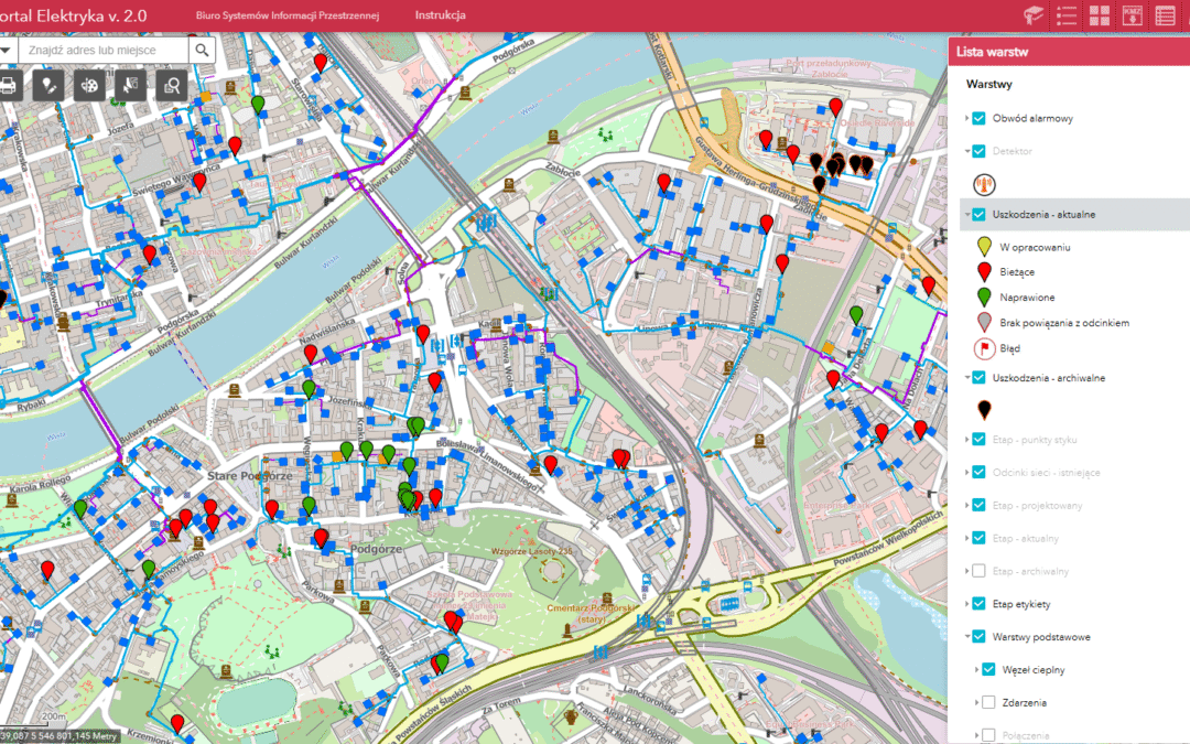
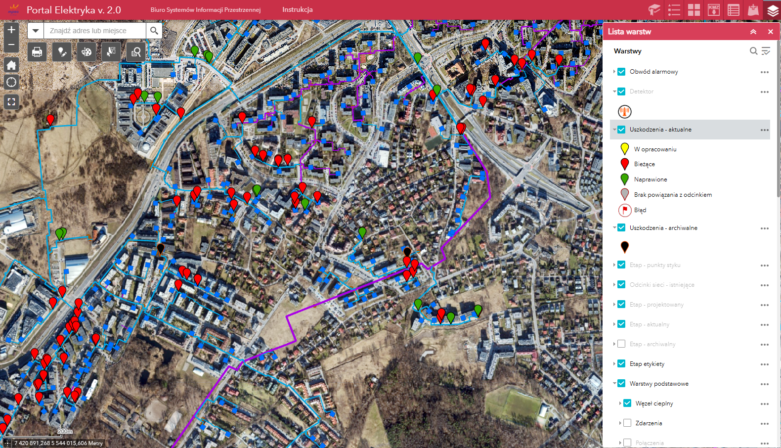
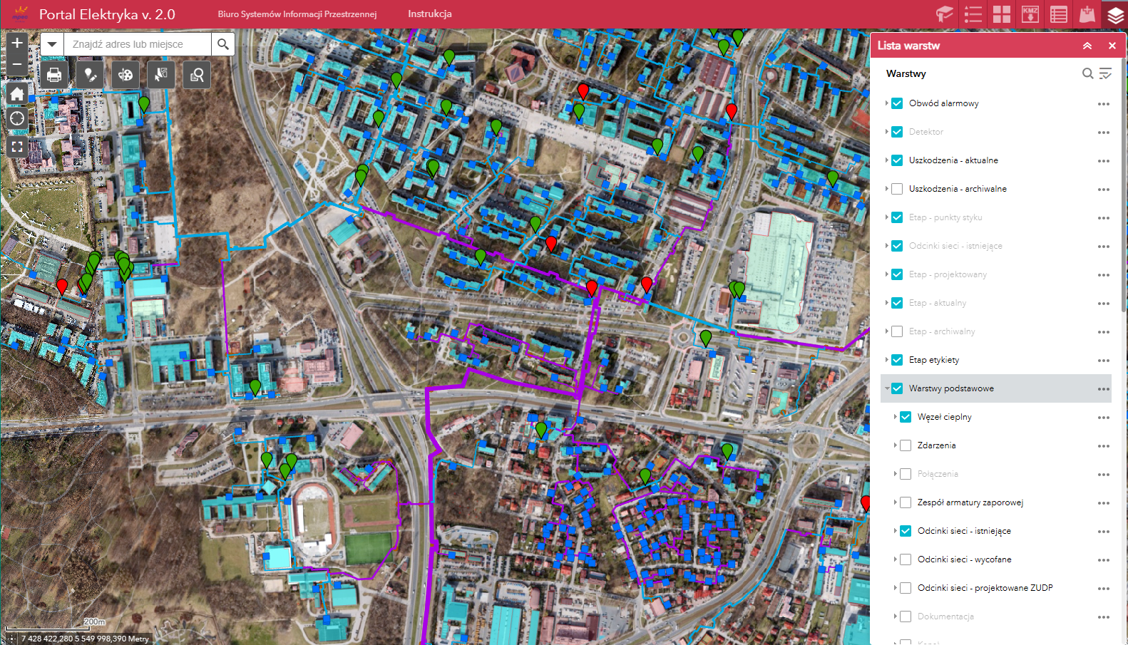
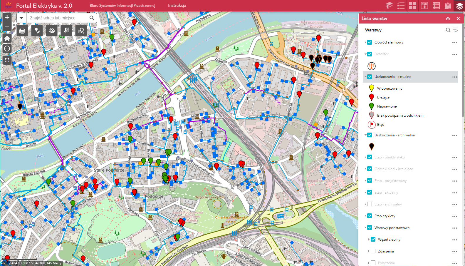
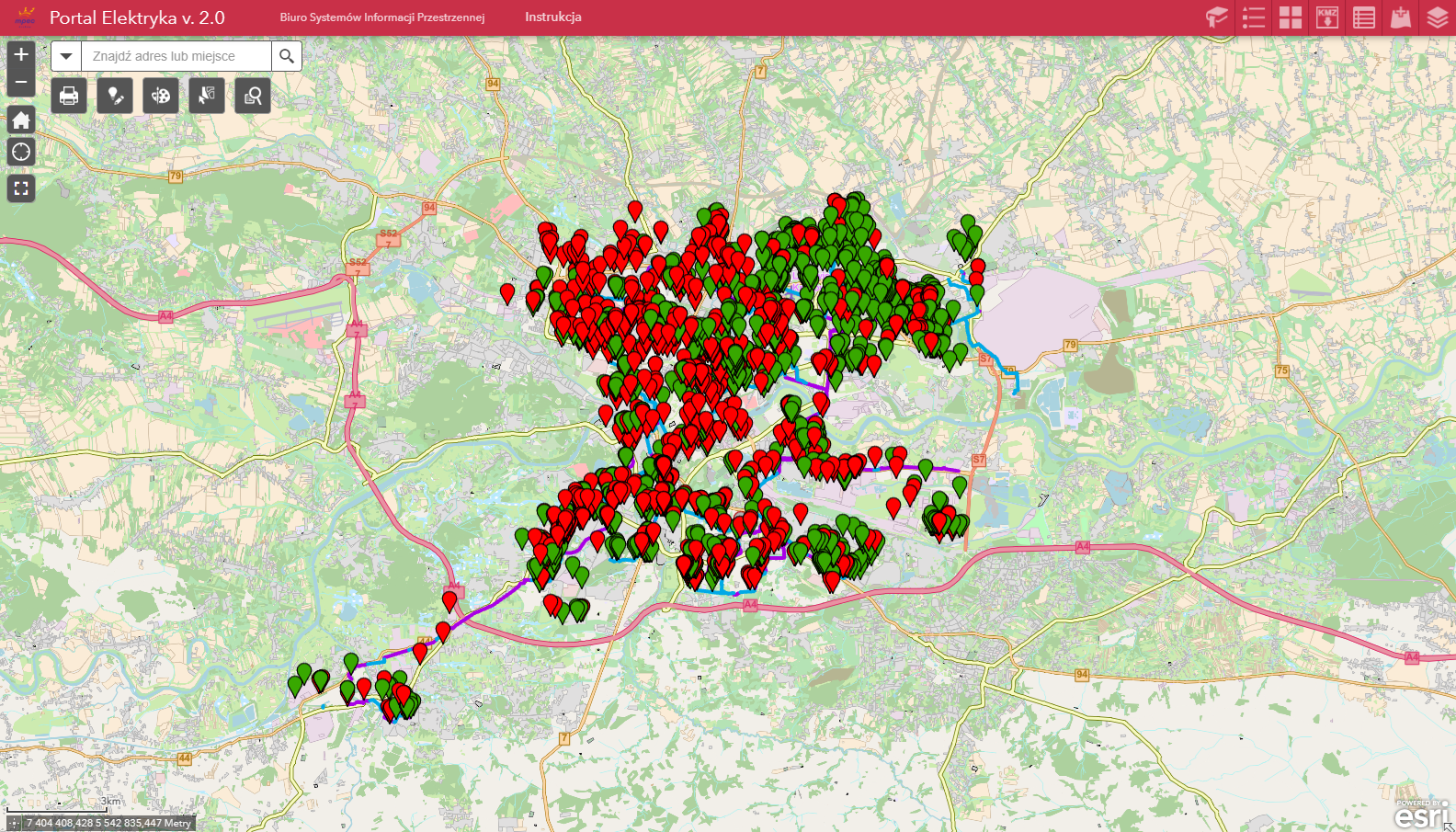
Following the project of network inventory of the whole 20,000 km-long asset network of the Polish national railway power distributor (PGE Energetyka Kolejowa, formerly PKP Energetyka), as well as a successful implementation of the GRIDonLine application (Link do: Case 12, wersja ang) – currently developed under GRID.Networks name – our company got involved in the ambitious project of creating the Electronic Map of the Railway Traction Network (EMTN).

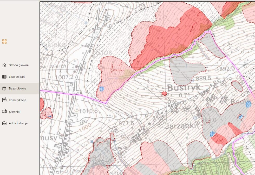
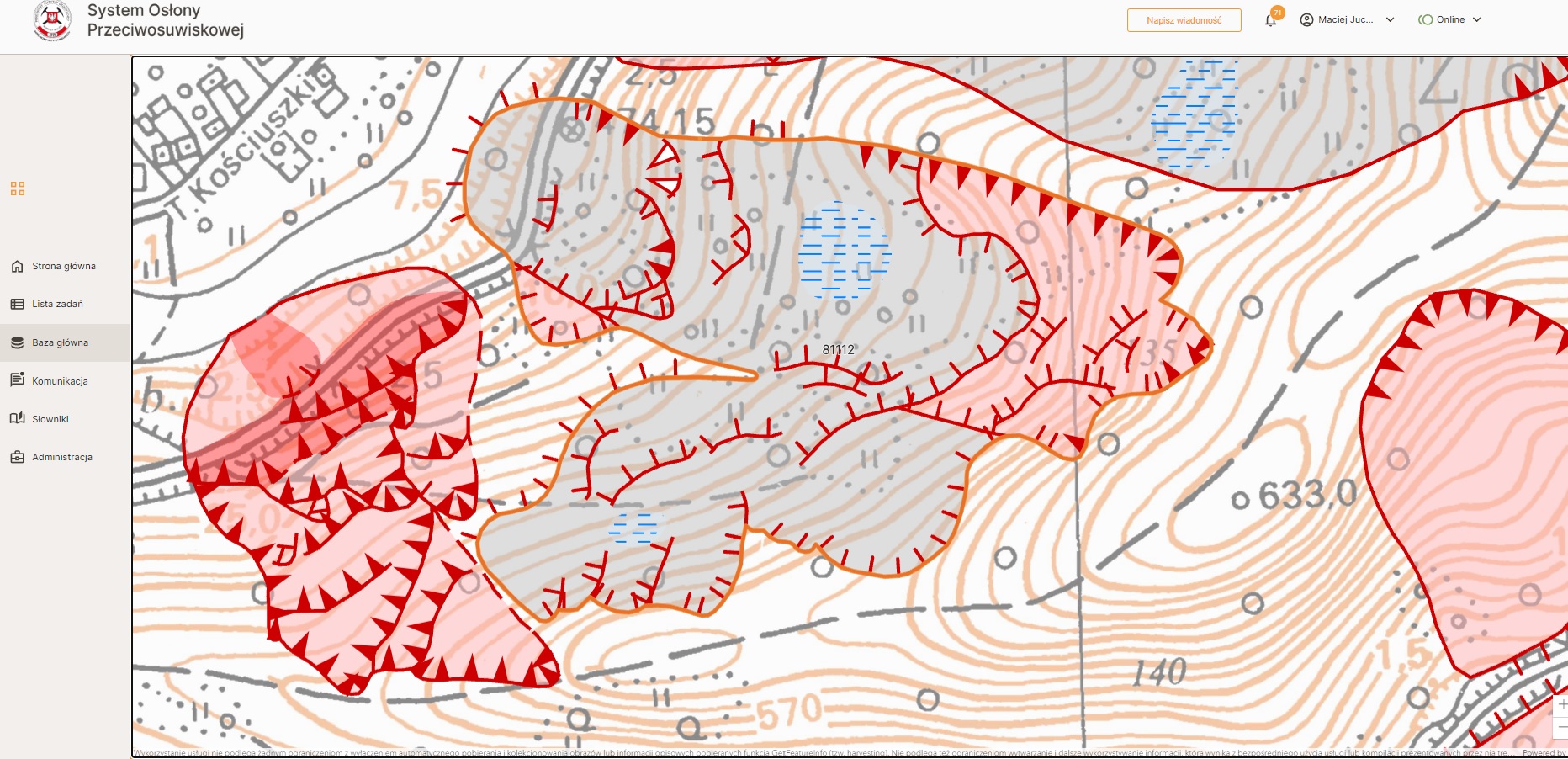
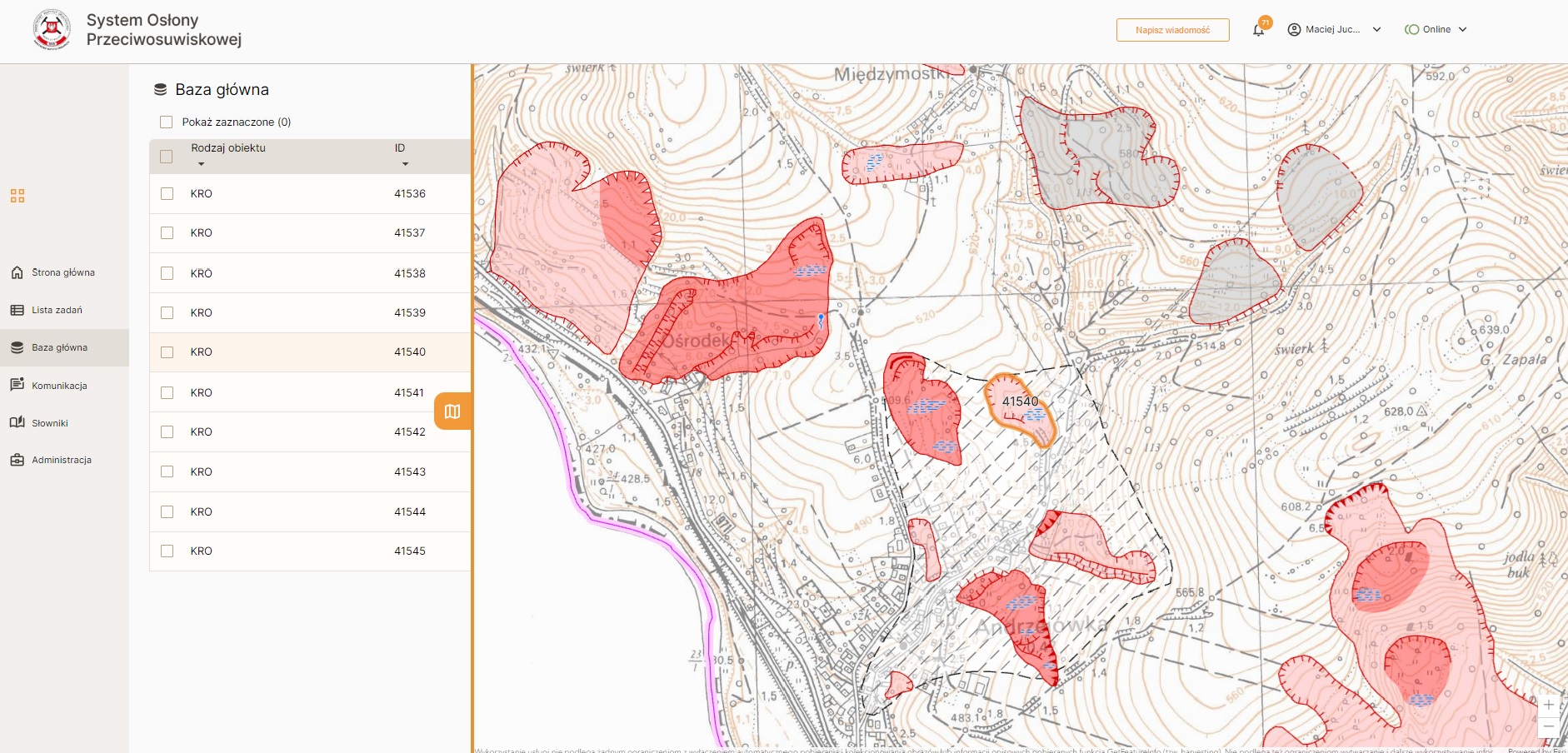
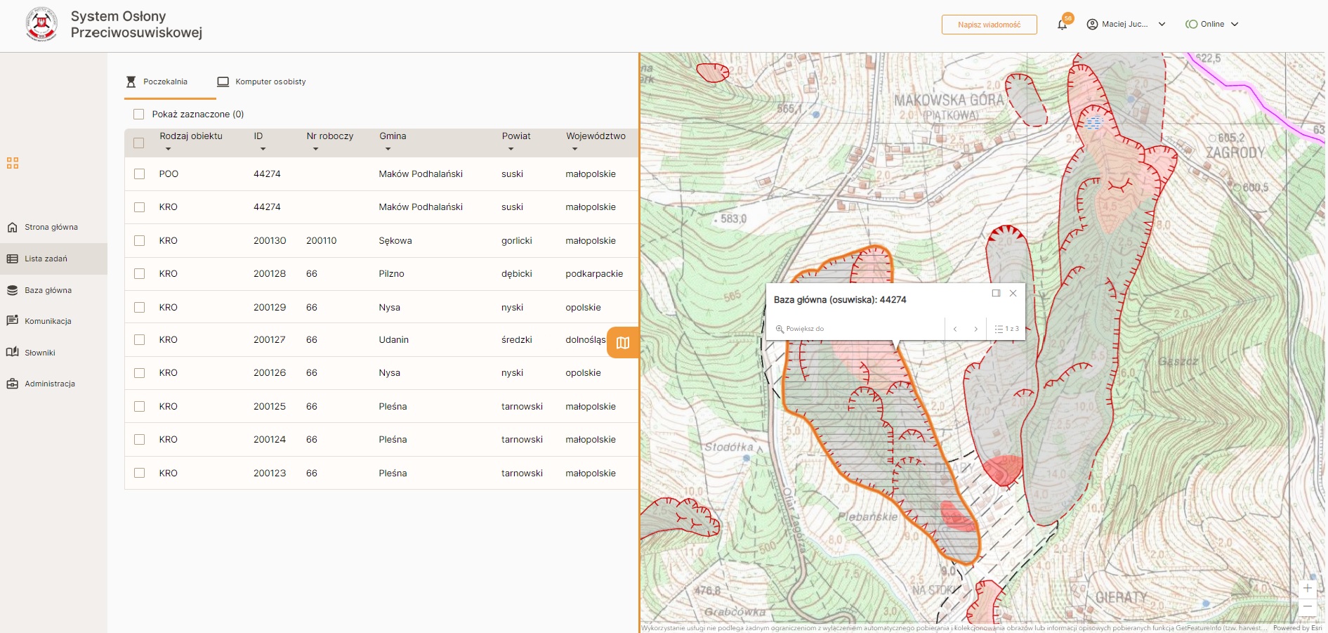
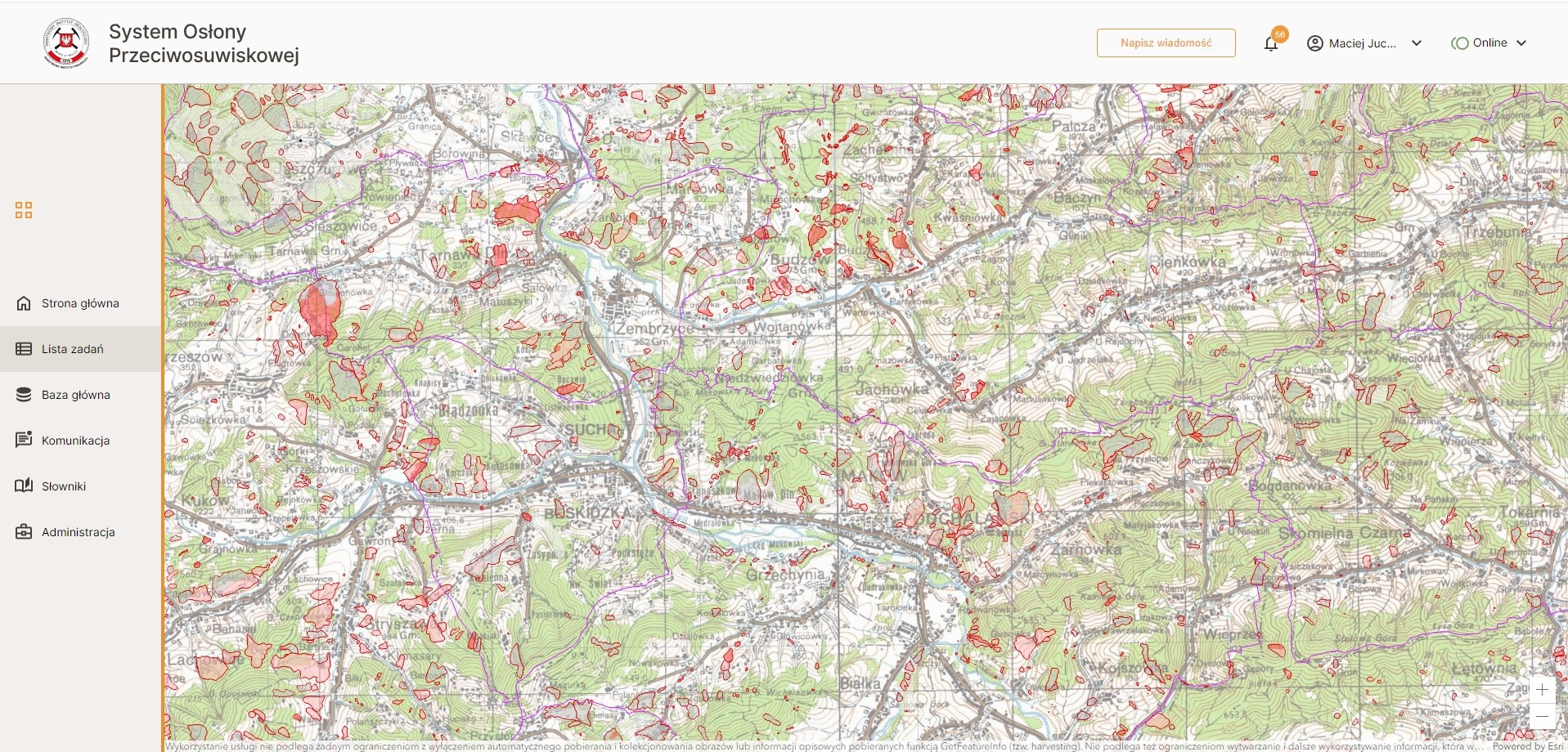
The purpose of this project was to build, in a GIS environment, a spatial database of the traction infrastructure components, based on a countrywide field inventory. Main functionalities of the EMTN cover: showcasing precise locations and relative positions of the assets, enabling visualization, editing and wide range of spatial analyses. As such, EMTN addresses several Client’s business needs:

  • Capability for direct assessment of the technical condition of traction network assets,
  • Support for managing processes at the interface between the distribution and traction networks through the availability of data for both networks within a single system,
  • Support for traction network maintenance through access to the locations of traction network sections and assets, against the background of the distribution network and the full set of reference data and map layers,
  • Support for traction network maintenance through system access to an object-based map of the traction network with spatially linked networks schemes and photographic documentation,
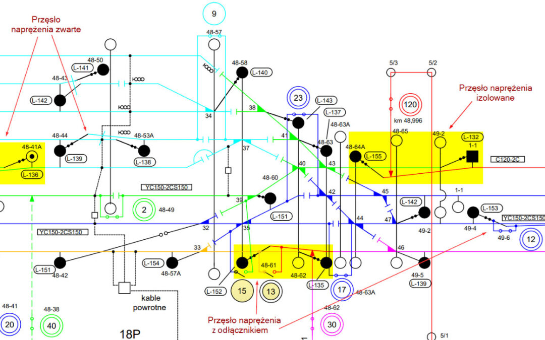
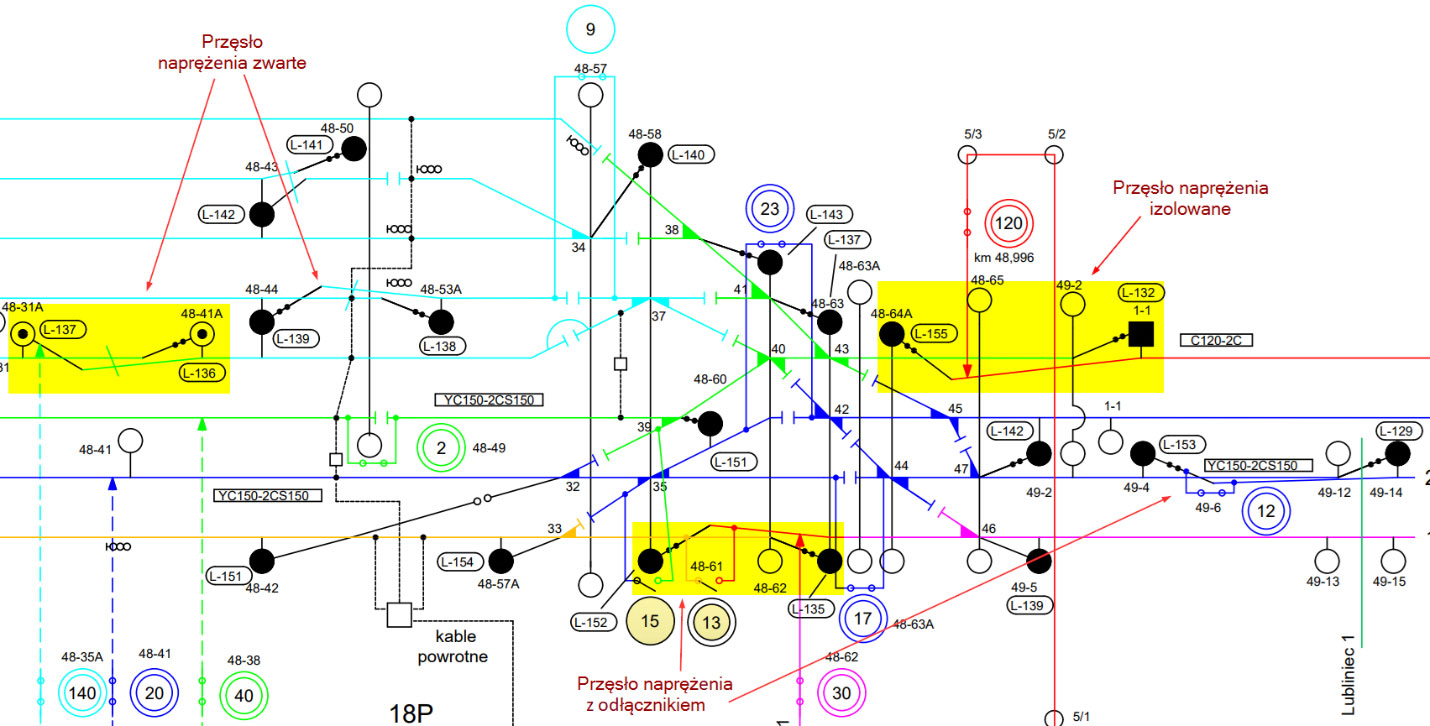
  • Up-to-date sectionalizing diagrams available in electronic format,
  • Increased automation of field crew planning, outage scheduling, and failure handling, with respect to specific traction network sections, disconnectors, and shared infrastructure,
  • Map-based visualization of notifications regarding planned works and scheduled outages for specific traction network elements,
  • Spatial presentation of failure statistics for traction network assets.

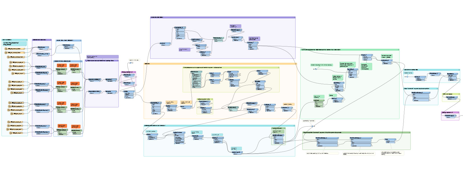
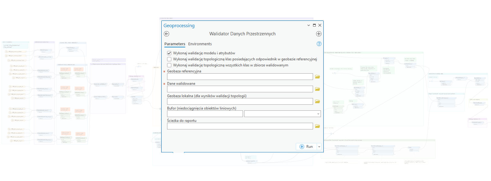
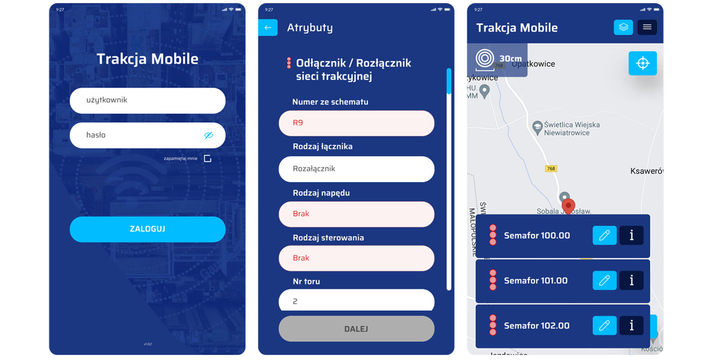
Implementation of the EMTN assumes developing the traction component of the GIRD.Networks (formely GRIDonLine) GIS system, consisting of a set of web applications: Mapper, Manager, Admin and Terrain. It also requires GIS integration with SCADA and DMS systems.

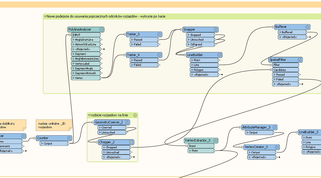
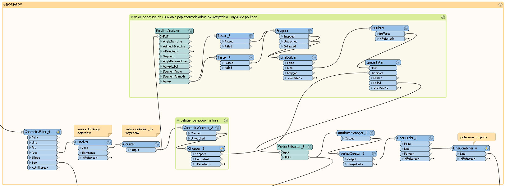
As part of the project, the network inventory of traction assets have been planned, along with the implementation and delivery of functionality for exporting traction network data to CAD format. The latter was aimed to support the maintenance of traction network sectionalizing diagrams.

Outcome & Impact

Due to the Client’s ownership restructuring, the project advanced to the stage of collecting hectometrage data for the entire railway traction network in Poland, as well as developing a pilot dataset comprising complete traction network information for a selected area. The design of the Electronic Map of the Railway Traction Network, together with the ‘Traction’ module of GRIDonLine (now GRID.Networks)—a solution built around probably one of the most sophisticated web applications in Poland—represents significant potential, pending the Client’s readiness to resume and finalize the project.

See some things

we’ve worked on

Developing GIS system for the Central Communication Port (Centralny Port Komunikacyjny)

Developing GIS system for the Central Communication Port (Centralny Port Komunikacyjny)

Home 9 Project Category: GIS System Implementation

Case studies

Developing GIS system for the Central Communication Port (Centralny Port Komunikacyjny)

Client

Industry

Transportation
Consumer Applications

Region

Europe / Poland

Technology

ArcGIS Pro
Data Interoperability
Python
CAD
FME Server

Overview

Client: Client: Centralny Port Komunikacyjny S.A.

GISonLine was proud to deliver an ambitious GIS project for the Central Communication Port (Centralny Port Komunikacyjny, CPK) — a groundbreaking investment in the Polish airport industry, and the largest of its kind in decades, currently under construction between Łódź and Warsaw. Scheduled to open around 2032, CPK is set to become the largest transportation hub in Central and Eastern Europe, combining a major airport with a high-speed railway hub, seamlessly integrated with the national motorway network. The port is expected to handle 34 million passengers annually.

An investment of this scale and significance requires advanced GIS support from the earliest stages of planning.

Our project focused on enhancing and automating the process of spatial data acquisition, through CAD and GML to GIS migrations, as well as the unification and validation of data received from various sources and databases. The overarching goal was to create a coherent spatial information database for the future CPK construction site and surrounding areas, covering both inventory and project data (such as planned railway axes). Special attention was given to empowering the Client with the necessary competences to continue working with the implemented solutions.

Outcome & Impact

Main tasks covered within our project included:

  • CAD-to-GIS migration of projected railway axis schemes, with data processing elements applied where necessary. This task involved topology control and improvement (when required), as well as the completion of attribute data in the GIS system based on annotations present in the CAD files.
  • GML geodetic data migration to GIS, carried out according to a defined final data schema. The geodetic datasets originated from two different GML structures and therefore required respective adjustments.
  • Development of an automated FME Server-based procedure for data acquisition from the national cadastral register via WFS (Web Feature Service), covering as many as 54 poviats (counties). The main challenges included the substantial volume of data to be processed and the variety of data structures depending on the poviat, necessitating data unification.
  • Creation of the Spatial Data Validator – a specialized tool tailored to the Clients needs for the automated validation of data received from various sources and across different thematic areas. The validation algorithm, written in Python, enabled the Client to designate any file geodatabase as the reference (final) database. (tu brakuje tekstu) The Spatial Data Validator could read this metadata and validate incoming datasets accordingly. The validation criteria were flexible and easily adaptable to a range of thematic domains necessary for investment planning, such as geology, hydrology, and others.

    The Client was provided with access to topological and attribute analysis through an intuitive graphical interface, offering the option to generate reports either as .xlsx files (listing errors and missing data) or as geometric layers with marked topological errors.

See some things

we’ve worked on

Developing GIS System for District Heating in Krakow, Poland

Developing GIS System for District Heating in Krakow, Poland

Home 9 Project Category: GIS System Implementation

Case studies

Developing GIS System for District Heating in Krakow, Poland

Client

Industry

Energy & Utilities

Region

Kraków – Polska / Europa

Technology

ArcGIS Web AppBuilder, JavaScript, HTML, CSS, Esri ArcGIS Enterprise, Portal for ArcGIS, Postgre SQL, FME, GE SmallWorld, .Net Core, Python

Overview

Client: Miejskie Przedsiębiorstwo Energetyki Cieplnej w Krakowie

District heating is one of the most economically and environmentally efficient methods of heat and hot water distribution in urban areas. It helps to reduce air pollution and the risk of carbon monoxide poisoning. We are pleased that our home city – Kraków – is among the national leaders in the field of district heating expansion and modernization, and we are proud to contribute to this progress by providing GIS solutions and services to MPEC S.A. for several years.

MPEC S.A. in Kraków has been systematically expanding its geoinformation system, and through that continuously improving the quality and efficiency of its network management. Following the implementation of a GIS system based on ESRI solutions – a project entrusted to our company several years ago – and our subsequent upgrades, version enhancements, development of a network management dashboard, and ongoing maintenance services, we have now undertaken the expansion of the Electrical Portal.

The Electrical Portal evolved from the concept of an application originally titled “Failures in Pre-insulated Networks“. It is dedicated to MPEC specialists responsible for monitoring the condition of pre-insulated pipes, based on a network of electronic sensors used to detect leaks.

As of 2025, the district heating network in Kraków extends nearly 1,000 km, with approximately 70% consisting of modern pre-insulated pipelines. Since pre-insulated pipes are a more efficient method of heat transfer compared to traditional solutions, both their share and total length are expected to continue increasing. Consequently, rapid response to potential failures and malfunctions is a task of critical—and steadily growing—importance.

Outcome & Impact

The Electrical Portal 2.0 has been enhanced with the ability to create and edit new object classes: Alarm Circuit, Detector, and Stage. These classes were designed along with the relationships linking them to each other and to the object classes already present in the previous version of the Electrical Portal.

As a result, the application is now better tailored to the needs of its dedicated user group, enabling, for example, the association of detectors with alarm circuits, the assignment of stage attributes to cable sections, and linking the Stage layer to records from the Stage Document table, with inheritance of specific attributes. The Electrical Portal 2.0 project also introduced data quality control procedures.

All these modifications were developed based on the Client’s experience with the previous version of the portal, and further refined through workshop sessions and ongoing collaboration between the Client and our team.

See some things

we’ve worked on

Updating the geodetic inventory of poles for the highest-voltage transmission lines

Updating the geodetic inventory of poles for the highest-voltage transmission lines

Case studies

Updating the geodetic inventory of poles for the highest-voltage transmission lines

Client

Industry

Energy & Utilities

Region

Poland / Europe

Technology

QGIS, PostgreSQL/PostGIS, pomiary geodezyjne z wykorzystaniem sprzętu Leica/Trimble

Overview

Client: Polskie Sieci Elektroenergetyczne S.A.

At the beginning of 2025, GISonLine commenced a geodetic service project for Polskie Sieci Elektroenergetyczne S.A. (abbreviated PSE) – an electricity transmission system operator in Poland and the sole operator of the country’s high-voltage transmission lines.

The project involves updating the accurate locations of the highest-voltage poles in official geodetic registers, based on photogrammetric documentation provided by the Client, as well as geodetic surveys conducted directly on-site. Updating the official topographic basemaps is also an expected outcome of the project.

The work covers almost 7,000 objects located across 64 Polish poviats (counties). The project is scheduled for completion in late autumn 2025.

See some things

we’ve worked on

Implementation of the GIS system within the Landslide Counteracting System

Implementation of the GIS system within the Landslide Counteracting System

Home 9 Project Category: GIS System Implementation

Case studies

Implementation of the GIS system within the Landslide Counteracting System

Client

Industry

Science/Research

Region

Europe / Poland

Technology

ArcGIS Enterprise, PWA (Progressive Web Application), Oracle, ArcGIS Javascript API, React, IIS, NLB, Branch versioning, SOA (Service-Oriented Architecture), High Availability (HA) architecture

Overview

Client: Polish Geological Institute – National Research Institute

The estimated number of landslides and areas at mass wasting risk in Poland exceeds 100,000, covering considerable areas especially in the southern Poland. GISonLine designed and implemented a comprehensive GIS system used by the National Geological Service for mapping and monitoring landslides, to warn endangered populations and protect private and public property.

The project was carried out by a consortium of companies, GISonLine Sp. z o.o. and Esri Polska Sp. z o.o. GISonLine was responsible for the modernization and development of the system’s functionality using the client’s GIS technology and architecture, as well as implementing technological upgrades. As a result, the client received a webmap application for mapping and monitoring landslides and areas at risk, combining the highest level of data security with a broad range of functionalities. The application is fully compatible with the legal guidelines for reporting upon the landslide risk and is flexible – tailored to the needs of users with different levels of access permissions. It also maintains many of its functionalities in the offline mode, which makes it suitable for use during fieldwork. As a part of the implementation, a three-day training session was conducted, and the entire system was covered by technical support.

The project was delivered in 2024.

Challenges

  • High complexity of the network’s architecture and a wide range of application use cases
  • Data security requirements, including an architecture based on services with multi-level access authorization and extensive configuration of network areas
  • High availability (HA) architecture – the system’s availability and reliability requirements necessitated that every component be redundant. The implementation of HA solutions makes the system more resilient to failures and facilitates the maintenance of up-to-date components
  • Client’s expectations for the automation of the form-filling process
  • Required modes of operation: both online and offline
  • Client’s expectations for a high degree of flexibility for the administrator in assigning user permissions
  • Comprehensive and immutable (legally defined) scope of registration forms for objects (landslides and areas at risk), with a multi-step process for entering them into the system
  • Introduction of a map component displaying the current status of objects

The Outcome

modern, comprehensive, user-friendly, functional, and secure webmap application (created with HA-class architecture) featuring forms for inventorying new and updating data on existing landslides and areas at risk. Available to users in both online and offline modes, adapted for fieldwork without internet access.

Main strengths:

  • wide-ranging automation of the process of filling out registration forms for landslides/areas at risk, compatible with the legally-defined catalog of landslides’ features to be reported.
  • approximately 40 attributes (features) generated automatically, based on a dozen spatial analyses of data from multiple sources/services (meeting high expectations of the client in terms of network security, as well as the application’s stability/reliability).
  • numerous validation rules applied to ensure the correctness of the data entered.

See some things

we’ve worked on