Providing Field Crews with Mobile Mapping For High Voltage Power Transmission Asset Inventory (PSE)

Providing Field Crews with Mobile Mapping For High Voltage Power Transmission Asset Inventory (PSE)

Home 9 Project Category: GIS System Implementation ( Page 2 )
Case studies

Providing Field Crews with Mobile Mapping For High Voltage Power Transmission Asset Inventory (PSE)

Client

Industry

Energy & Utilities

Region

Europe

Technology

ESRI – ArcGIS Server
ESRI ArcGIS Online
Android
Windows Mobile

Overview

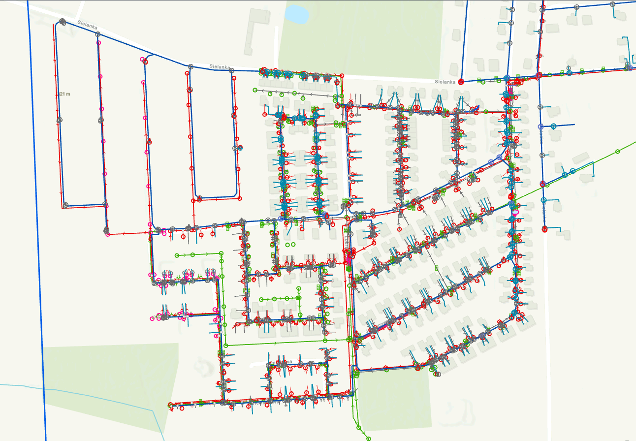
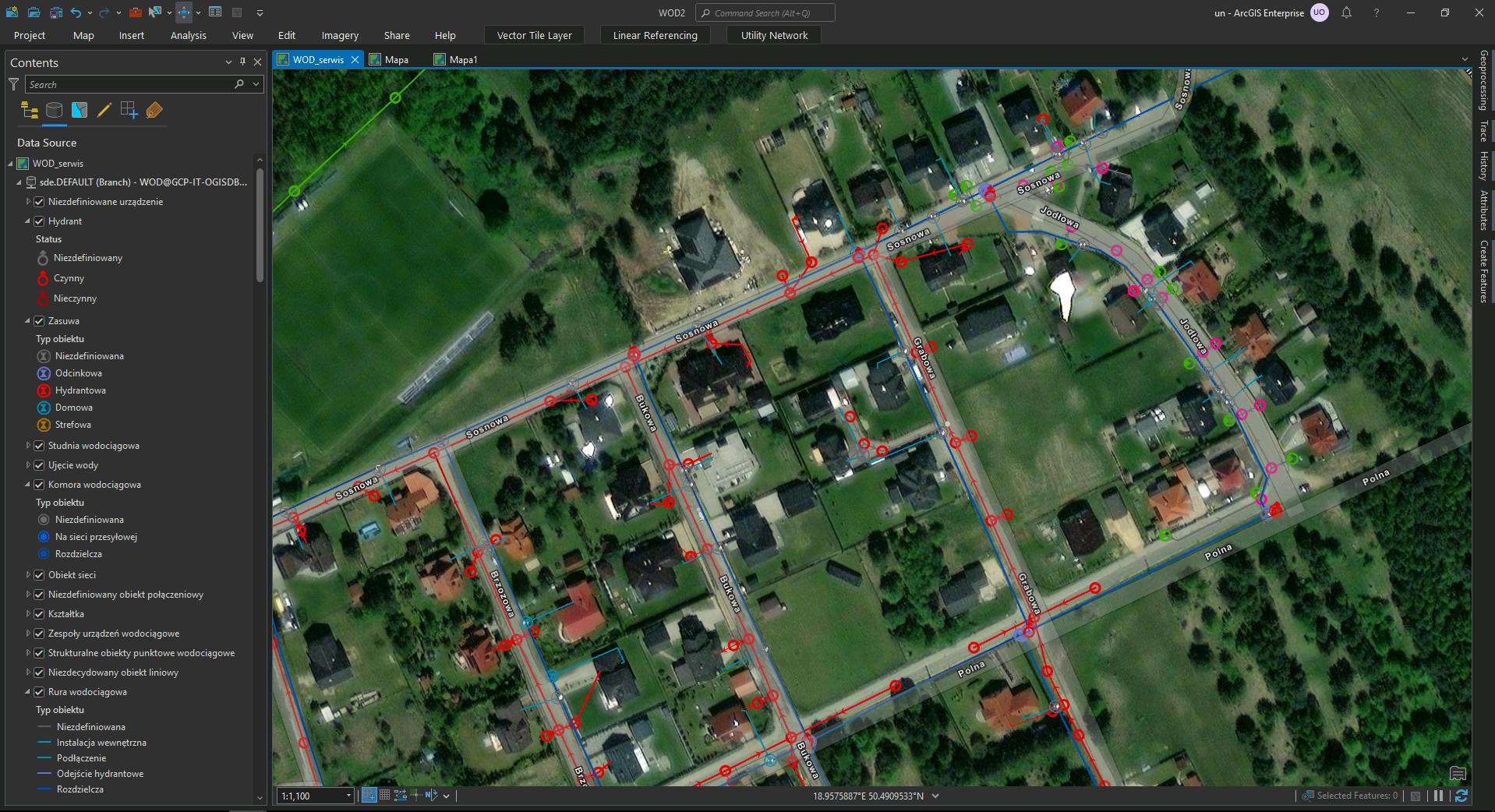
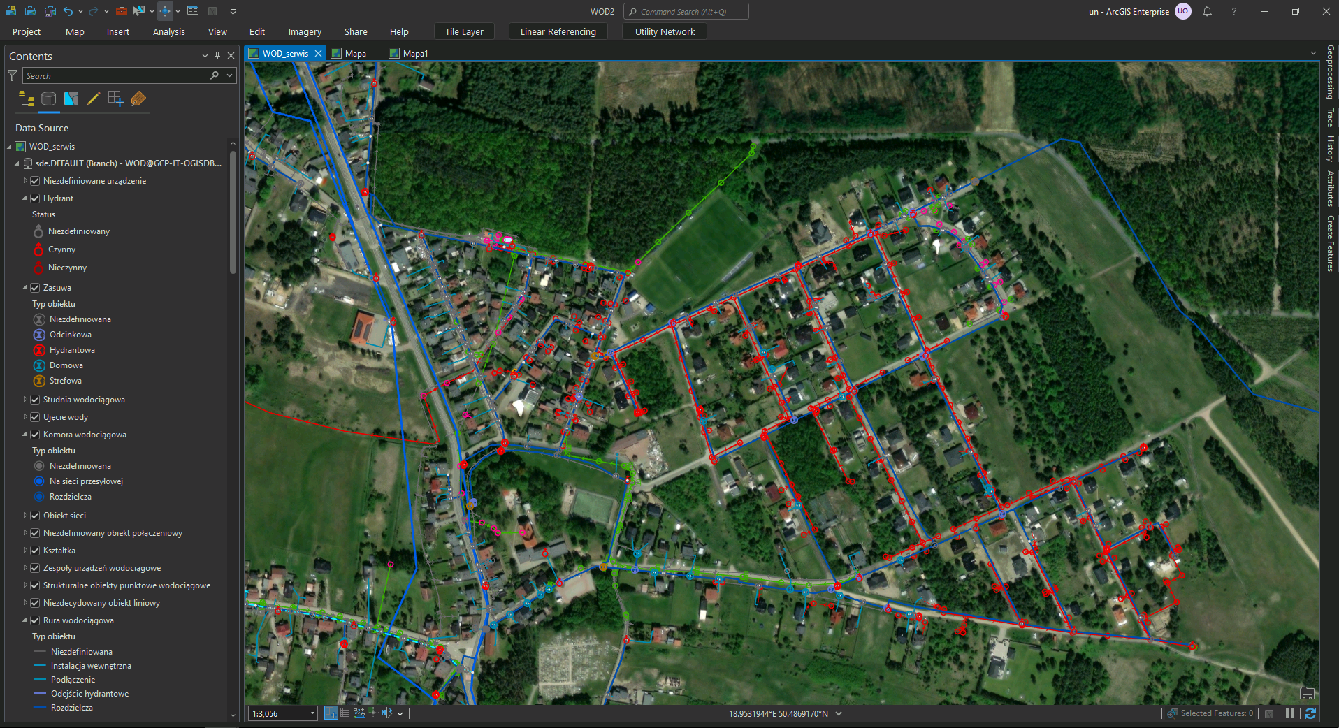
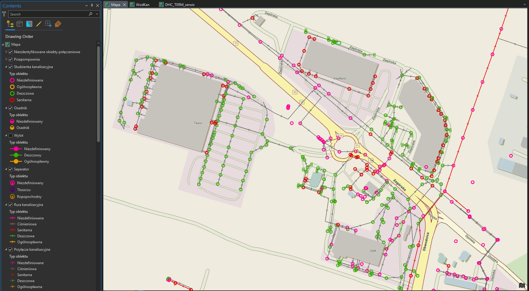
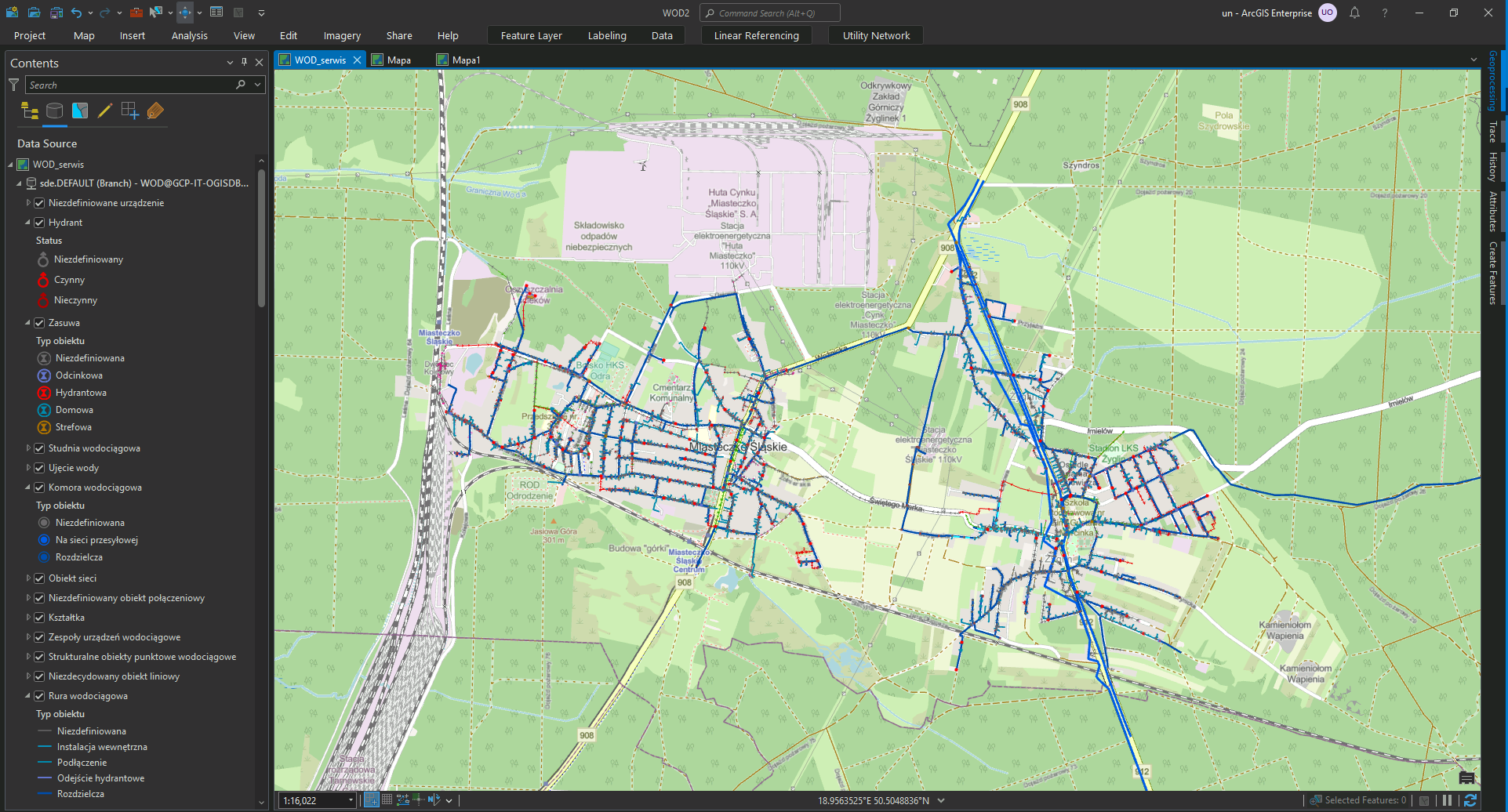
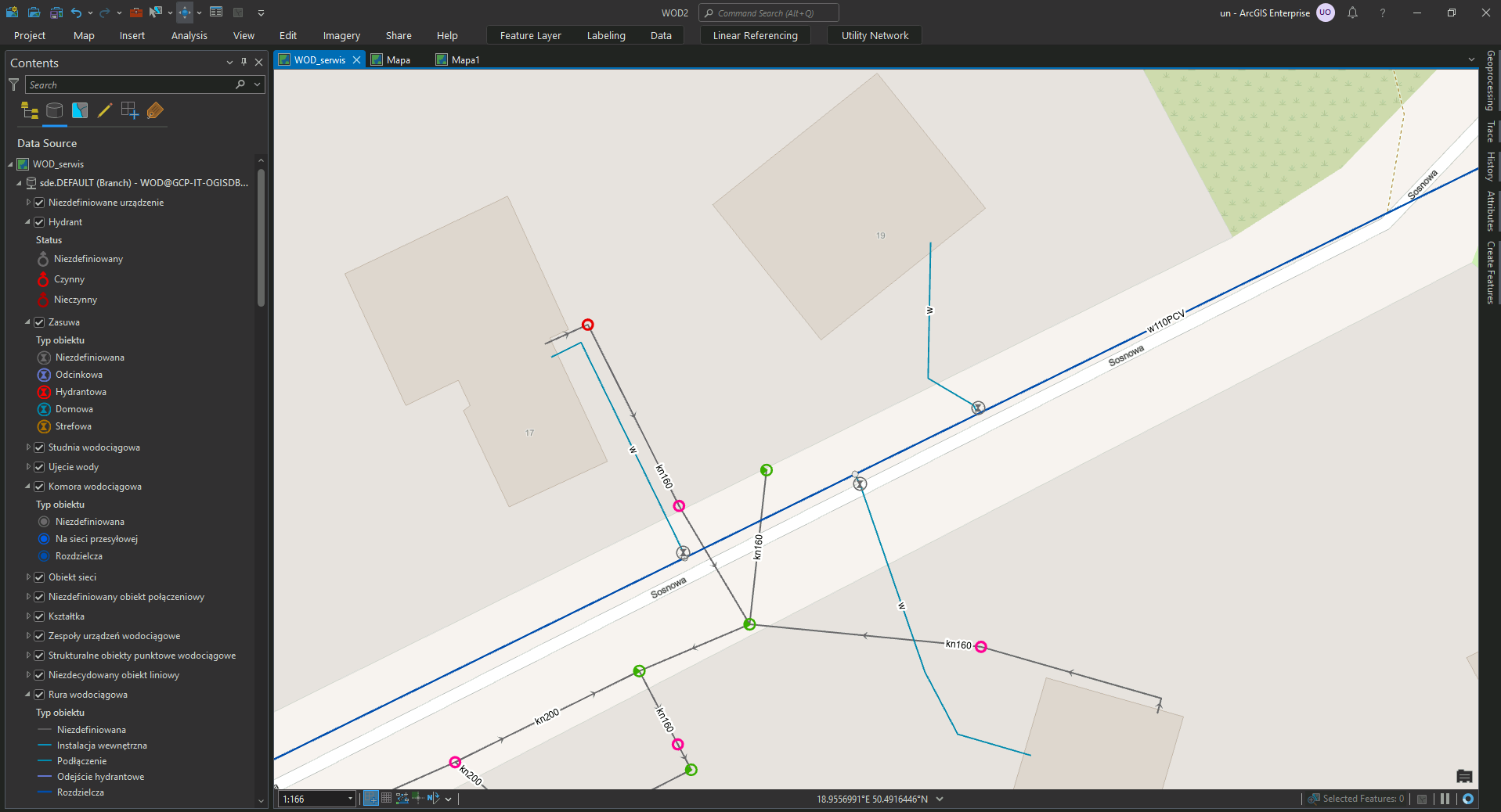
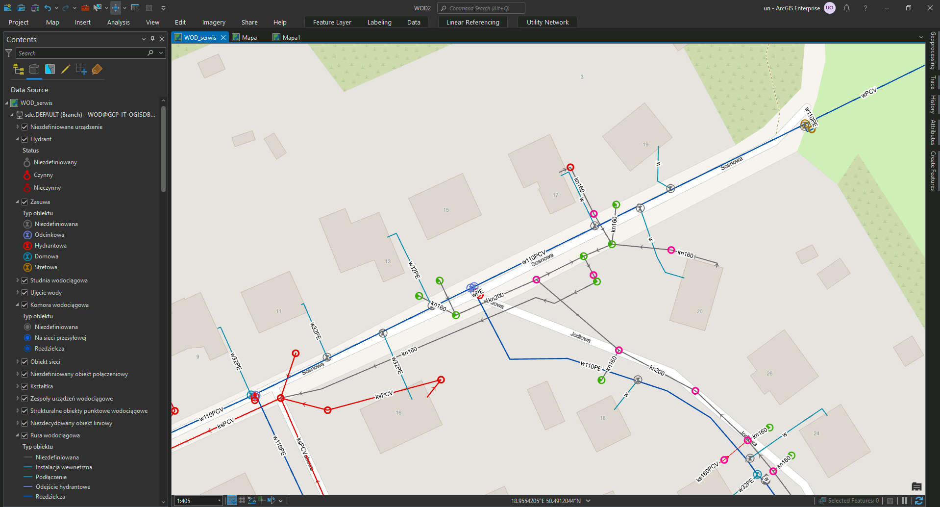
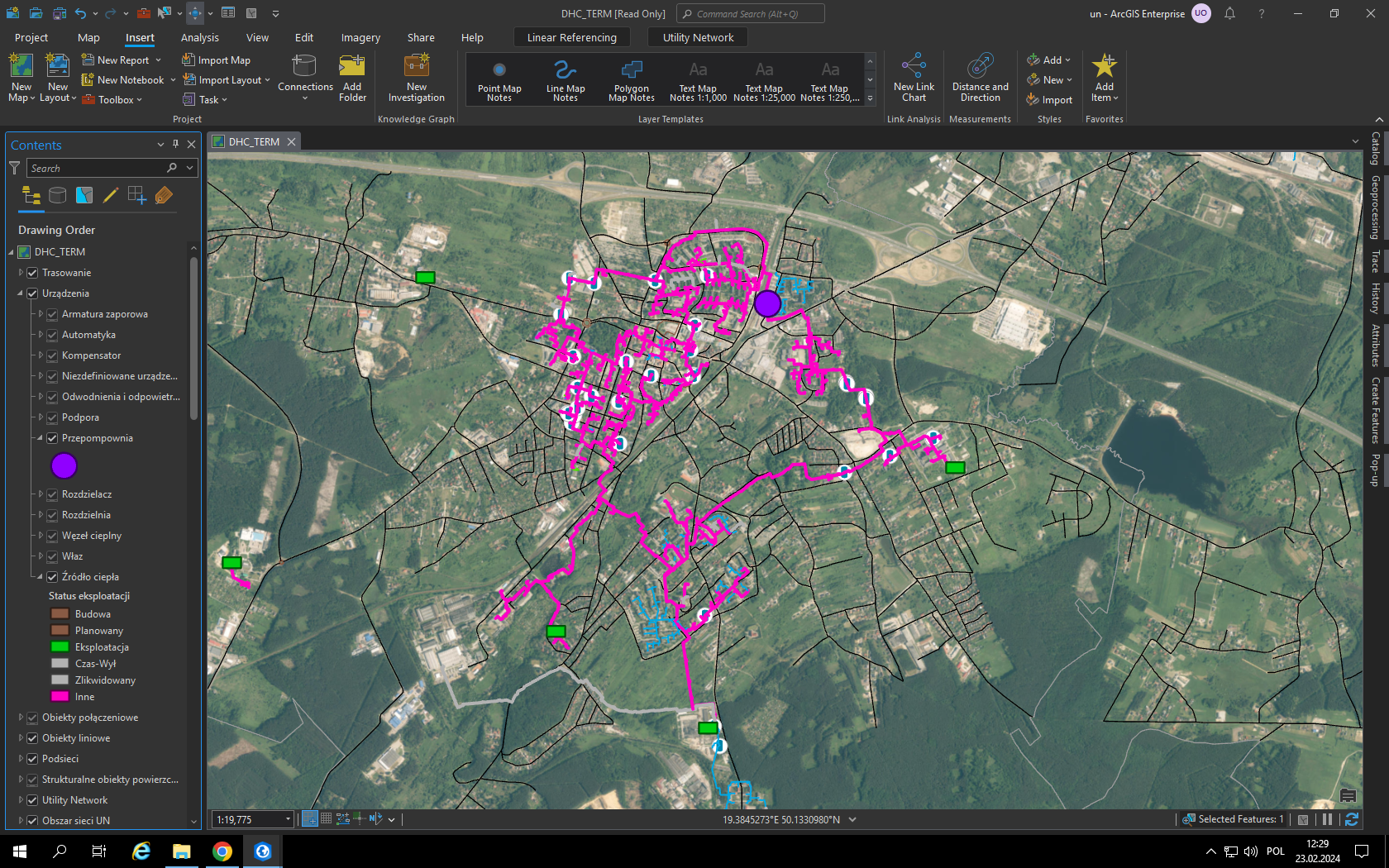
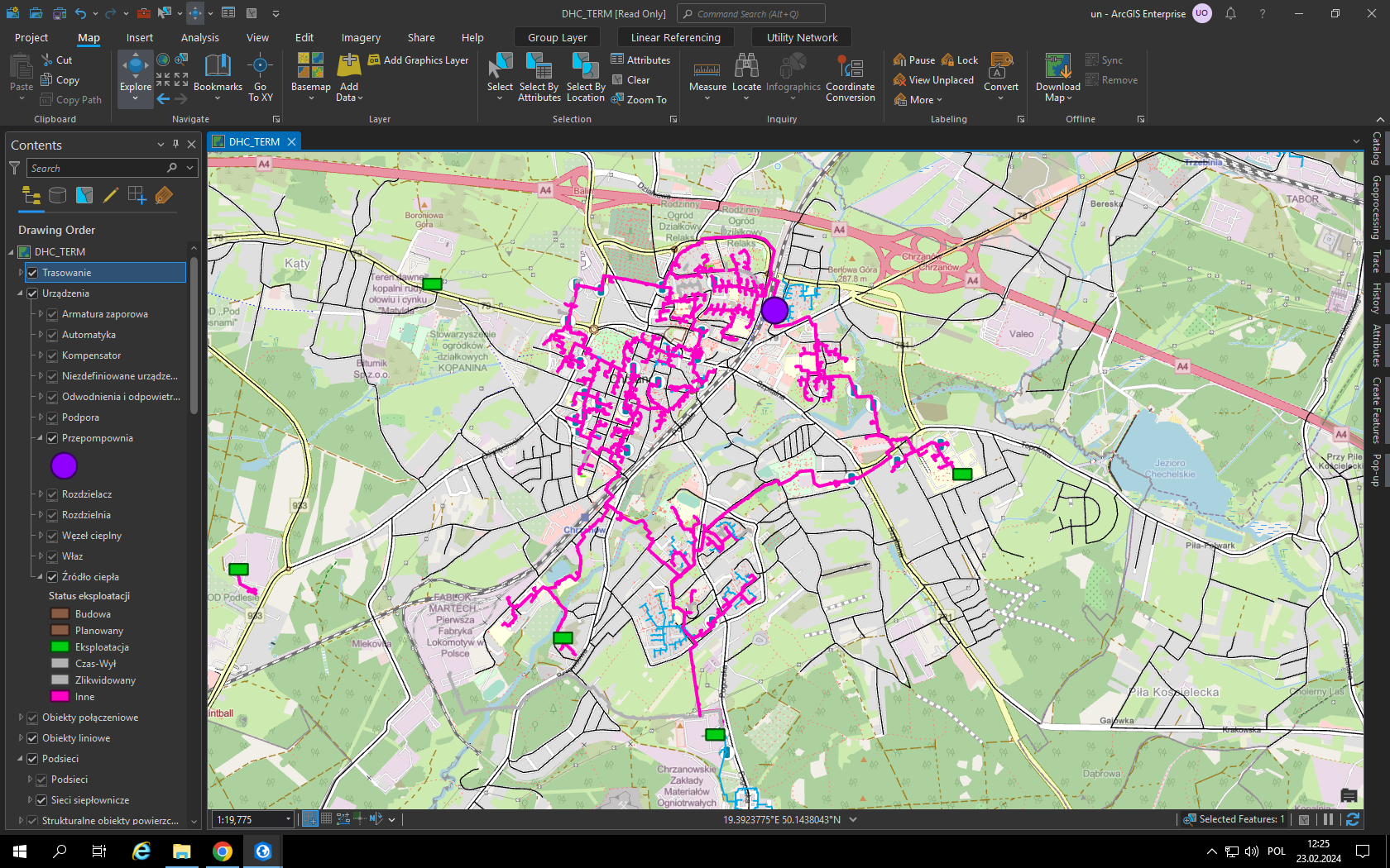
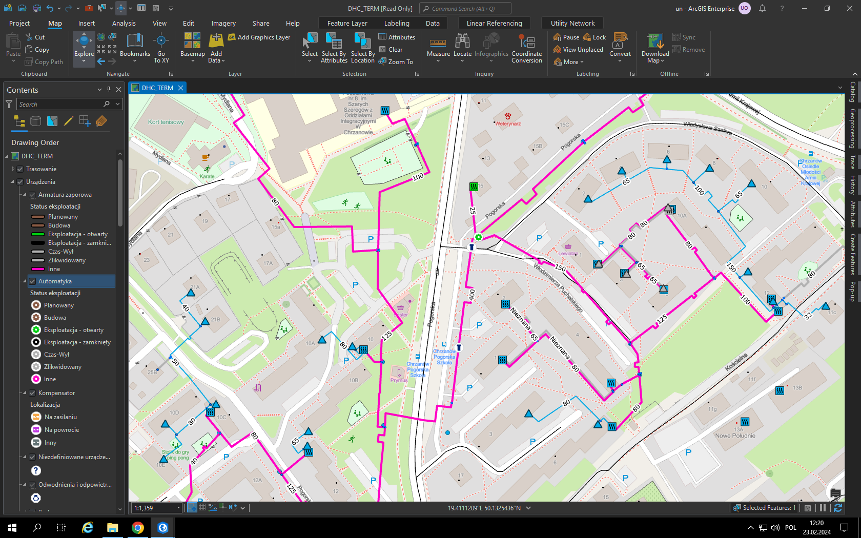
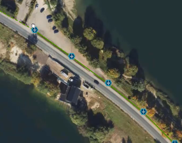
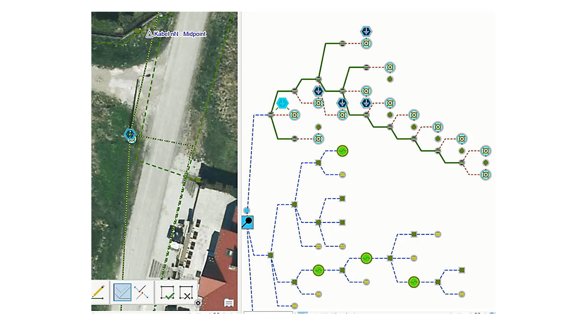
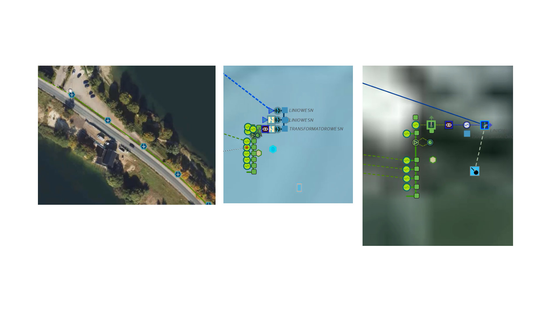
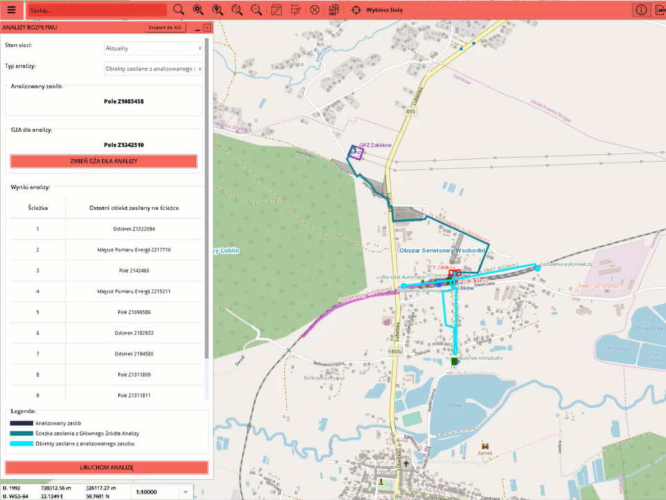
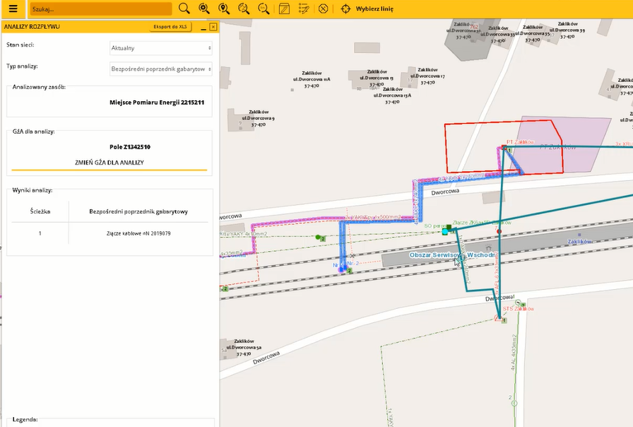
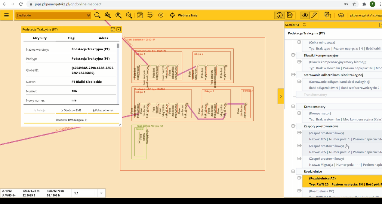
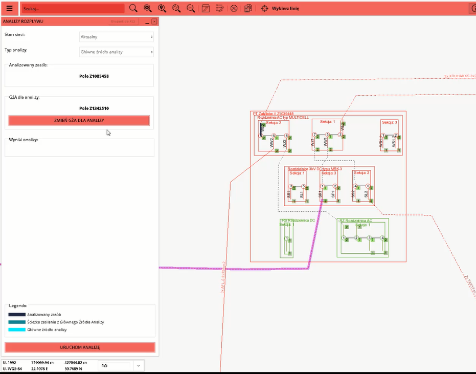
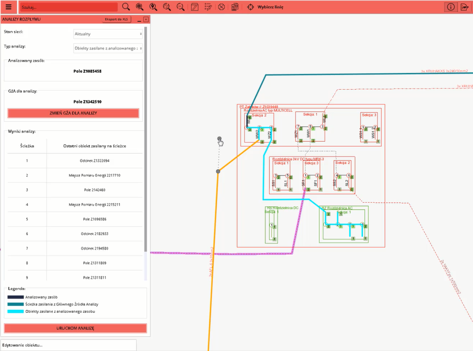
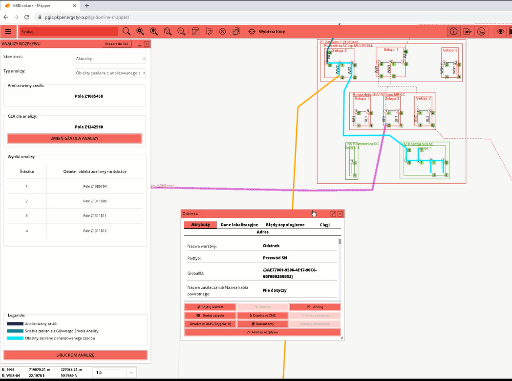
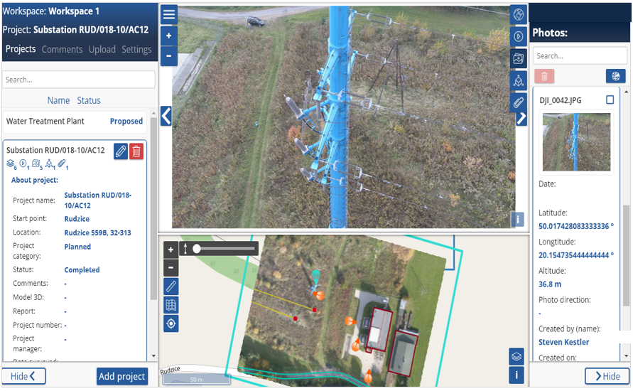
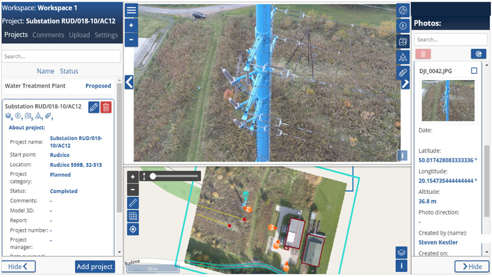
GISonLine was engaged in a project to perform a large-scale asset inventory for energy provider (Polskie Sieci Energetyczne – PSE).  The project included capturing and analyzing high voltage power transmission network assets and infrastructure.  A primary goal of the project was to establish a geospatial zmobile application that allowed PSE field crews to have specific mapping capabilities in support of data collections and asset inventory.

The Impact

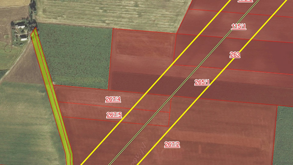
As part of the project initiatives, GISonLine combined utility network spatial datasets with existing land ownership database records, which then directly supported utility network planning and analysis.  GISonLine provided PSE field crews with a custom mobile geospatial application designed specifically for the collection and inventory of utility assets.

The outcome

PSE field crews are now able to support business operations using asset inventory and location analysis capabilities that aid in decision making processes such as: asset location risks, site planning, and environmental impacts.

GISonLine provided PSE with mobile mapping capabilities to perform site planning and spatial analysis / visualization of high voltage transmission assets and allowing for spatial analysis of assets in relation to physical surroundings (ex: buildings, roads, housing, water bodies).

See some things

we’ve worked on

Contact us

Looking for Location Intelligence?

1 + 12 =

Transforming the water and wastewater network management through the implementation of the Utility Network

Transforming the water and wastewater network management through the implementation of the Utility Network

Home 9 Project Category: GIS System Implementation ( Page 2 )

Case studies

Transforming the water and wastewater network management through the implementation of the Utility Network

Client

Water and sewage system operator

Industry

Energy & Utilities

Region

Tarnowskie Góry – Poland / Europe

Technology

ArcGIS Experience Builder
JavaScript, HTML, CSS
Esri ArcGIS Enterprise
Portal for ArcGIS
PostgreSQL

Client: Water and sewage system operator

GISonLine was proud to implement ESRI Utility Network for a shareholder of the water and sewage operator in Tarnowskie Góry (Silesian Voivodeship, Poland), a city of around 80,000 inhabitants.

Total length of networks in operation:

  • water supply network: 683 km
  • sewage network: 393.8 km

GISonLine implemented ESRI Utility Network technology to optimize network management processes by creating a reliable model of the water and wastewater network.

Outcome & Impact

The Client provides high-quality services in the field of collective water supply, sewage collection and treatment and sewage sludge management to local governments and industry.

Implementation of Utility Network technology enabled optimization of network management processes through faster access to information about failures and events thanks to the analytics module in ESRI’s solution.

Another benefit is the ability to inform users of water supply interruptions in advance.

GISonLine successfully implemented the ESRI Utility Network solution platform into Client’s business operations. Now the customers’ users can effectively utilize the mechanisms of the guided editing, quality validation and network rules, supporting the Client’s employees with their network management business processes.

See some things

we’ve worked on

Contact us

Looking for Location Intelligence?

12 + 2 =

Transforming the district heating network management through the implementation of the ESRI Utility Network

Transforming the district heating network management through the implementation of the ESRI Utility Network

Home 9 Project Category: GIS System Implementation ( Page 2 )

Case studies

Transforming the district heating network management through the implementation of the ESRI Utility Network

Client

District system operator

Industry

Energy & Utilities

Region

Poland / Europe

Technology

ArcGIS Experience Builder
JavaScript, HTML, CSS
Esri ArcGIS Enterprise
Portal for ArcGIS
PostgreSQL

Client: District system operator
Location: Poland

GISonLine successfully delivered Utility Network implementation for the largest private district heating network operator in Poland – opearating district heating in 78 cities and managing district heating networks in 58 cities, by providing:

  • System heat for heating purposes and domestic hot water
  • Heating-related services operation of substations, boiler rooms, and replacement of heat meters / water meters
  • Energy efficiency audit of other companies
  • Small producer cogeneration
  • Construction of comprehensive energy solutions and operation of local heat sources, container boiler houses, and electrode boilers
  • Renewable energy source (RES) installations and photovoltaic heat pump energy storage
  • Management of district heating systems – cooperation with the city administration and businesses – leasing of the heating system

GISonLine implemented ESRI Utility Network technology to optimize network management processes by creating a faithful model of the district heating network.

Outcome & Impact

GISonLine successfully implemented the ESRI Utility Network solution platform into Client’s business operations. Implementation of ESRI Utility Network technology enables the optimization of network management processes through faster access to information about failures and events using the analytics module in ESRI’s solution.

Now Client’s users can effectively utilize the mechanisms of guided editing, quality validation and network rules, supporting their employees with their network management business processes. Another benefit is the ability to inform users of water supply interruptions in advance.

See some things

we’ve worked on

Contact us

Looking for Location Intelligence?

15 + 6 =

Pilot implementation of Utility Network for the Power Grid – PKP Power (Rail Energy)

Pilot implementation of Utility Network for the Power Grid – PKP Power (Rail Energy)

Home 9 Project Category: GIS System Implementation ( Page 2 )

Case studies

Pilot implementation of Utility Network for the Power Grid – PKP Power (Rail Energy)

Client

Industry

Energy & Utilities

Region

Europe

Technology

ArcGIS Experience Builder
JavaScript, HTML, CSS
Esri ArcGIS Enterprise
Portal for ArcGIS
PostgreSQL

Location: Poland

The project to implement a network topology based on graph technology was part of a larger program – the transformation of PKP Power (a European utility provider) asset management processes using modern geospatial capabilities to support the supply, management, and delivery of electricity distribution for railway transportation.

The project aimed to verify the ESRI Utility network technology about the business needs of PKP Power and to plan a roadmap for the future implementation of the Utility Network

The Impact

GISonLine implemented a pilot of the the ESRI Utility Network project,

GISONline implemented a pilot project to conduct a series of workshops in which the strengths and weaknesses of the technology were verified by modeling a real slice of customer data.

The Outcome

The pilot project allowed the client to familiarize themselves with the technology, understand the benefits and limitations, and prepare a plan for the future implementation of the Utility Network

With over 800 users connecting to the GRIDonLine platform, visualization of PKP Energetyka assets and their details can be communicated across the enterprise and managed via the centralized repository.

See some things

we’ve worked on

Contact us

Looking for Location Intelligence?

7 + 11 =

GRIDonLine – implementation of graph-based network topology for comprehensive power grid modeling – PKP Power (Rail Energy)

GRIDonLine – implementation of graph-based network topology for comprehensive power grid modeling – PKP Power (Rail Energy)

Home 9 Project Category: GIS System Implementation ( Page 2 )

Case studies

GRIDonLine – implementation of graph-based network topology for comprehensive power grid modeling – PKP Power (Rail Energy)

Client

Industry

Energy & Utilities

Region

Europe

Technology

ArcGIS Experience Builder
JavaScript, HTML, CSS
Esri ArcGIS Enterprise
Portal for ArcGIS
PostgreSQL

Client: PKP Power (Rail Energy)

Location: Poland

The project to implement a network topology based on graph technology was part of a larger program – the transformation of PKP Power (a European utility provider) asset management processes using modern geospatial capabilities to support the supply, management, and delivery of electricity distribution for railway transportation.

The challenge was the implementation of a network topology in a modern, ESRI web-based solution in a time when the geometry network became legacy technology and the ESRI Utility Network was not mature enough to replace it. The customer urgently needed a working spatial network model to be able to fulfill business needs.

The Impact

GISonLine implemented a system graph-based topology as a part of the GRIDonLine product, which is a custom ESRI ArcGIS enterprise mapping system of the inventory.

The custom service-based topology enabled advanced network analysis, vital for advanced business processes supporting infrastructure management.

The Outcome

GISonLine performed a successful digital transformation of the PKP Power asset management processes and a technology upgrade with the implementation of the GRIDonLine custom ESRI solution designed by GISonLine.

The GRIDonLine solution enhanced with graph-based network topology addressed the complexity of formalizing and managing the railway utility distribution networks.

With over 800 users connecting to the GRIDonLine platform, visualization of PKP Energetyka assets and their details can be communicated across the enterprise and managed via the centralized repository.

See some things

we’ve worked on

Contact us

Looking for Location Intelligence?

8 + 15 =