Mapping Telecom Broadband Network Coverage Using Geospatial Analysis (Podlaskie Region, Poland)

Mapping Telecom Broadband Network Coverage Using Geospatial Analysis (Podlaskie Region, Poland)

Home 9 Project Category: Data Management ( Page 4 )

Case studies

Mapping Telecom Broadband Network Coverage Using Geospatial Analysis (Podlaskie Region, Poland)

Client

Industry

Local Government

Region

Europe

Technology

Esri ArcGIS
MapInfo

Overview

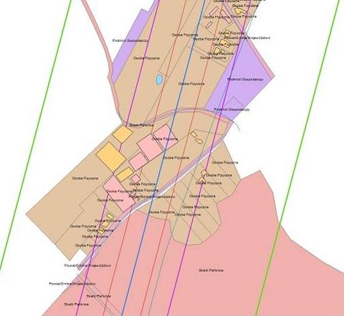
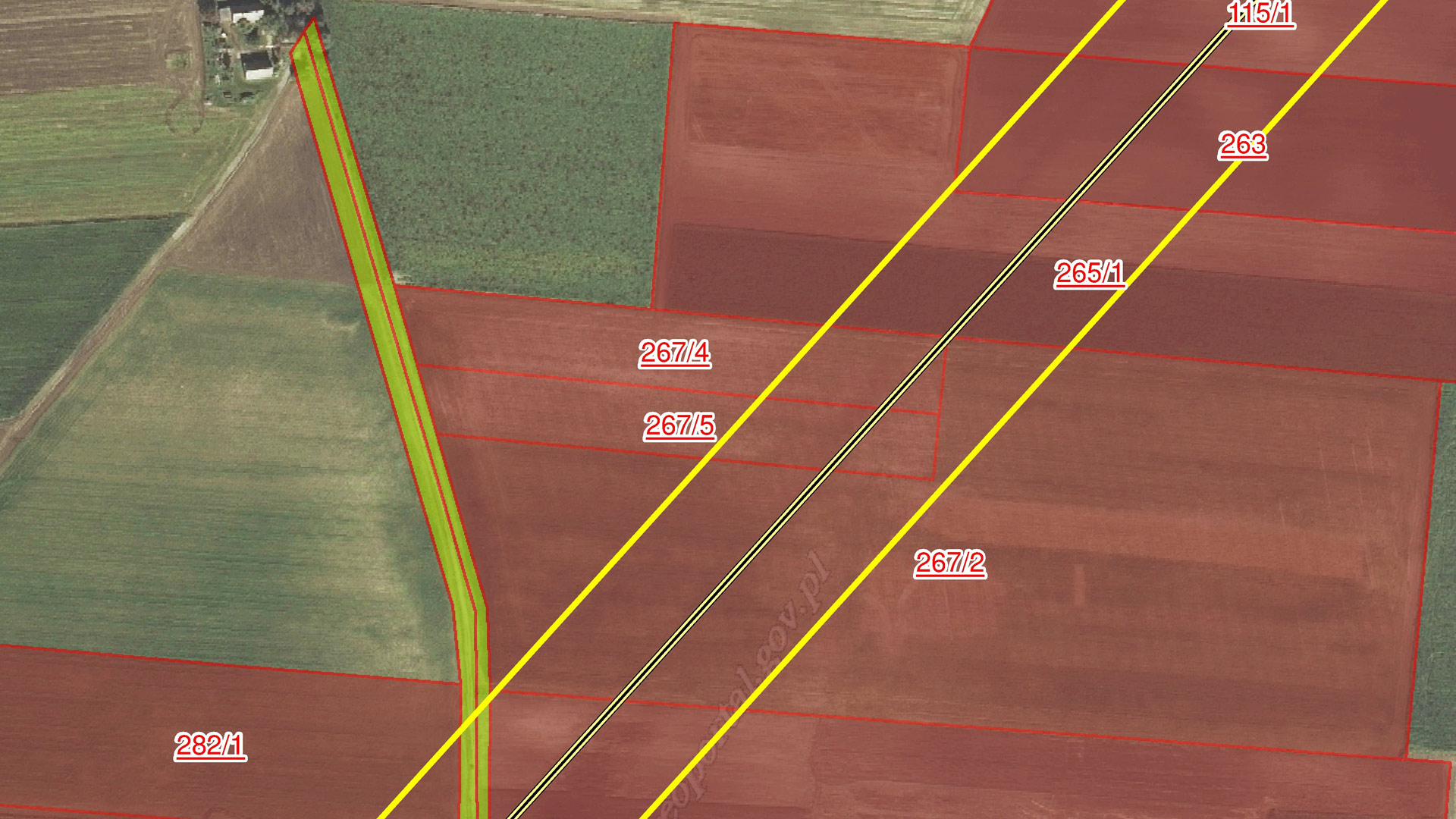
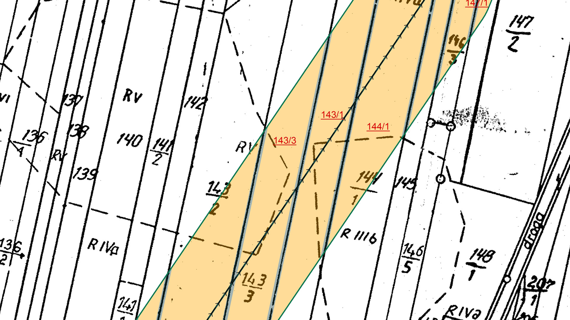
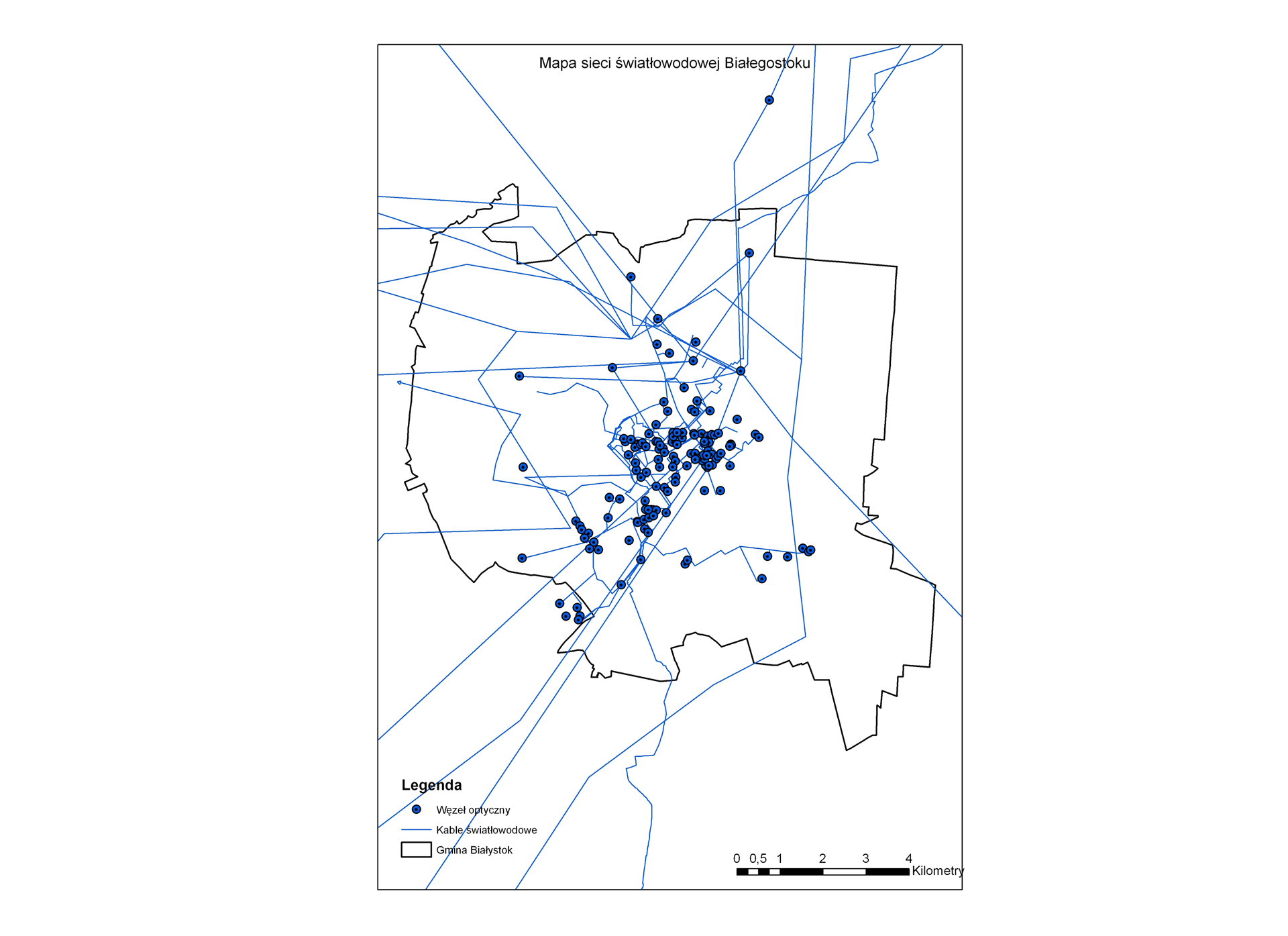
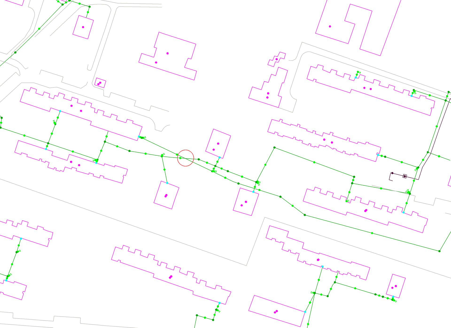
In support of establishing telecommunication broadband network infrastructure for the Podlaskie region in Poland, GISonLine was tasked to produce an accurate inventory and geospatial visualization of the telecommunication network.

The Impact

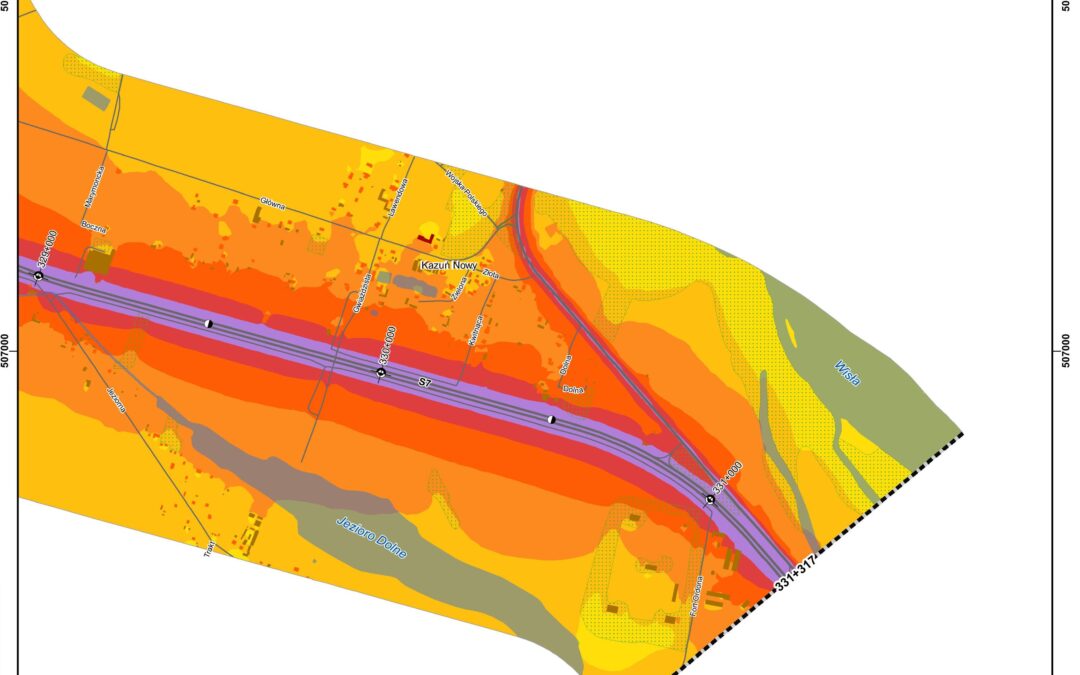
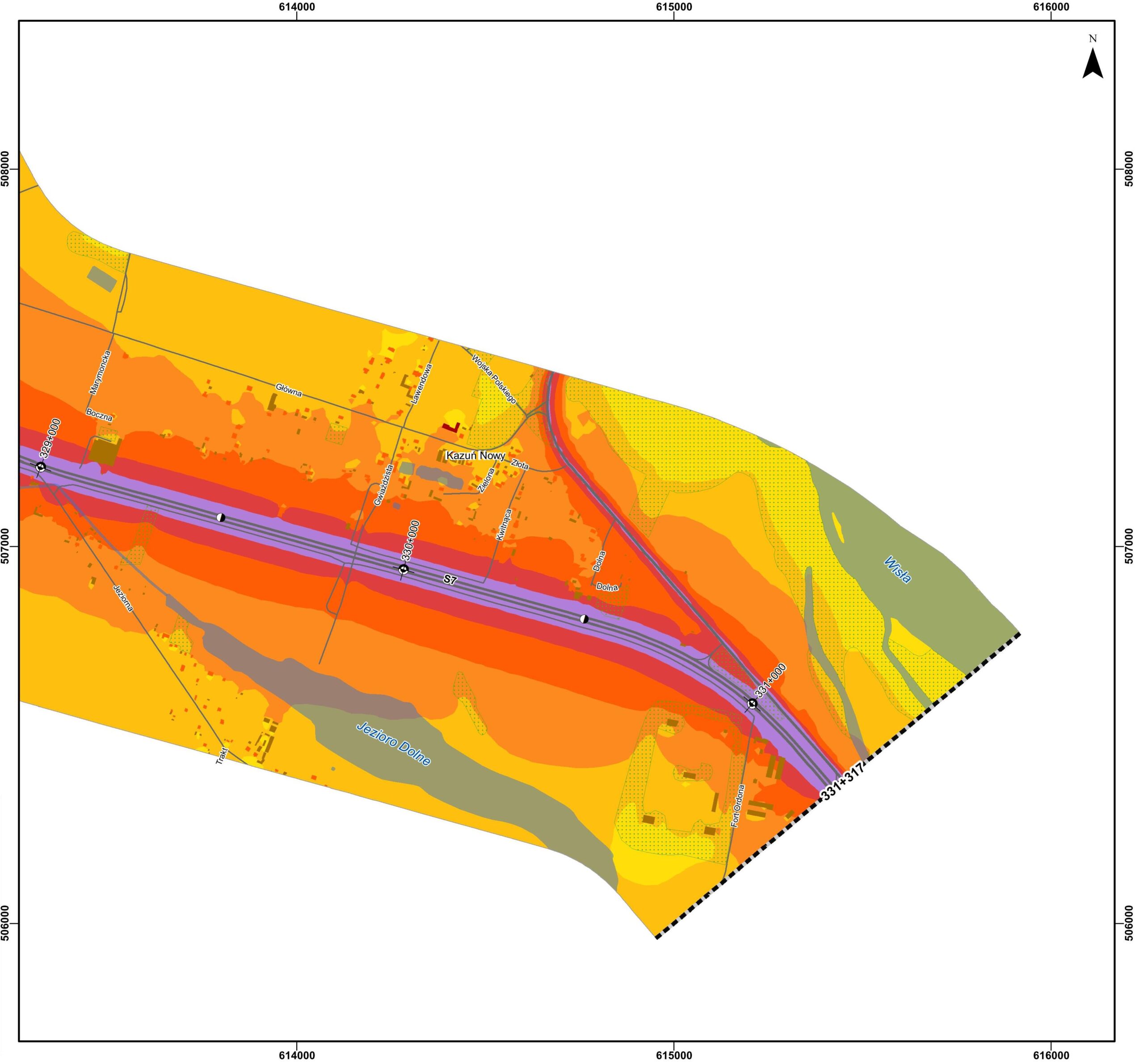
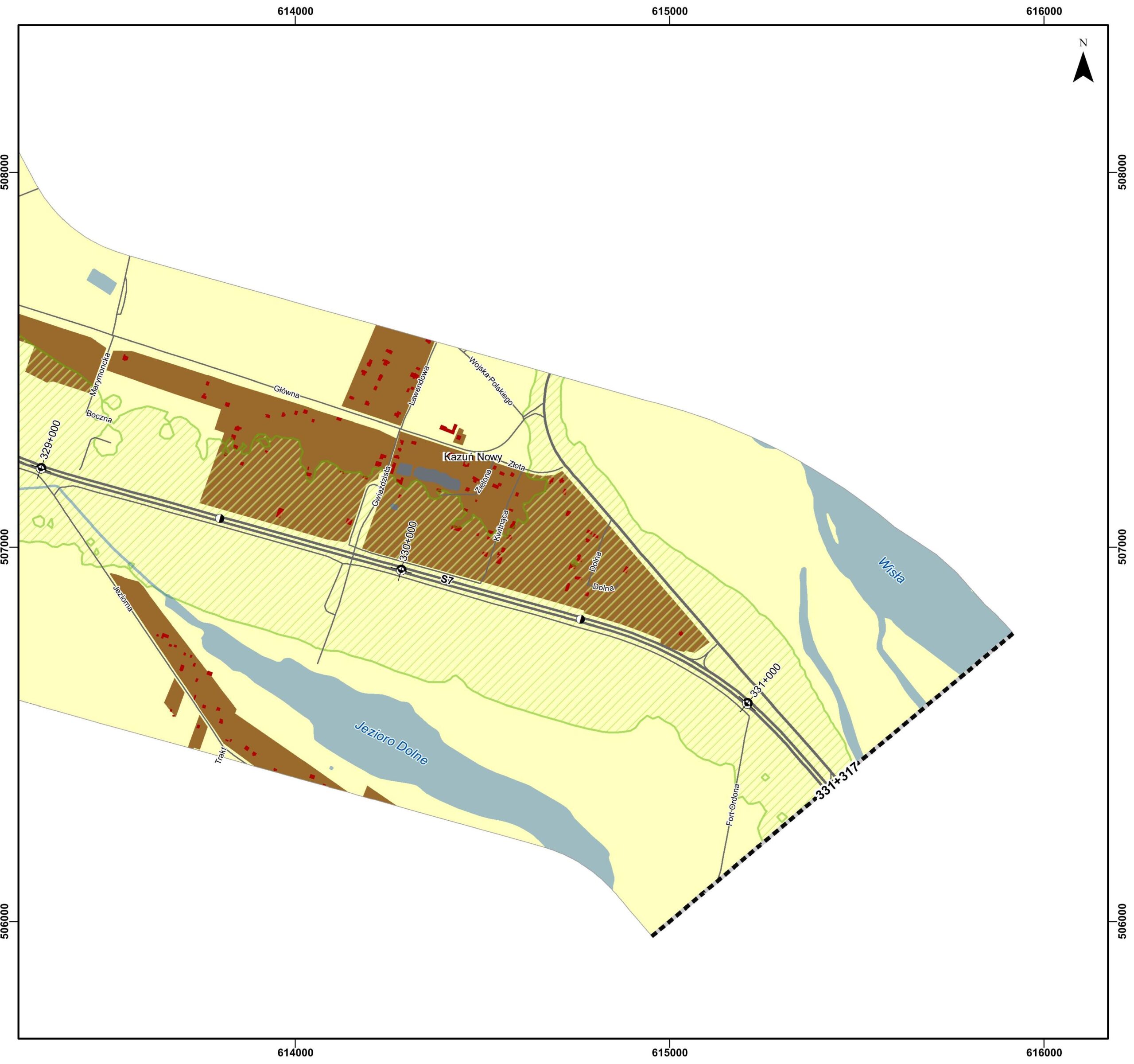
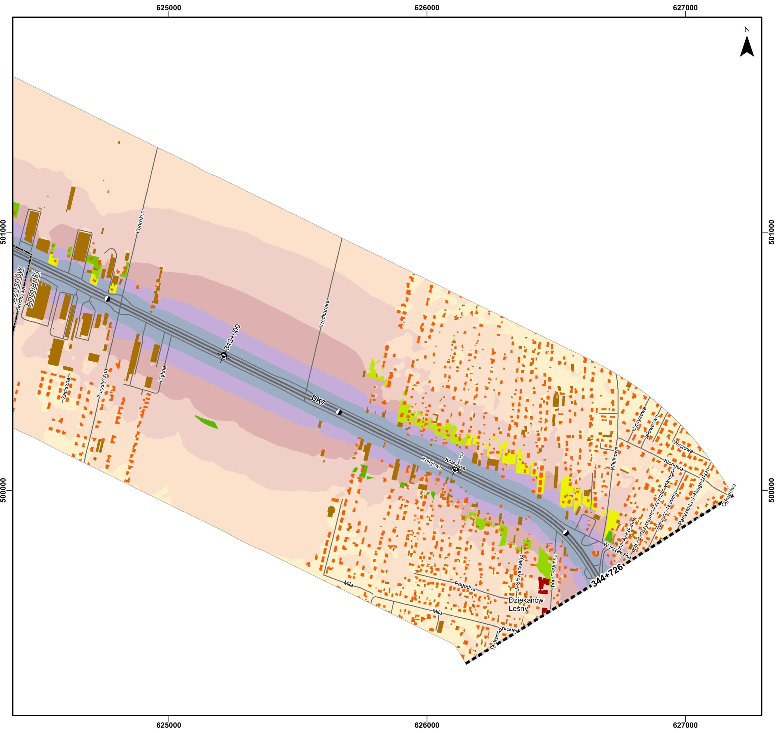
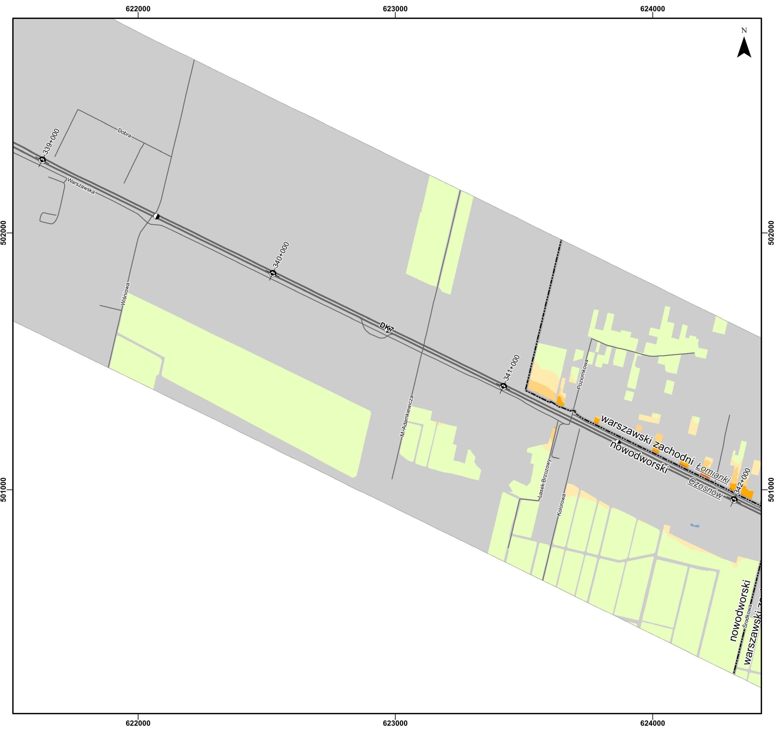
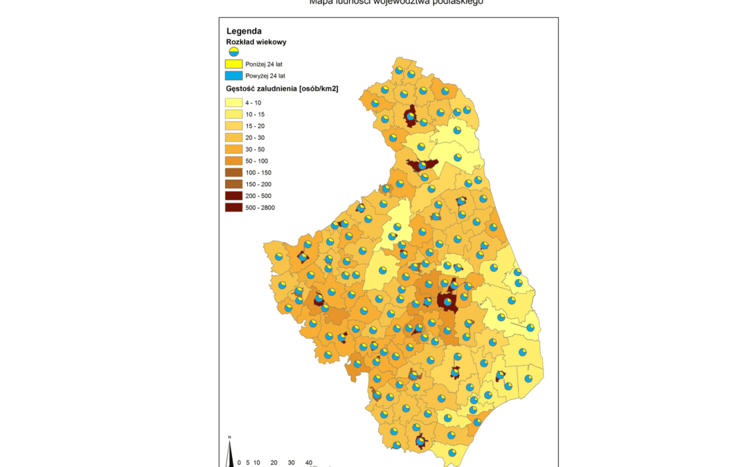
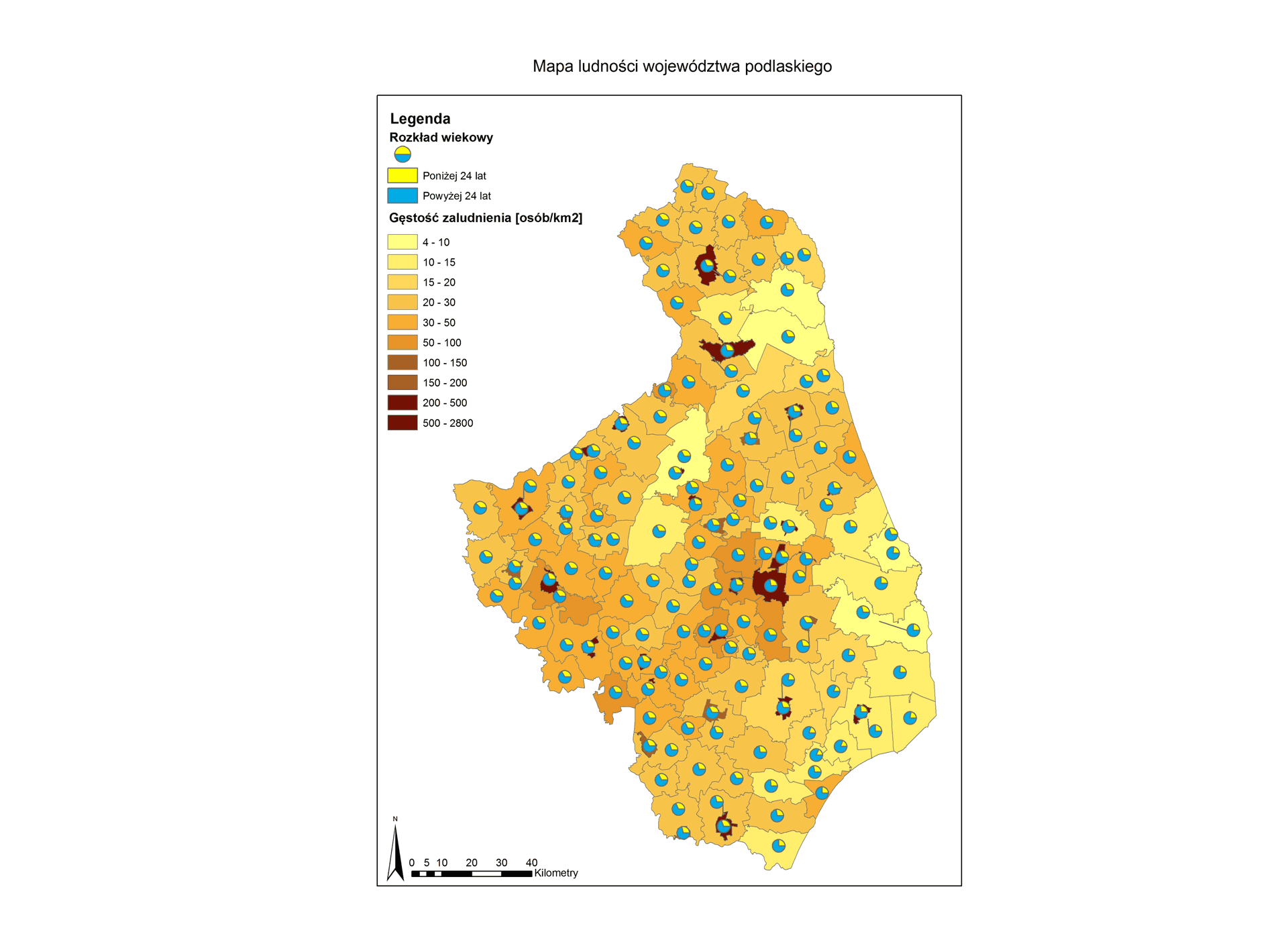
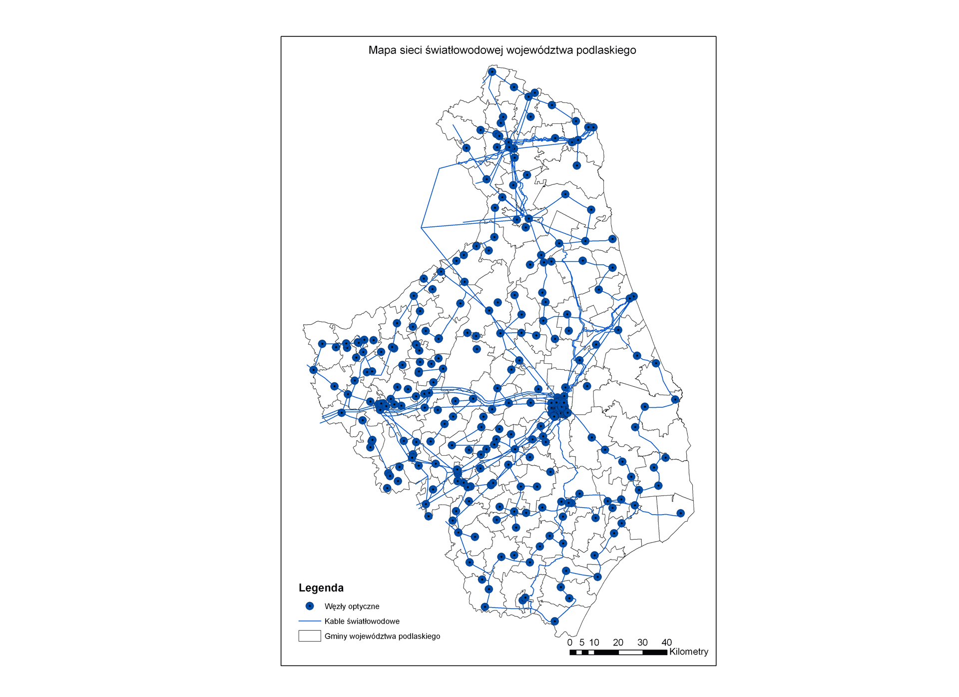
The project included conducting spatial analysis and visualization of the broadband network for identification of areas with the weakest coverage in services along with combining population and demographic datasets.

The Outcome

GISonLine obtained and collated industry data, regional population data, and telecom administrative data from multiple sources and disparate formats to form a comprehensive telecom broadband network spatial data visualization. 

A key deliverable was the development of geospatial feature layers covering the broadband telecom infrastructure and included CAD and GIS datasets, imagery, and associated attributes (populations, demographics, telecom services).  Results of the spatial analysis and mapping allowed for the effective planning and expansion of the telecom network taking into consideration the geospatial analysis showing the population data and areas of weakest coverage.

See some things

we’ve worked on

Contact us

Looking for Location Intelligence?

4 + 8 =

Supporting Feasibility Studies For Newly Built 400 kV Power Lines (PSE -Polskie Sieci Energetyczne)

Supporting Feasibility Studies For Newly Built 400 kV Power Lines (PSE -Polskie Sieci Energetyczne)

Home 9 Project Category: Data Management ( Page 4 )

Case studies

Supporting Feasibility Studies For Newly Built 400 kV Power Lines (PSE -Polskie Sieci Energetyczne)

Client

Industry

Energy & Utilities
Environmental Management

Region

Europe

Technology

Esri ArcGISONLINE
Javascript API

Overview

In support of the electrical transmission system operator PSE (Polskie Sieci Energetyczne), GISonLine provided geospatial support services that aided planning and decision support for the  feasibility studies associated with the planned placement of newly built 400 kV power lines. 

GISonLine obtained existing site surveys and land register maps and integrated the data into a single geospatial data model.  The site survey and land use data provided key information to combine with spatial data that provided the ability to perform spatial and statistical analysis in support of site feasibility studies and optimal placement of the electrical power line towers.

The Impact

For the feasibility studies, which included 241 kilometers of area, over 160 sheets of existing geodetic maps were obtained at various scales, as well as 35,000 feature extracts from the land and building register which were converted and stored in the newly designed digital database.

The Outcome

GISonLine successfully collated and integrated the site data obtained from the geodetic maps and land & building registry to form a single instance of a digital database.

Using the obtained data, GISonLine integrated the information into the Esri ArcGIS environment and performed a series of geo-statistical analysis, map visualizations, and created a set of spatial reports.

The spatial analysis and visualizations enabled the project contractors and stakeholders to visualize the number of plots through which the proposed power lines were planned to be developed. In addition, the spatial analysis provided key decision support to optimally design the final course and layout of the proposed high-voltage lines and towers.  

Deliverables and tasks under this project included:

  • Acquiring data from regional surveying centers
  • Conversion of data to spatial / vector formats
  • Construction of the spatial data model
  • Creating thematic maps using Esri ArcGIS
  • Performing spatial and statistical analysis

See some things

we’ve worked on

Contact us

Looking for Location Intelligence?

5 + 12 =

Supporting Environmental Protection Through Acoustic Noise Mapping (Mazowieckie Region, Poland)

Supporting Environmental Protection Through Acoustic Noise Mapping (Mazowieckie Region, Poland)

Home 9 Project Category: Data Management ( Page 4 )

Case studies

Supporting Environmental Protection Through Acoustic Noise Mapping (Mazowieckie Region, Poland)

Client

Industry

Environmental Management
Transportation

Region

Europe

Technology

ESRI ArcGIS
ArcGIS SDE
FME

Overview

GISonLine participated in the project to develop acoustic noise maps for the Mazowieckie region of Poland and the Directorate of National Roads & Motorways.  The project included providing geospatial support for key environmental protection and noise abatement programs. The project focus was centered on collecting and organizing data from multiple disparate sources that provide authoritative information in support of creating environmental mapping output and spatial analysis.

The Impact

Through the data collection efforts involving multiple government offices, digitization of analog materials, and migration of existing registration data, GISonLine was able to create a comprehensive picture and geospatial database of the noise impact caused by vehicle traffic was established for the region.

The Outcome

GISonLine successfully performed and delivered spatial analysis reports and thematic maps covering an area of ​​over a million kilometers of roadways within the Mazowieckie region. Deliverables under this project included:

  • Preparation of over 9,000 thematic maps for national environmental monitoring
  • Conducting spatial analysis & acoustic calculations of noise impact on the environment
  • Development of a formalized data model
  • Generation of reports for the European Commission

See some things

we’ve worked on

Contact us

Looking for Location Intelligence?

10 + 9 =

Local Government Ecological Initiatives Mapping Using Esri ArcGIS Online (Świętokrzyskie Region, Poland)

Local Government Ecological Initiatives Mapping Using Esri ArcGIS Online (Świętokrzyskie Region, Poland)

Home 9 Project Category: Data Management ( Page 4 )

Case studies

Local Government Ecological Initiatives Mapping Using Esri ArcGIS Online (Świętokrzyskie Region, Poland)

Client

Industry

Local Government

Region

Europe

Technology

Esri ArcGIS Online
GML
ESRI ArcGIS Pro
FME

Overview

In support of the local government (Świętokrzyskie region in Poland) ecological initiatives and investments, GISonLine was tasked to establish geodatabases and a custom web mapping portal that displayed the thematic maps containing the local government’s investments in ecological projects.

The Impact

As part of the project data was obtained and organized from over 150 institutions and local government units from the Świętokrzyskie region. The data was then used to provide attribute and content information to feed the database and populate the local government web-based mapping platform.

The Outcome

GISonLine successfully collected and developed a set geospatial feature layers (with feature attribution) to establish the thematic database displaying spatially where the investments occured in support of ecological initiatives. The project included creation of a web-based mapping portal using Esri ArcGIS Online and supported the local government representatives and project stakeholders with investment decision support. Deliverables associated with the project included:

  • Design and creation of web-based portal using Esri ArcGIS Online
  • Packaging and delivery of Esri Shapefiles & GML formats
  • Map prints displaying ecological initiatives and their locations
  • Instructional training on ArcGIS portal


See some things

we’ve worked on

Contact us

Looking for Location Intelligence?

11 + 4 =

Mapping Impervious Surfaces in Support of Stormwater Management Programs (Cobb County, Georgia, USA)

Mapping Impervious Surfaces in Support of Stormwater Management Programs (Cobb County, Georgia, USA)

Home 9 Project Category: Data Management ( Page 4 )

Case studies

Mapping Impervious Surfaces in Support of Stormwater Management Programs (Cobb County, Georgia, USA)

Client

Industry

Local Government
Environmental Management

Region

USA

Technology

Esri ArcGIS
orthophoto digitization
ArcGIS SDE

Client: Critigen
Location: Georgia, USA

GISonLine was pleased to provide support through the creation of geospatial feature layers and geodatabases associated with the mapping of impervious surfaces (ex: roofs, driveways, sidewalks, roads, parking lots…etc.) using orthophotos covering an area of ​​over 100 km2 within Cobb County, Georgia, USA.

The Impact

Primary goals of the project were to establish a geodatabase containing the feature layers of impervious surfaces for the purpose of fee collections associated with rainwater run-off and storm water sewer systems.

The Outcome

GISonLine successfully performed digitization and feature layer creation of impervious surfaces using the orthomosaic imagery. In addition, GISonLine provided spatial data quality control and assessment with delivery of a topologically correct vector database to Cobb County, Georgia stakeholders.

See some things

we’ve worked on

Contact us

Looking for Location Intelligence?

11 + 6 =