Case studies
Mapping Impervious Surfaces in Support of Stormwater Management Programs (Cobb County, Georgia, USA)
Client

Industry
Local Government
Environmental Management
Region
USA
Technology
Esri ArcGIS
orthophoto digitization
ArcGIS SDE
Client: Critigen
Location: Georgia, USA
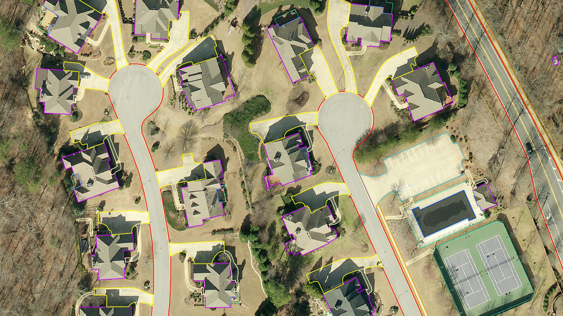
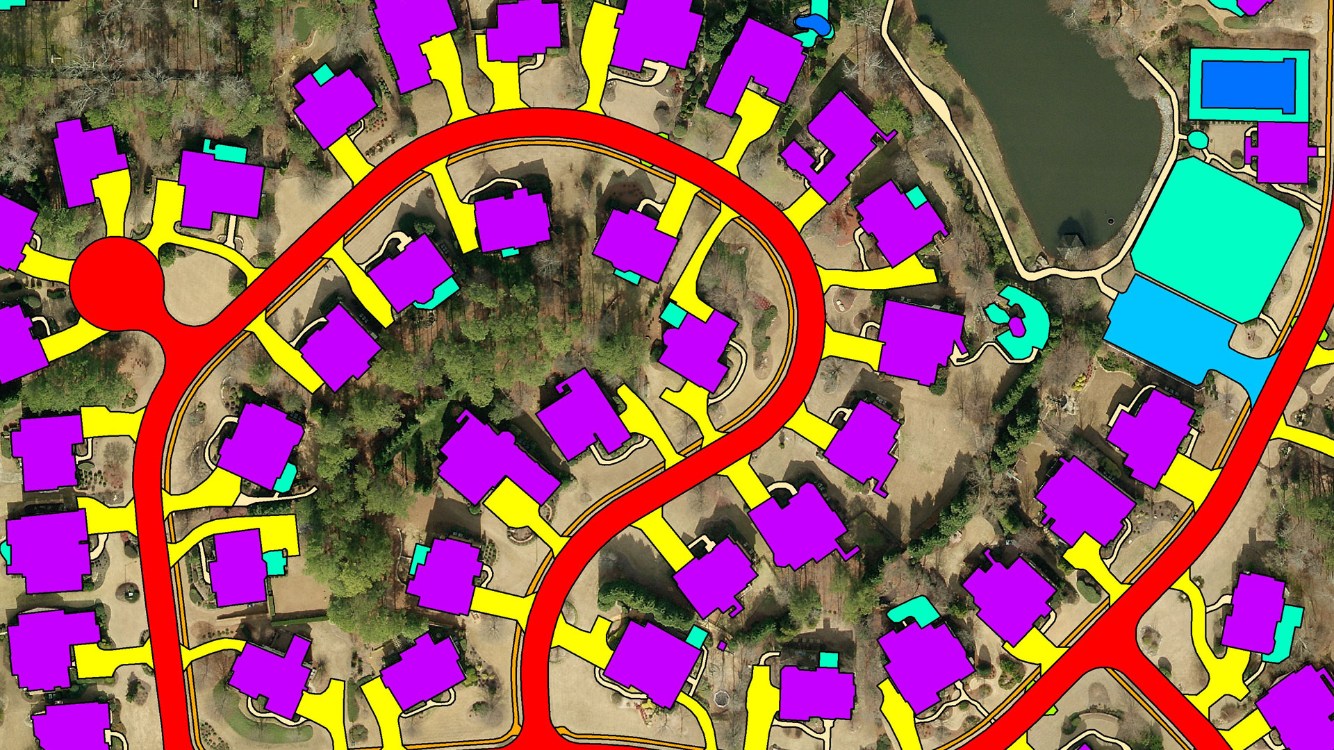
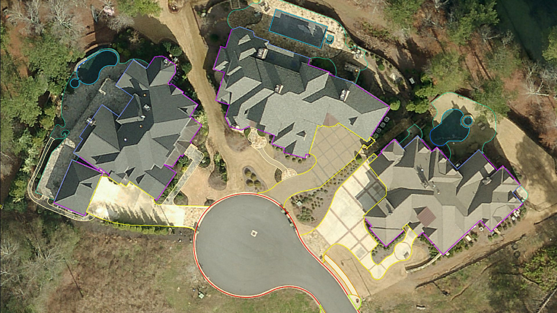
GISonLine was pleased to provide support through the creation of geospatial feature layers and geodatabases associated with the mapping of impervious surfaces (ex: roofs, driveways, sidewalks, roads, parking lots…etc.) using orthophotos covering an area of over 100 km2 within Cobb County, Georgia, USA.
The Impact
Primary goals of the project were to establish a geodatabase containing the feature layers of impervious surfaces for the purpose of fee collections associated with rainwater run-off and storm water sewer systems.
The Outcome
GISonLine successfully performed digitization and feature layer creation of impervious surfaces using the orthomosaic imagery. In addition, GISonLine provided spatial data quality control and assessment with delivery of a topologically correct vector database to Cobb County, Georgia stakeholders.
See some things
we’ve worked on

Contact us
Looking for Location Intelligence?