Using Drone Data Collections To Identify Medium Voltage (MV) Railway Assets (PKP Energetyka)

Using Drone Data Collections To Identify Medium Voltage (MV) Railway Assets (PKP Energetyka)

Home 9 Project Category: Data Management ( Page 5 )

Case studies

Using Drone Data Collections To Identify Medium Voltage (MV) Railway Assets (PKP Energetyka)

Client

Industry

Energy & Utilities
Survey & Inspection
Transportation

Region

Europe

Technology

Phoenix Unmanned Aerial Vehicle (UAV)
Griffin multi-Rotor Unmanned Aerial Vehicle (UAV)
ESRI ArcGIS

Client:  PKP Energetyka
Location: Podłęże-Bochnia, Poland

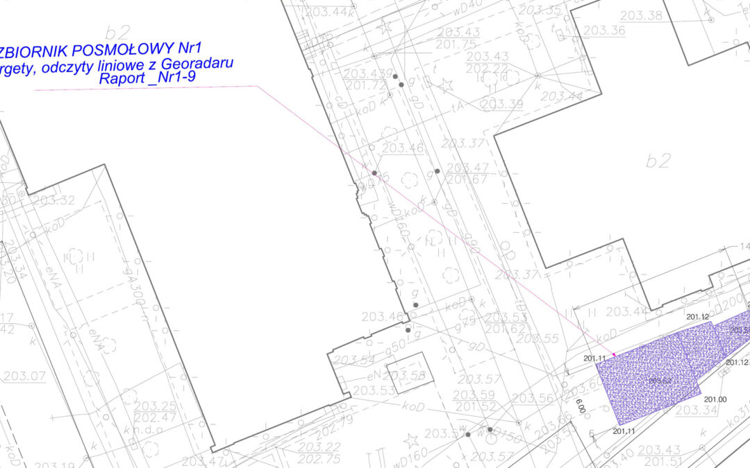
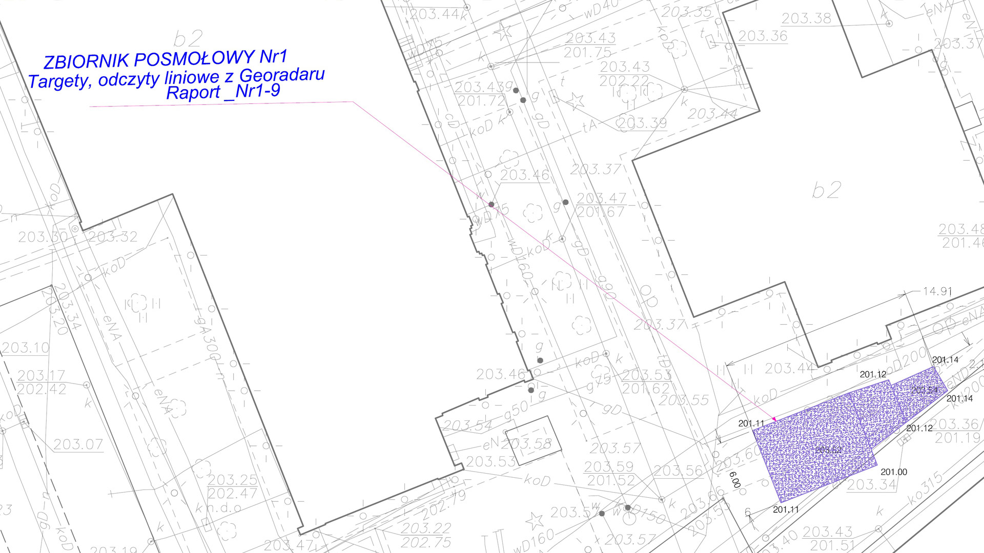
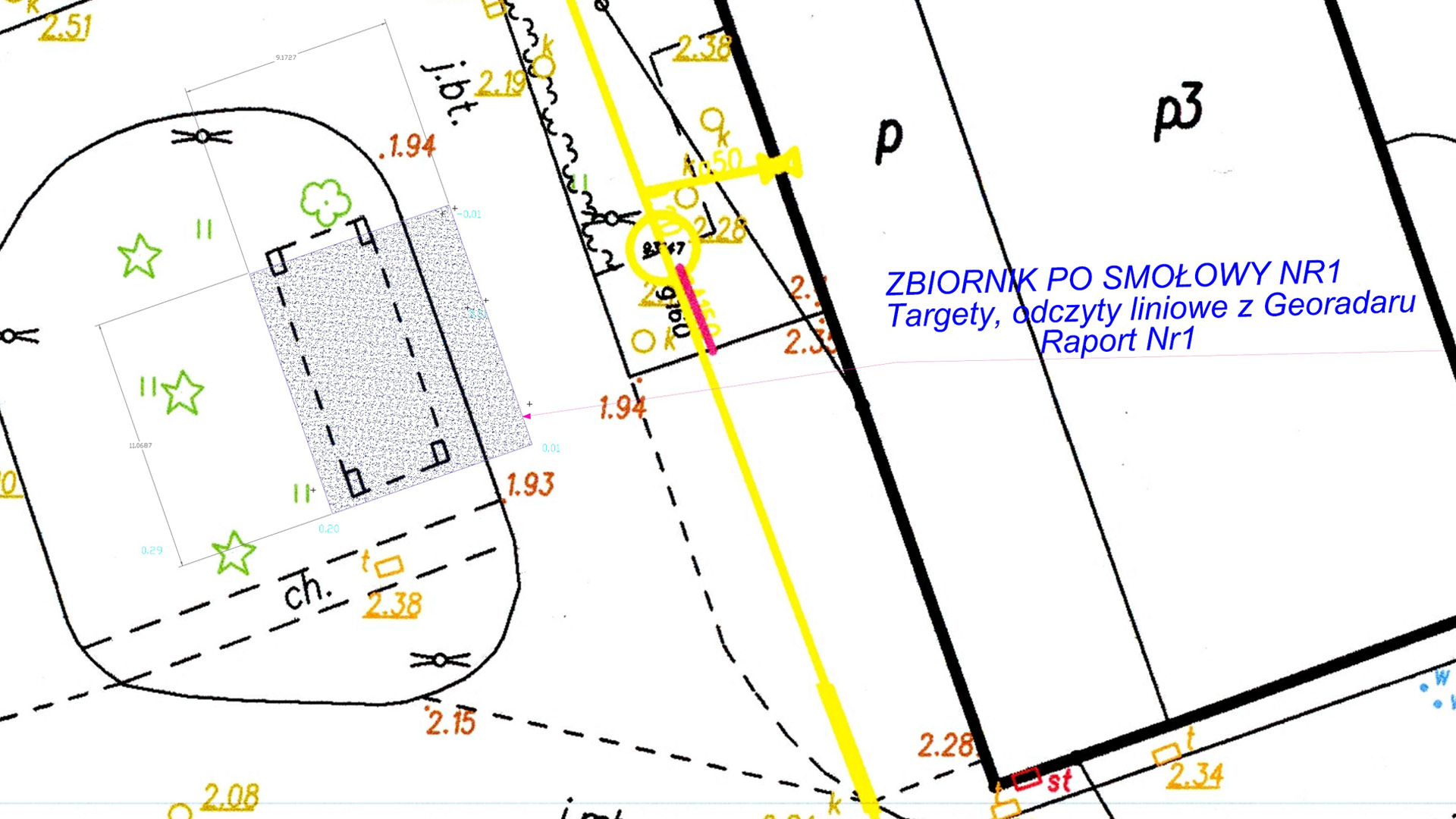
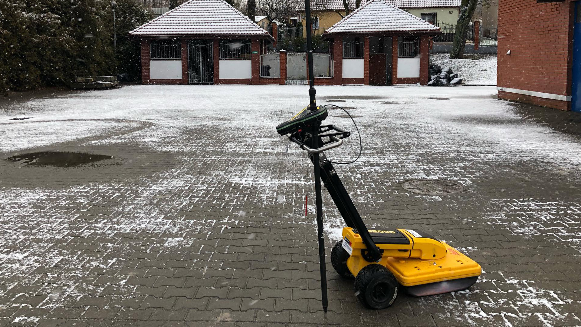
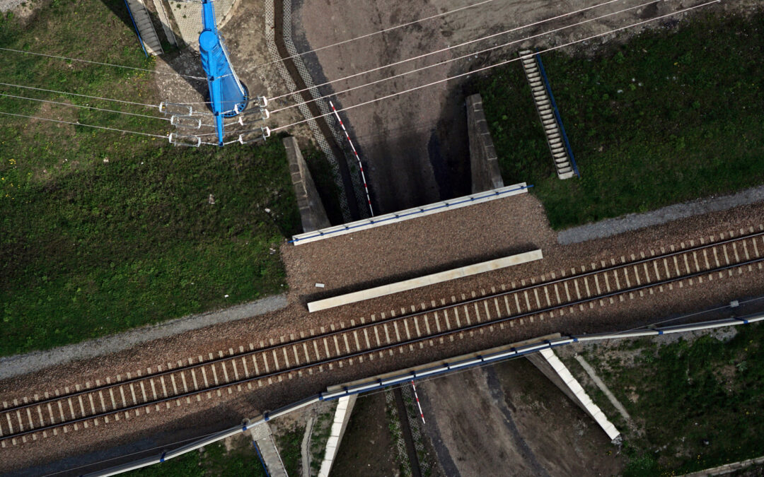
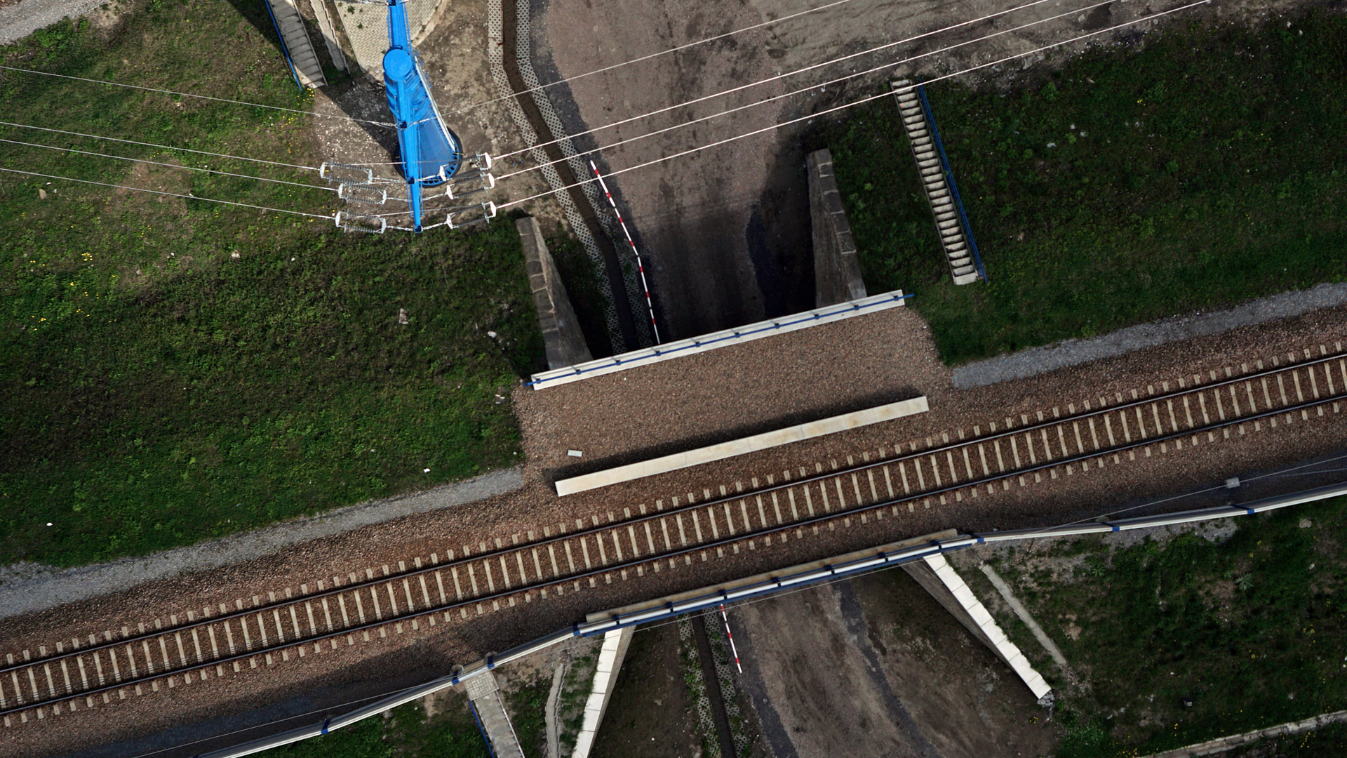
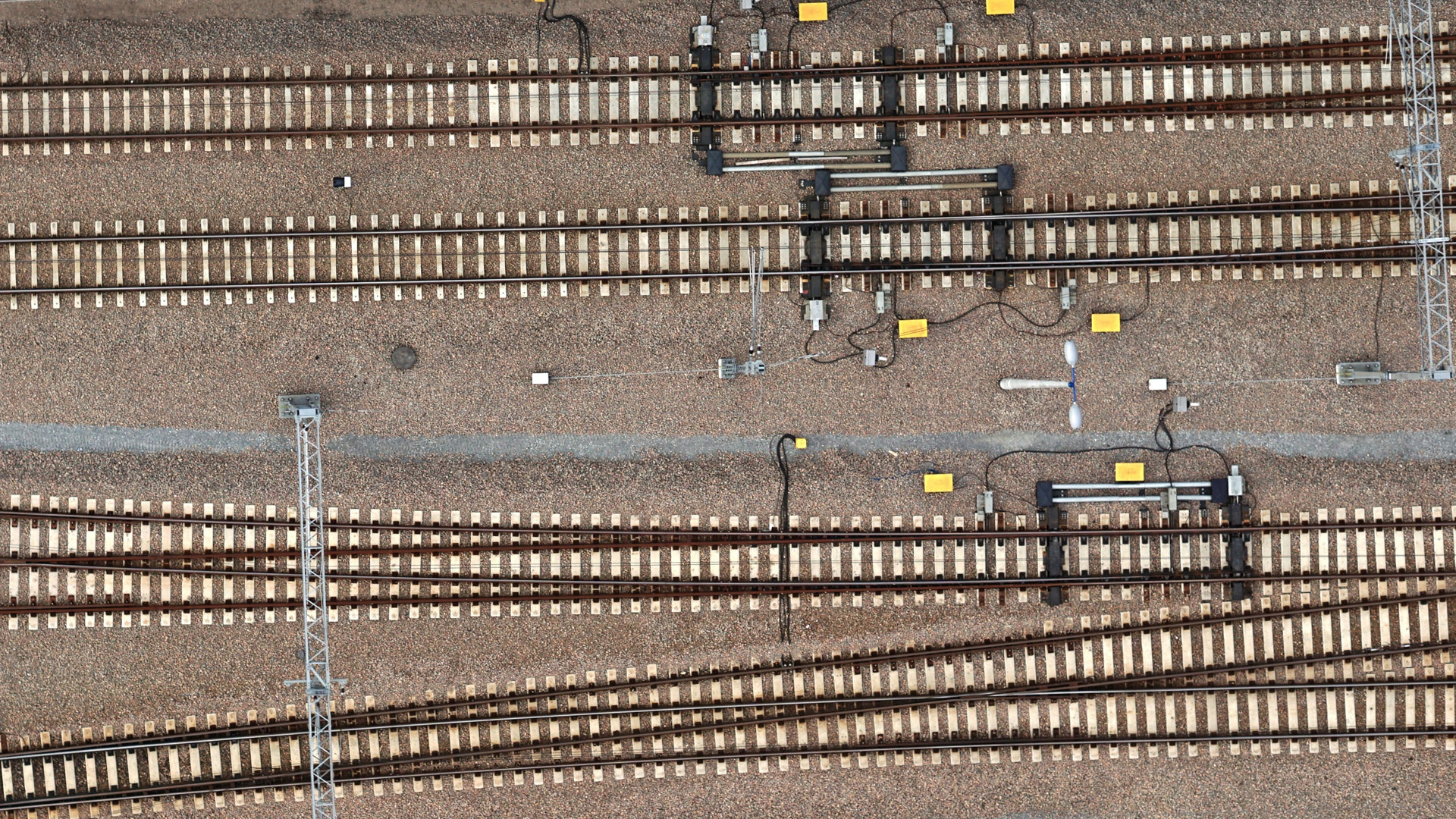
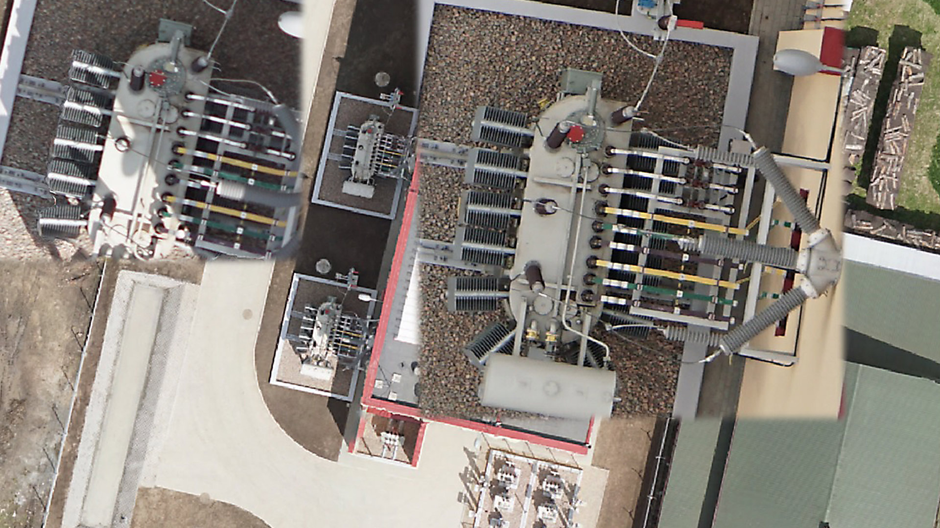
GISonLine completed a research and development project in support of PKP Energetyka’s Medium Voltage (MV) utility networks by conducting an asset inventory using drone data captures for the newly renovated section (20 km) of the Podłęże-Bochnia railway line. 

Successful results of the research and data capture efforts supported PKP Energetyka interests in the topic of using drones for the inventory and inspection processes associated with utilities enterprise asset management.

The Impact 

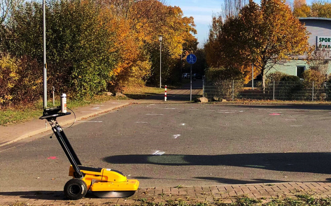
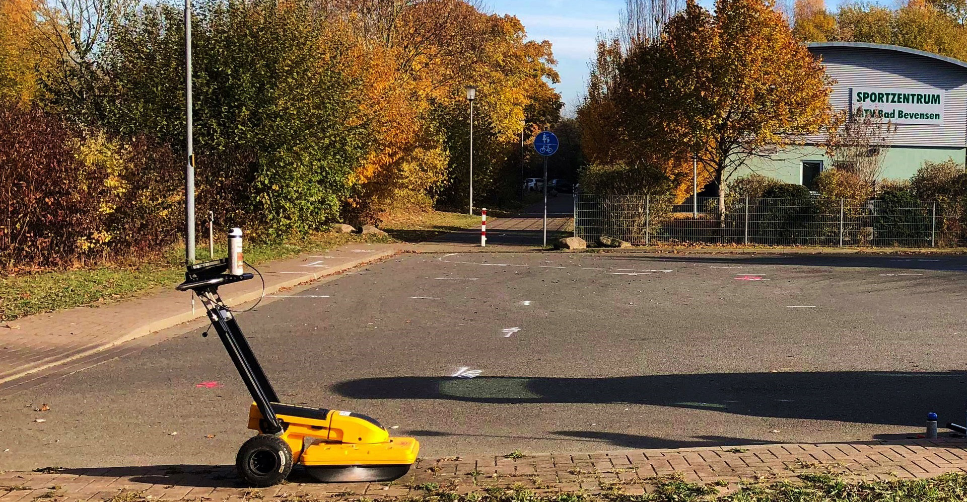
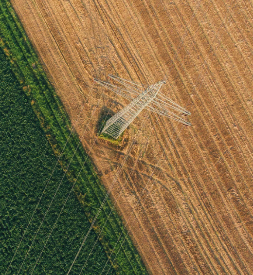
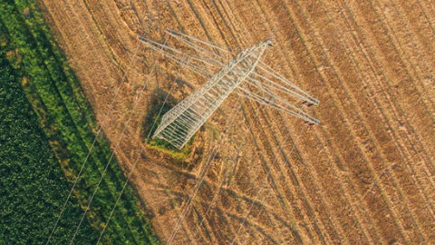
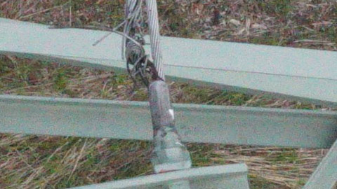
Based on the drone identification and inventory of electrical utility assets, the newly renovated section of railway line was captured using two different types of UAV’s: the Phoenix UAV and the Griffin multi-Rotor platforms.

Both drone systems were equipped with high-resolution cameras producing high quality images and videos to support the production of orthophoto maps with a resolution of 1 cm / pixel, a numerical model of land cover, and point cloud data for the visualization of the area in a 3D environment.  

The Outcome

GISonLine successfully conducted the aerial data capture covering the 20 kilometers area of railway electrical networks and provided to PKP Energetyka core deliverables:

  • High-resolution orthophoto maps
  • Point Cloud Data
  • 3D Models
  • High-resolution images & video of utility network assets
  • Geodatabase of utility  objects
  • Comprehensive report on the use of drones for inspecting utility networks

See some things

we’ve worked on

Contact us

Looking for Location Intelligence?

13 + 5 =

Using Ground Penetrating Radar to Map & Visualize Underground Utility Networks (Bad Bevensen, Germany)

Using Ground Penetrating Radar to Map & Visualize Underground Utility Networks (Bad Bevensen, Germany)

Home 9 Project Category: Data Management ( Page 5 )

Case studies

Using Ground Penetrating Radar to Map & Visualize Underground Utility Networks (Bad Bevensen, Germany)

Client

Industry

Energy & Utilities
Survey & Inspection
Transportation

Region

Europe

Technology

Ground Penetrating Radar (GPR)
AutoCAD

Client: Exact
Location: Bad Bevensen, Germany

In support of its survey and inspection partnership, GISonline conducted an underground detection survey to create multi-disciplinary digital maps of the underground utilities network covering an area of ​​approximately 1 Kilometer in the Bad Bevensen region of Germany. The project included integrating data from a comprehensive soil surveys associated with sections of the project area for the visualization of buried utilities and soil types.

The Impact

The project had a significant impact on determining the course and the depth of the existing underground utility network using detection methods such as Ground Penetrating Radar (GPR).

The Outcome

GISonLine successfully conducted the underground detection survey of the project site and utility lines and produced key sets of deliverables:

  •  GRP survey detection of underground obstacles and objects
  • Preparation and delivery of underground utility maps
  • Integration of existing documentation related to the project site
  • Delivery of all CAD mapping data and files

See some things

we’ve worked on

Contact us

Looking for Location Intelligence?

13 + 14 =

Reducing Power Outages Using Drones to Detect Faults in High Voltage Power Lines (Tauron Dystrybucja SA)

Reducing Power Outages Using Drones to Detect Faults in High Voltage Power Lines (Tauron Dystrybucja SA)

Home 9 Project Category: Data Management ( Page 5 )

Case studies

Reducing Power Outages Using Drones to Detect Faults in High Voltage Power Lines (Tauron Dystrybucja SA)

Client

Industry

Survey & Inspection
Energy & Utilities

Region

Europe

Technology

UAV
High Resolution Image Capture

Client: Tauron Dystrybucja SA
Location: Poland

GISonLine performed a series of inspections on the technical condition and state of the high-voltage (HV) power lines and network objects using aerial drone inspections in support of Tauron Dystrybucja SA utility provider.

The Impact  

The high-voltage power lines were surveyed using two different UAV’s equipped with high-resolution digital cameras that made possible the identification of asset damages and fault issues. The work was carried out in remote and difficult terrain conditions where access was only possible using UAV platforms. Targeted objects for inspection included:

  • Phase Lines
  • Overhead Lines
  • Support structures
  • Network distribution objects (circuit bridges, insulators)

The Outcome

GISonLine successfully conducted the aerial inspection and captured high resolution images and videos detailing the power line networks and assets.

Due to the high resolution and quality of the photos and videos obtained, it was possible to identify and flag areas of damage and concerns associated with the power line sections and network distribution objects.  While analyzing the results of the survey, GISonLine identified and documented a number of feature issues (faults) which had a significant impact on the proper functioning of the network such as:

  • Lightning protection wires unbraiding
  • Wear and discoloration of wire braids
  • Damaged and unbraiding of vibration dampers and protective cables 
  • Damage to electrical insulators

See some things

we’ve worked on

Contact us

Looking for Location Intelligence?

12 + 9 =

Cleaning up the Environment by Detecting & Mapping Buried Storage Tanks (PG Kielce)

Cleaning up the Environment by Detecting & Mapping Buried Storage Tanks (PG Kielce)

Home 9 Project Category: Data Management ( Page 5 )

Case studies

Cleaning up the Environment by Detecting & Mapping Buried Storage Tanks (PG Kielce)

Client

Industry

Survey & Inspection

Region

Europe

Technology

Ground Penetrating Radar (GPR)
Geo-Radar Measurements
AutoCAD

Client: Przedsiębiorstwo Geologiczne Sp. z o.o.
Location: multiple cities in Poland

At the request of one of the largest Polish geological companies  (PG Kielce), GISonLine carried out an extensive underground detection survey to verify the location of tanks buried in the 20th century.

The Impact

Given the absence of archival documentation and the exact locations of the buried storage tanks, GISonLine was tasked with providing underground detection services to accurately identify and map the location, dimensions & thickness, buried depths, and construction materials used for the storage tanks.

The Outcome

GISonLine successfully conducted the underground surveys using Ground Penetrating Radar (GPR)  and geodetic measurements and completed the work in 15 Polish cities to include: Gdańsk, Gorzów Wielkopolski, Kraków, Łódź and Opole.   

The project included delivery of key underground detection survey products:

  • Geo-radar measurements confirming the location of the underground tanks
  • Detection of tank boundaries and determination of their depth
  • Data and attributes related to each tank’s thickness, detected depth, and other detected objects
  • Investigation of additional located objects found near the project sites
  • Custom maps displaying tank locations and surrounding environmental areas

See some things

we’ve worked on

Contact us

Looking for Location Intelligence?

15 + 10 =

Integrating Esri ArcGIS Capabilities in Support of District Heating Asset Management (Krakow, Poland)

Integrating Esri ArcGIS Capabilities in Support of District Heating Asset Management (Krakow, Poland)

Home 9 Project Category: Data Management ( Page 5 )

Case studies

Integrating Esri ArcGIS Capabilities in Support of District Heating Asset Management (Krakow, Poland)

Client

Industry

Energy & Utilities
Local Government

Region

Europe

Technology

ArcGIS Web AppBuilder
JavaScript, HTML, CSS
Esri ArcGIS Enterprise
Portal for ArcGIS
PostgreSQL
FME
SmallWorld
.Net Core

Client: MPEC
Location: Krakow, Poland

In support of MPEC (Miejskie Przedsiębiorstwo Energetyki Cieplnej) business operations and the supply of district heating to Krakow residents, GISonLine provided geospatial mobile applications and custom web portals that provided geospatial resources and capabilities to MPEC’s asset management processes.

MPEC is one of the leaders in the heating industry in Poland providing heat to over 65 percent of residents in the city of Krakow. Heat from the MPEC utility network (almost 900 kilometers long) supports the heating of municipal entities such as: housing estates, shopping malls, congress halls, offices, schools, hospitals and churches.

The Impact

MPEC’s activities and infrastructure are important for the environment and addressing the city of Krakow’s air quality due to smog.  Notably, the transition of gas stoves being replaced with MPEC’s central hot water system.  Having a geospatial system designed for managing MPEC’s existing utility infrastructure and to serve as a tool for planning future development are key aspects of modernization and successful city planning.

The Outcome

GISonLine successfully integrated the Esri ArcGIS platform into MPEC’s business operations, connected ArcGIS with authoritative data sources, and established a set of applications that supported MPEC employees with their asset management and visualization workflows.  In addition, GISonLine implemented:

  • Geospatial applications for mobile field workers conducting asset maintenance
  • Web based dashboards to help MPEC managers report on current data and statistics
  • Esri ArcGIS web applications providing geospatial tools to manage utility infrastructure and plan future development.

See some things

we’ve worked on

Contact us

Looking for Location Intelligence?

11 + 2 =