Power Grid Inventory & Automated Data Migrations for Electrical Utilities Network (Innogy)

Power Grid Inventory & Automated Data Migrations for Electrical Utilities Network (Innogy)

Home 9 Project Category: Data Management ( Page 2 )

Case studies

Power Grid Inventory & Automated Data Migrations for Electrical Utilities Network (Innogy)

Client

Industry

Energy & Utilities

Region

Europe

Technology

ESRI – ArcGIS Server
GE Smallworld
Safe Software – FME
.NET
Python – Arc.py

Client: Innogy
Location: Poland

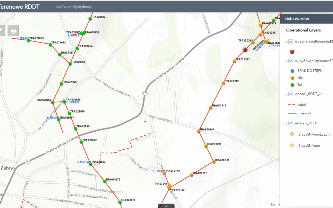
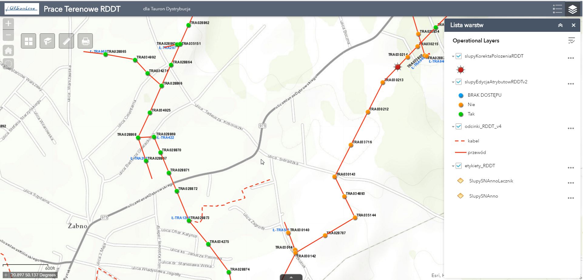
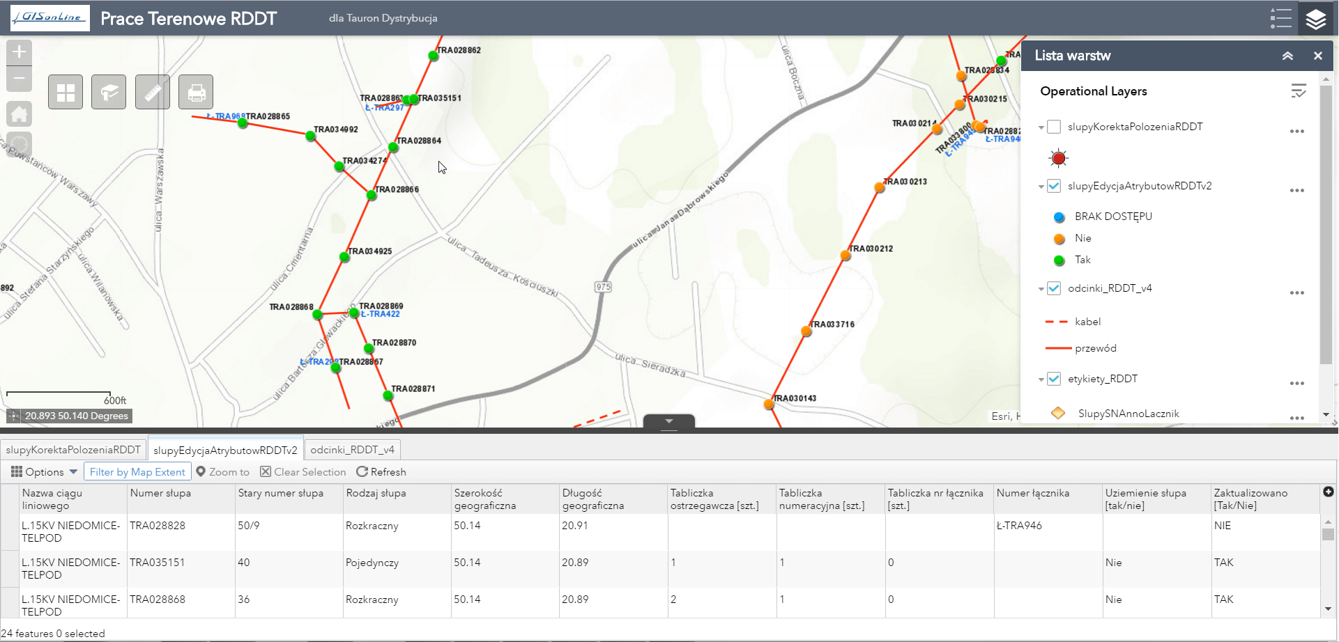
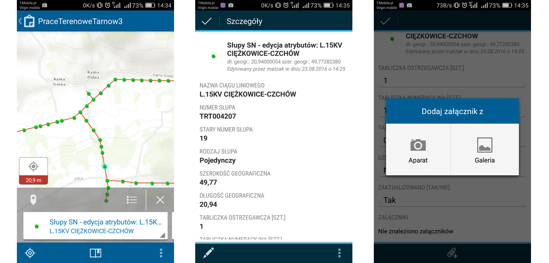
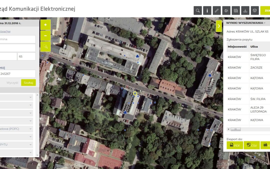
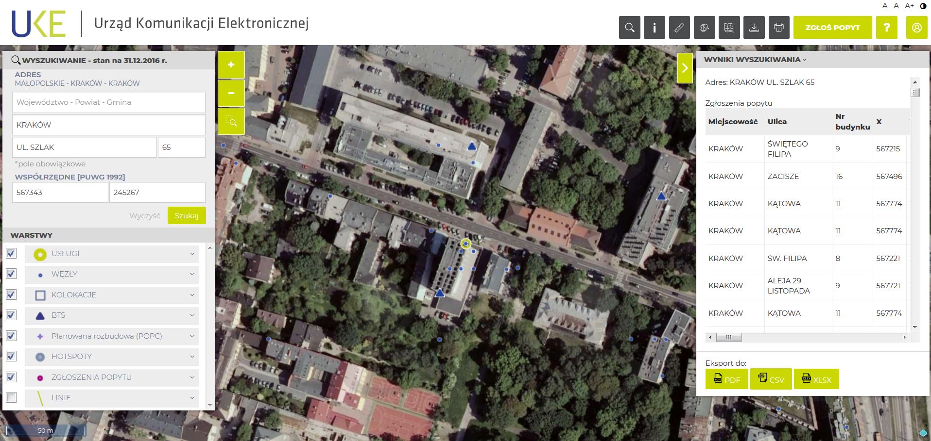
GISonLine participated in the implementation of the power grid inventory and data migrtations in support RWE IT Polska utilities provider (now Innogy). The scope of work included professional GIS services to include consultations in the field of passporting, data migration, quality control and programming services. 

The Impact

As part of the work, GISonLine established project management oversight and the creation of technical and project documentation that included:

  • Project schedules and milestones
  • Data migration strategy
  • Inventory methodology
  • Data cleaning strategy
  • Data quality assurance and quality control methods

The outcome

GISonLine successfully formalized and executed the data migration, data cleaning, and data quality control plans. Through these efforts, GISonLine established a set of dedicated software tools designed specifically to automate the quality assessment and control processes of Innogy’s enterprise utility asset data. The project also included delivery of system integration plans to migrate from GE Smallworld to targeted Esri ArcGIS environment. 

See some things

we’ve worked on

Contact us

Looking for Location Intelligence?

11 + 3 =

Integrating Custom Mobile Apps for Field Data Collections of Electrical Utility Network (Tauron Dystrybucja SA)

Integrating Custom Mobile Apps for Field Data Collections of Electrical Utility Network (Tauron Dystrybucja SA)

Home 9 Project Category: Data Management ( Page 2 )

Case studies

Integrating Custom Mobile Apps for Field Data Collections of Electrical Utility Network (Tauron Dystrybucja SA)

Client

Industry

Energy & Utilities
Survey & Inspection
Consumer Applications

Region

Europe

Technology

Esri- ArcGIS Server
Esri ArcGIS Online
Safe Software – FME
.NET
Android
Collector for ArcGIS

Overview

GISonLine was tasked to support a large scale network inventory project involving field data collections for the TAURON network of utility assets & resources. In addition, a core requirement was for TAURON to maintain critical business operations during the transition from a legacy asset management system to a modern geospatial mapping platform.

The Impact

Integration of mobile geospatial technology allowed TAURON team-members the ability to collect and inventory core utility assets and attributes while operating in the field.  

Over 40 thousand electrical poles and substations were surveyed with detailed information collected regarding their spatial locations, condition and attributes, and documention via site photos.  

The outcome

GISonLine successfully implemented a custom mobile mapping solution that supports field crews during the data collection and inventory of utility assets. The mobile app supported workflow and data management tools designed to work with specifically with geospatial data.

The custom application included reporting dashboards allowing users to track project phases with required performance indicators and issue management. As a result of the mobile applications, TAURON was able to leverage up-to-date geospatial capabilities for managing and visualizing their enterprise utility network of assets.

See some things

we’ve worked on

Contact us

Looking for Location Intelligence?

3 + 11 =

Using Google Maps in support of the National Program of Telecom Infrastructure Inventory (UKE)

Using Google Maps in support of the National Program of Telecom Infrastructure Inventory (UKE)

Home 9 Project Category: Data Management ( Page 2 )

Case studies

Using Google Maps in support of the National Program of Telecom Infrastructure Inventory (UKE)

Client

Industry

Telecommunications

Region

Europe

Technology

Google Maps API
PostgreSQL / PostGIS database platform
React/Redux
Entity Framework
WCF
.Net Core

Overview

The goal of the project was to establish a web-based platform that integrates telecommunication network inventory of geospatial data and allows users to query, visualize and analyze the location of telecom assets. In addition, the requirements included the ability for Users to report on the demand for telecom services in support of investment planning.

The Impact

The telecom inventory covered public and private telecommunications networks, telephone services, data transmission services for broadband Internet, and radio and television broadcasting services.

The outcome

GISonLine established a telecommunications web mapping solution that was based on a technology stack using Geoserver / Google Maps technology/ PostgreSQL / Postgis.

The implemented solution allowed clients to view and provide information on the availability of infrastructure and telecom services provided to the public.

Development of the telecom mapping portal incorporated the business needs and requirements to enable end users to:


  • Perform online searching of physical assets & services
  • Report on the demand for new services
  • Download telecommunications data packages
  • Connect to multiple spatial services for data analysis
  • Generate reports
  • Connect to external spatial data repositories

See some things

we’ve worked on

Contact us

Looking for Location Intelligence?

13 + 10 =

Transitioning from GE Smallworld to Esri ArcGIS for Utilities Asset Management (Tauron Dystrybucja SA)

Transitioning from GE Smallworld to Esri ArcGIS for Utilities Asset Management (Tauron Dystrybucja SA)

Home 9 Project Category: Data Management ( Page 2 )

Case studies

Transitioning from GE Smallworld to Esri ArcGIS for Utilities Asset Management (Tauron Dystrybucja SA)

Client

Industry

Energy & Utilities

Region

Europe

Technology

ESRI – ArcGIS Server
GE Smallworld
Safe Software – FME
.NET
Python – Arc.py

Overview

As part of the implementation of the Integrated Network Asset Management System for Tauron Distribution SA (European utility provider), the aim of the project was to transition TAURON from their legacy asset management system (GE Smallworld) to the Esri ArcGIS platform.  In addition to the Esri ArcGIS system implementation, the goal was to perform enterprise data migrations of Tauron’s electric distribution network of assets into the new ArcGIS environment. 

The Impact

To ensure the utilities data migration was successful, GISonLine developed a methodology for the migration of data using Extract, Transform, and Load (ETL) software, which automated complex data conversions and guaranteed repeatability of the conversion and migration processes. The data migration of Tauron’s utility assets included:

  • 33 000 kilometers of utility assets
  • 8000 power stations
  • 300 000 utility poles
  • 180 000 junction points.

The Outcome

Tauron maintained critical business operations while successfully transitioing from GE Smallworld to the Esri ArcGIS environment.  The enterprise data migration process utilized a formalized methodology to ensure data conversions were complete and compatible with Esri ArcGIS data models.  The Esri system implementation and data transformation enabled TAURON to operate on a modern and up-to-date geospatial platform that supports business operations for managing an enterprise distrubtion and transmission utilities network.

See some things

we’ve worked on

Contact us

Looking for Location Intelligence?

6 + 1 =

Customizing an Esri ArcGIS Solution in Support of Utilities Asset Management (PKP Energetyka)

Customizing an Esri ArcGIS Solution in Support of Utilities Asset Management (PKP Energetyka)

Home 9 Project Category: Data Management ( Page 2 )

Case studies

Customizing an Esri ArcGIS Solution in Support of Utilities Asset Management (PKP Energetyka)

Client

Industry

Energy & Utilities
Transportation

Region

Europe

Technology

Esri ArcGIS Server
.NET
SQL Server Spatial
JavaScript
REACT/REDUX

Overview

The goal of this project was to transform PKP Energetyka (European utility provider) asset management processes using modern geospatial capabilities in support of the supply, management, and delivery of electric distribution for railway transportation. In addition, the requirements were to establish a centralized repository of PKP’s geospatial assets that would support utility asset analysis, communications, and mapping products.

The Impact

GISonLine outlined the system integration plans and implementation for the GRIDonLine product, which is a custom Esri ArcGIS enterprise mapping system for the inventory, cataloging, and classification of utility assets.  The project impact included the cataloging and inventory of assets covering a 20K kilometer area of ​​PKP utility infrastructure.

The Outcome

GISonLine performed a successful digital transformation of PKP Energetyka’s asset management processes and technology upgrade with implementation of the GRIDonLine custom Esri solution designed by GISonLine. The GRIDonLine solution addressed the complexity of formalizing and managing PKP’s railway utility distribution networks.

With over 800 users connecting to the GRIDonLine platform, visualization of PKP Energetyka assets and their details can be communicated and visualized across the enterprise and managed via the centralized repository.

See some things

we’ve worked on

Contact us

Looking for Location Intelligence?

12 + 4 =