Case studies
Using Google Maps in support of the National Program of Telecom Infrastructure Inventory (UKE)
Client
Industry
Telecommunications
Region
Europe
Technology
PostgreSQL / PostGIS database platform
React/Redux
Entity Framework
WCF
.Net Core
Overview
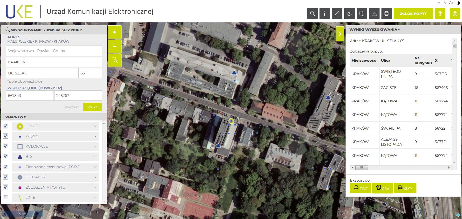
The goal of the project was to establish a web-based platform that integrates telecommunication network inventory of geospatial data and allows users to query, visualize and analyze the location of telecom assets. In addition, the requirements included the ability for Users to report on the demand for telecom services in support of investment planning.
The Impact
The telecom inventory covered public and private telecommunications networks, telephone services, data transmission services for broadband Internet, and radio and television broadcasting services.
The outcome
GISonLine established a telecommunications web mapping solution that was based on a technology stack using Geoserver / Google Maps technology/ PostgreSQL / Postgis.
The implemented solution allowed clients to view and provide information on the availability of infrastructure and telecom services provided to the public.
Development of the telecom mapping portal incorporated the business needs and requirements to enable end users to:
- Perform online searching of physical assets & services
- Report on the demand for new services
- Download telecommunications data packages
- Connect to multiple spatial services for data analysis
- Generate reports
- Connect to external spatial data repositories
See some things
we’ve worked on

Contact us
Looking for Location Intelligence?