GIS Consulting and Mapping Support to Thames Tideway Project (London, UK)

GIS Consulting and Mapping Support to Thames Tideway Project (London, UK)

Home 9 Project Category: Data Management ( Page 6 )

Case studies

GIS Consulting and Mapping Support to Thames Tideway Project (London, UK)

Client

Industry

Energy & Utilities
Local Government
Environmental Management

Region

Europe

Technology

Esri ArcGIS
FME (SAFE Software)

Client: Thames Water Utilities Ltd
Location: London, UK

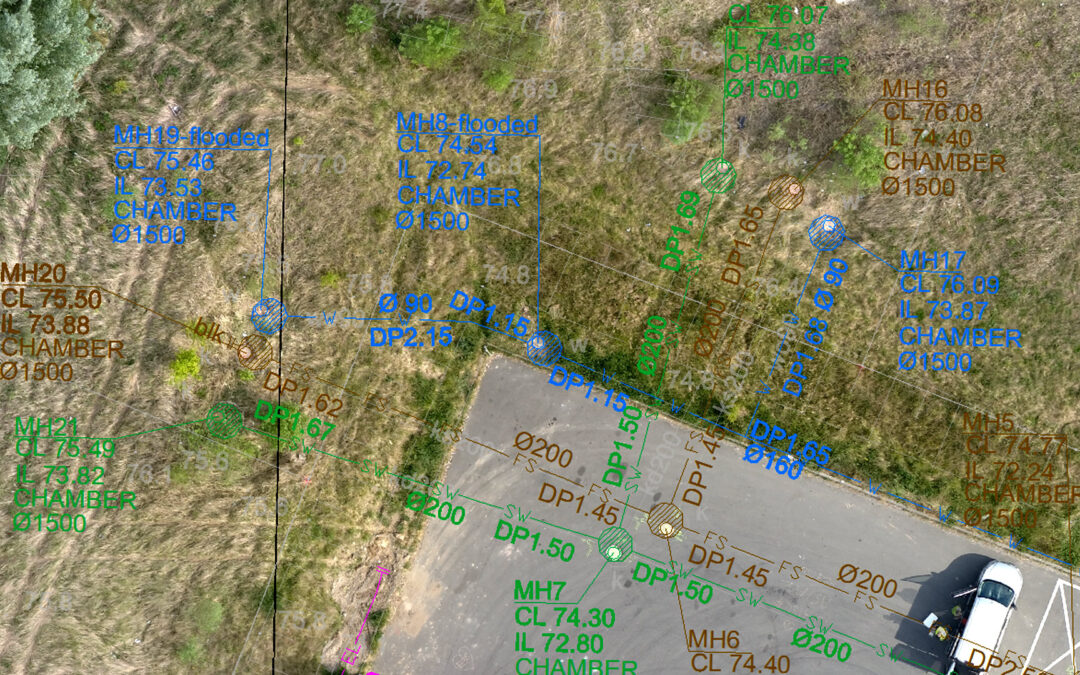
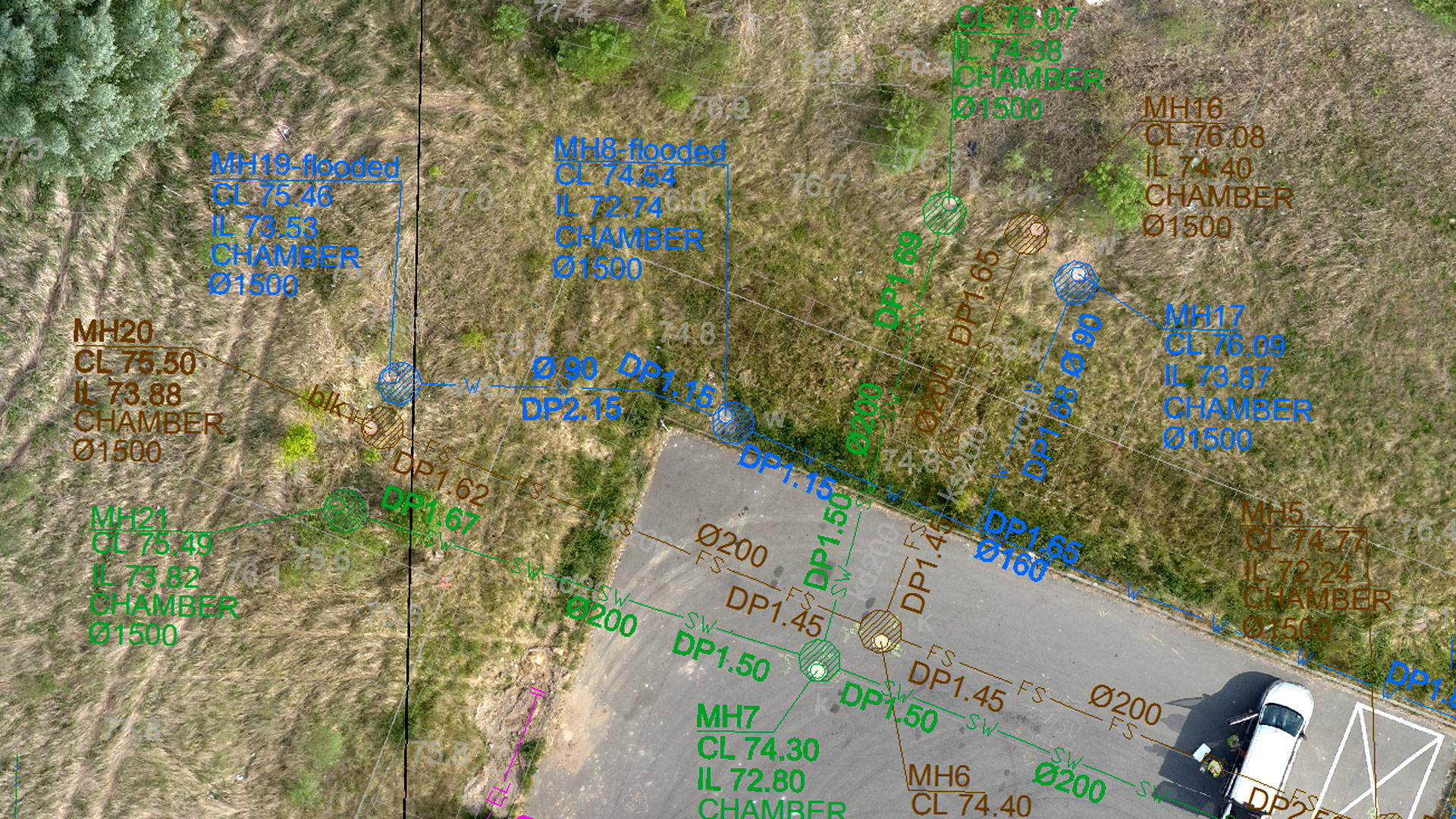
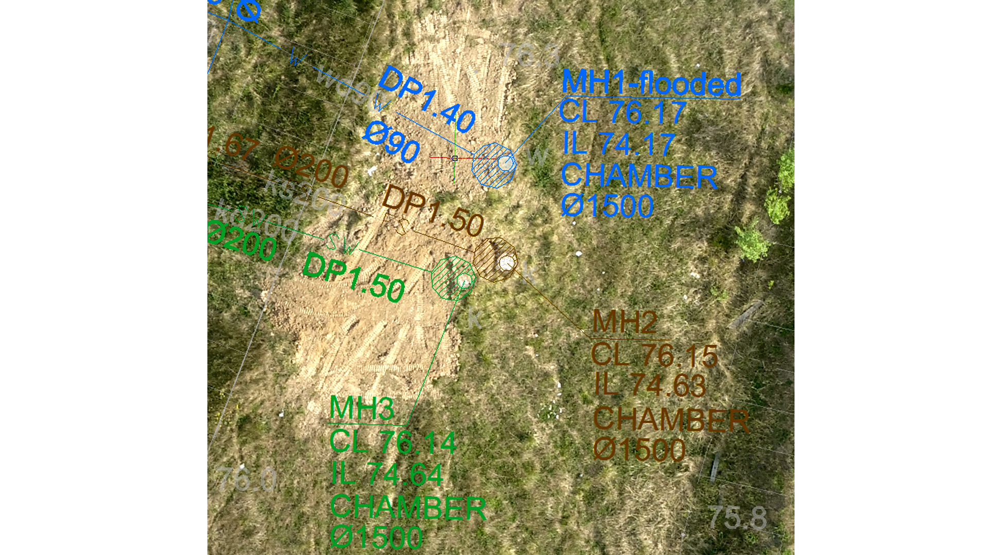
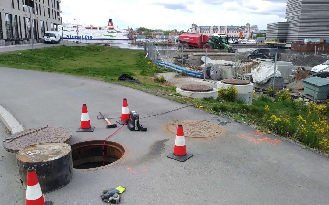
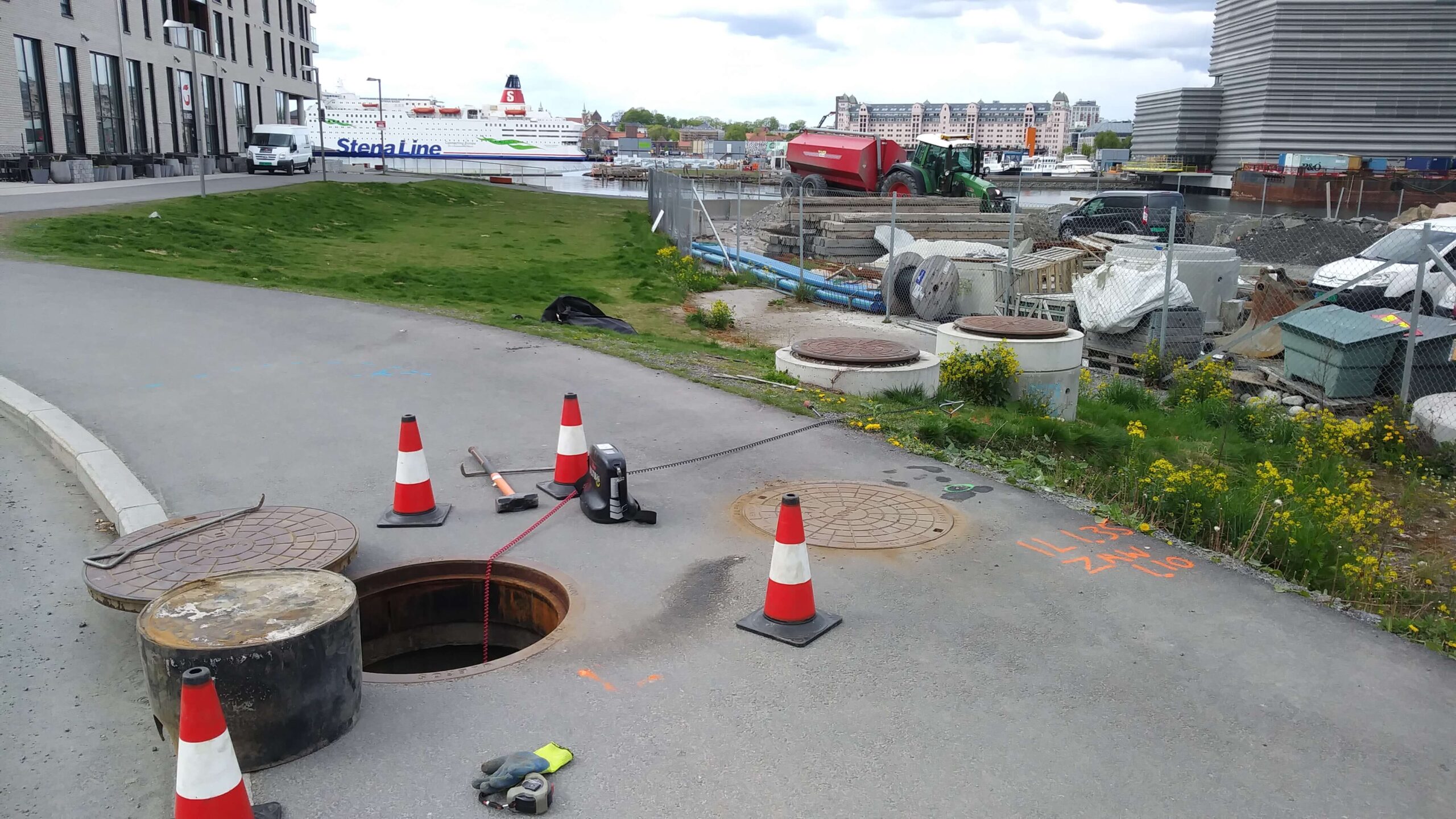
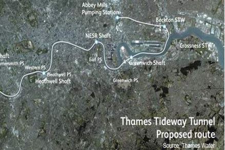
In support of the United Kingdom’s largest water and wastewater services agency (Thames Water), GISonLine provided Esri ArcGIS mapping and data migrations services. The aim of the program was a thorough reconstruction of London’s storm water drainage system, including the construction of two new tunnels: the ‘Thames Tunnel’ (32km long) and the ‘Lee Tunnel’ (7 km long). The tunnels are designed to capture and transfer wastewater discharges for treatment, which would otherwise enter the River Thames and its tributaries during heavy rainfalls.

The Impact

As a trusted geospatial consulting advisor and subcontractor to CH2M HILL (Critigen), GISonLine provided “Team as a Service” support services assigning dedicated GIS technicians and GIS Analysts onsite to the London offices.  The support roles provided Esri ArcGIS mapping support, CAD to GIS conversions, data migrations, and quick response times to requests for project design & site maps.

The Outcome

GISonLine successfully supported the Thames Tideway project, which included the collection, analysis, and interpretation of historical source data covering the last 200 years of research of the Thames Tideway.

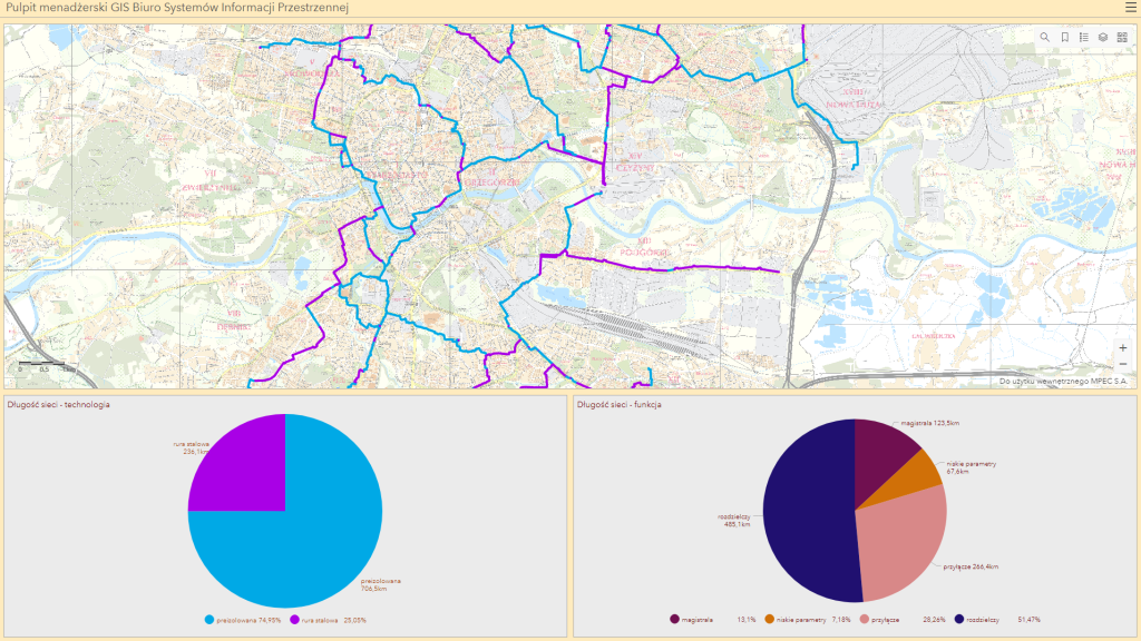
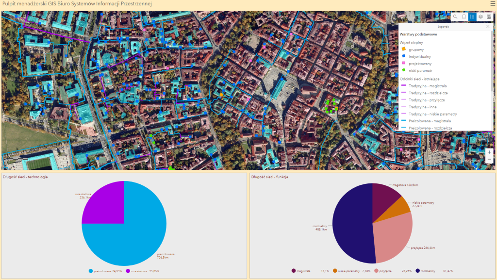
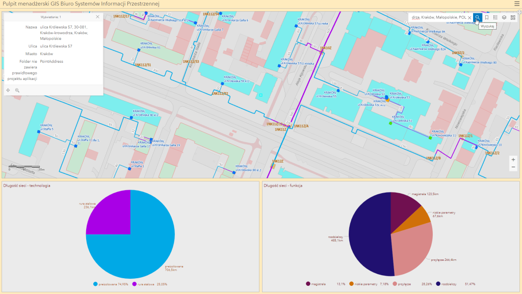
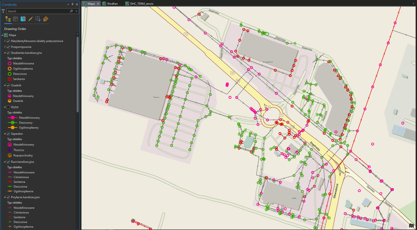
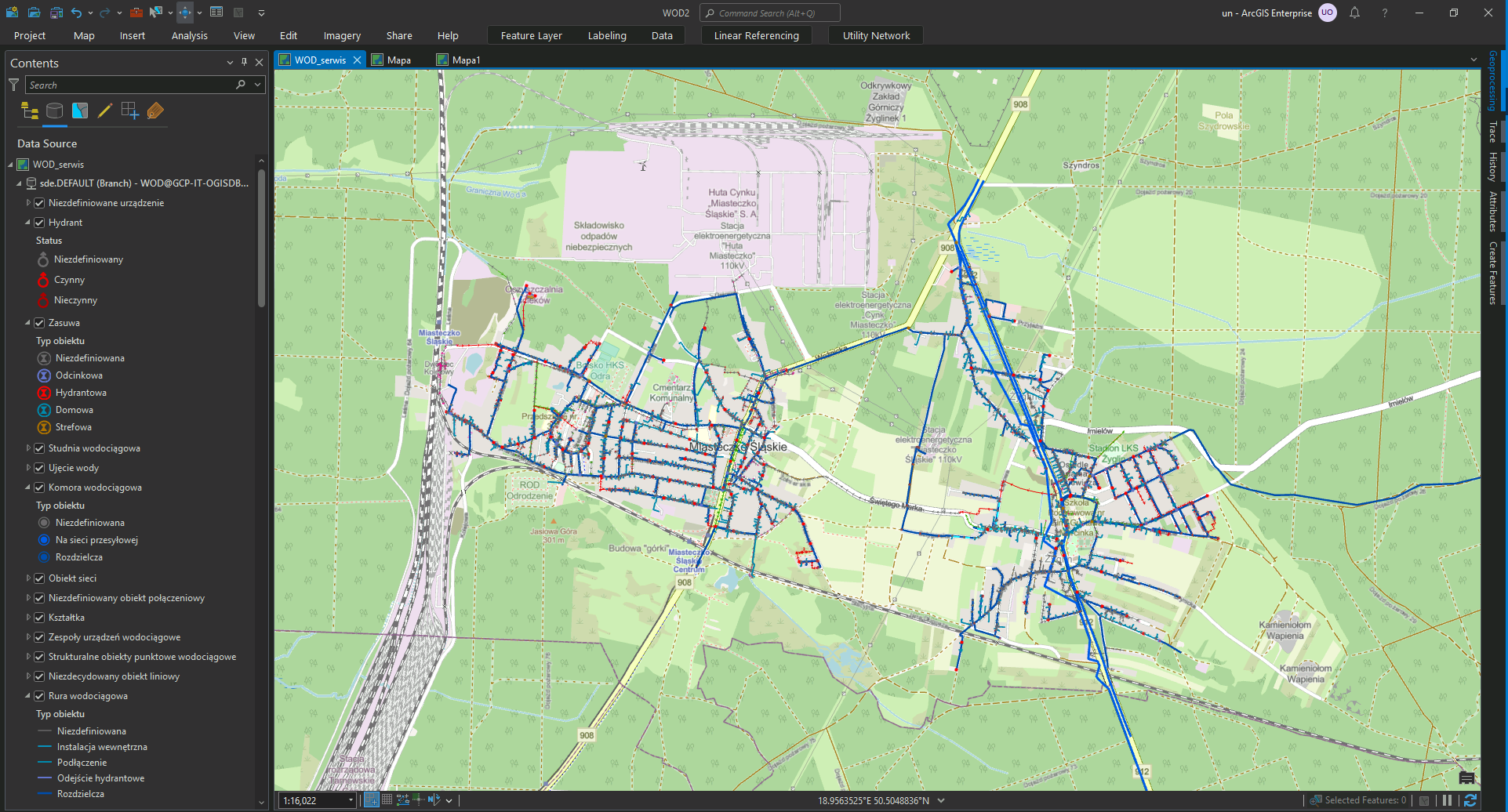
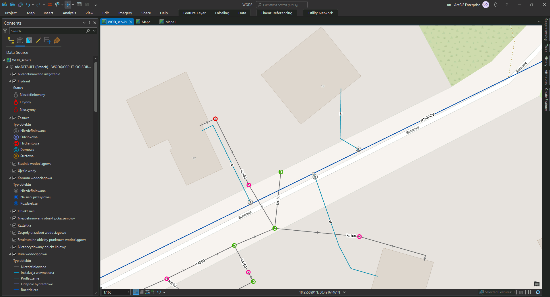
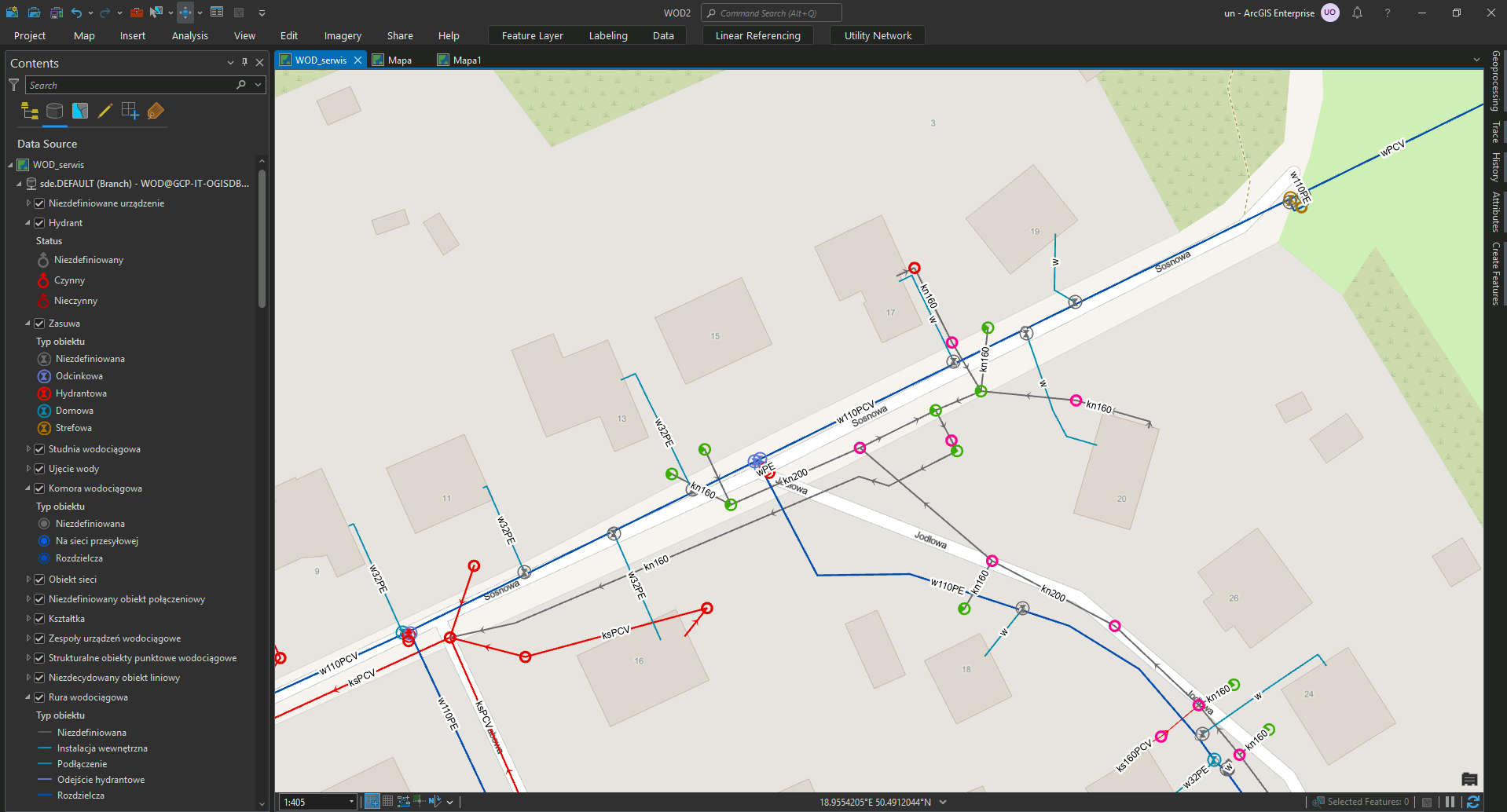
A key success of this project was migration of the data obtained from geological drilling works into a homogeneous Esri ArcGIS geodatabase that was used for mapping and communication of project status and site designs. The CAD to GIS data migrations performed by GISonLine included using FME (Safe Software) to provide the spatial data in a format compatible with the project teams use of the Esri ArcGIS environment.

See some things

we’ve worked on

Contact us

Looking for Location Intelligence?

15 + 15 =

Supporting the Expansion of Amazon’s Fulfillment Centers with Aerial & Underground Detection Mapping

Supporting the Expansion of Amazon’s Fulfillment Centers with Aerial & Underground Detection Mapping

Home 9 Project Category: Data Management ( Page 6 )

Case studies

Supporting the Expansion of Amazon’s Fulfillment Centers with Aerial & Underground Detection Mapping

Client

Industry

Energy & Utilities
Survey & Inspection

Region

Europe

Technology

GPR – Lecia DS2000
Detector – Leica Ultra Advanced
GNSS solution – Leica CS20/GS16
Drone DJI – Phantom 4 Pro V2.0
CAD, GPR and Pix4D software

Client: Amazon
Location: Krosno Odrzańskie, Poland

An Amazon fulfillment center is a logistics warehouse where incoming orders are received, stored, packed, and shipped out to customers. Planning for the expansion and construction of a fulfillment center requires comprehensive preparation and understanding of site conditions, underground assets, and environmental factors. Understanding exactly what lies beneath the ground prior to any construction and excavation is a key component to planning and safety.

GISonLine was pleased to participate in the project for underground detection and mapping surveys in support of future investments by Amazon. The surveys were carried out to update cartographic maps , perform geodetic measurements of the topography, and detection and mapping of underground utility lines.

The Impact

To provide a thorough understanding of the area, which encompassed 5 hectares (approximately 12 acres), GISonLine collected aerial photogrammetry pictures using drone platforms with a 4K high-resolution camera. Orthophoto maps of the entire area were established producing a 1.5cm terrain model representing land surface elevations to visualize relief. An underground detection survey was carried out using Ground Penetrating Radar (GPR) to establish a set of 2D maps identifying the underground utilities within the targeted areas of interests.

The Outcome

GISonLine successfully completed the underground detection surveys and site mapping delivering to Amazon a comprehensive and up-to-date model of the type and location of sub-surface utilities (ex: electrical, water, gas) and detailed mapping and imagery of site assets to support Amazon’s planning and expansion of fulfillment centers. The project deliverables included:

  • High Resolution Aerial Imagery
  • Orthophoto Maps
  • Digital Terrain Model
  • 2D maps outlining the type and location of underground utilities


See some things

we’ve worked on

Contact us

Looking for Location Intelligence?

9 + 4 =

3D Modeling of Underground Utilities Near Norwegian Opera House (Oslo, Norway)

3D Modeling of Underground Utilities Near Norwegian Opera House (Oslo, Norway)

Home 9 Project Category: Data Management ( Page 6 )

Case studies

3D Modeling of Underground Utilities Near Norwegian Opera House (Oslo, Norway)

Client

Industry

Energy & Utilities
Survey & Inspection

Region

Europe

Technology

GPR – Lecia DS2000
Detector – Leica Ultra Advanced
GNSS solution – Leica CS20/GS16
CAD and GPR software

Client: Exact
Location: Oslo, Norway

GISonLine carried out underground detection surveys near the Norwegian opera house in the center of Oslo. The purpose of the survey was to identify and map the underground utilities and assets in support of construction associated with a new apartment estate.

The Impact

Ground Penetrating Radar (GPR) technology was used for the sub-surface detection and identification of underground utilities. GISonLine performed post-processing of the GPR data to establish detailed 3D models of utility objects that were detected below the surface.

The Outcome

GISonLine successfully completed the underground detection surveys and provided key deliverables in the form of 2D maps, CAD drawings, and 3D models that supported the visualization on the type and location of underground utilities. The survey results and deliverables directly supported the planning, safety, and construction of the newly designed apartment estate.

See some things

we’ve worked on

Contact us

Looking for Location Intelligence?

8 + 10 =

Empowering the District Heating Efficiency by Implementing the ESRI Dashboard

Empowering the District Heating Efficiency by Implementing the ESRI Dashboard

Home 9 Project Category: Data Management ( Page 6 )

Case studies

Empowering the District Heating Efficiency by Implementing the ESRI Dashboard

Client

Industry

Energy & Utilities

Region

Europe

Technology

ArcGIS Web AppBuilder
JavaScript, HTML, CSS
Esri ArcGIS Enterprise
Portal for ArcGIS
PostgreSQL

Client: MPEC
Location: Krakow, Poland

In support of MPEC (Miejskie Przedsiębiorstwo Energetyki Cieplnej) business operations and the supply of district heating to Krakow residents, GISonLine provided geospatial mobile applications and custom web portals that provided geospatial resources and capabilities to MPEC’s asset management processes.

MPEC is one of the leaders in the heating industry in Poland providing heat to over 65 percent of residents in the city of Krakow. Heat from the MPEC utility network (almost 900 kilometers long) supports the heating of municipal entities.

The Challenge

In the world of infrastructure management, innovation is key. MPEC S.A. Kraków is at the forefront, systematically upgrading its network with cutting-edge technology to reduce heat loss and optimize energy usage. Adding to the challenge, Krakow’s rapid urban development demands an agile expansion of the heating network.

Seamless business operations rely on reliable network data accessible to everyone involved in network design, management, maintenance, and modernization.

The Impact

Up-to-date data in a modern web-Map dashboard. Access to information on the district heating network for a wide range of employees of the company, including the company’s management. Access to tools that allow the tracking of statistics on the development and modernization of infrastructure.

The Outcome

– Making data available to a wide range of recipients through dedicated GIS-web applications in technologies available within ArcGIS Enterprise.

– A dashboard for the company’s management in ArcGIS Dashboards technology presenting statistics on the company’s heating network, including the length of the network in terms of specific types, diameters or technologies used.


See some things

we’ve worked on

Contact us

Looking for Location Intelligence?

11 + 3 =

Transforming the water and wastewater network management through the implementation of the Utility Network

Transforming the water and wastewater network management through the implementation of the Utility Network

Home 9 Project Category: Data Management ( Page 6 )

Case studies

Transforming the water and wastewater network management through the implementation of the Utility Network

Client

Water and sewage system operator

Industry

Energy & Utilities

Region

Tarnowskie Góry – Poland / Europe

Technology

ArcGIS Experience Builder
JavaScript, HTML, CSS
Esri ArcGIS Enterprise
Portal for ArcGIS
PostgreSQL

Client: Water and sewage system operator

GISonLine was proud to implement ESRI Utility Network for a shareholder of the water and sewage operator in Tarnowskie Góry (Silesian Voivodeship, Poland), a city of around 80,000 inhabitants.

Total length of networks in operation:

  • water supply network: 683 km
  • sewage network: 393.8 km

GISonLine implemented ESRI Utility Network technology to optimize network management processes by creating a reliable model of the water and wastewater network.

Outcome & Impact

The Client provides high-quality services in the field of collective water supply, sewage collection and treatment and sewage sludge management to local governments and industry.

Implementation of Utility Network technology enabled optimization of network management processes through faster access to information about failures and events thanks to the analytics module in ESRI’s solution.

Another benefit is the ability to inform users of water supply interruptions in advance.

GISonLine successfully implemented the ESRI Utility Network solution platform into Client’s business operations. Now the customers’ users can effectively utilize the mechanisms of the guided editing, quality validation and network rules, supporting the Client’s employees with their network management business processes.

See some things

we’ve worked on

Contact us

Looking for Location Intelligence?

4 + 11 =