Integrating Custom Mobile Apps for Field Data Collections of Electrical Utility Network (Tauron Dystrybucja SA)

Integrating Custom Mobile Apps for Field Data Collections of Electrical Utility Network (Tauron Dystrybucja SA)

Home 9 Project Category: App Development

Case studies

Integrating Custom Mobile Apps for Field Data Collections of Electrical Utility Network (Tauron Dystrybucja SA)

Client

Industry

Energy & Utilities
Survey & Inspection
Consumer Applications

Region

Europe

Technology

Esri- ArcGIS Server
Esri ArcGIS Online
Safe Software – FME
.NET
Android
Collector for ArcGIS

Overview

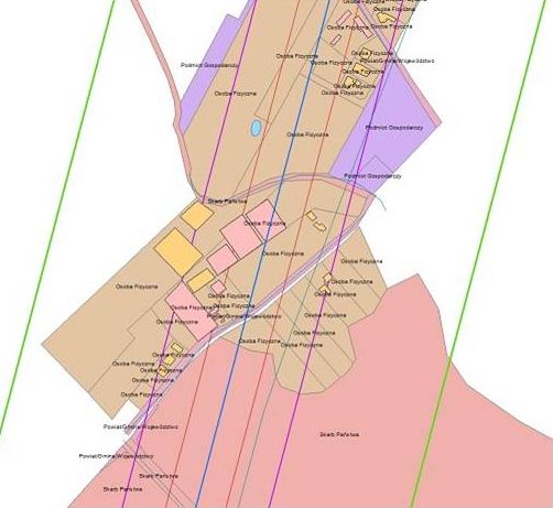
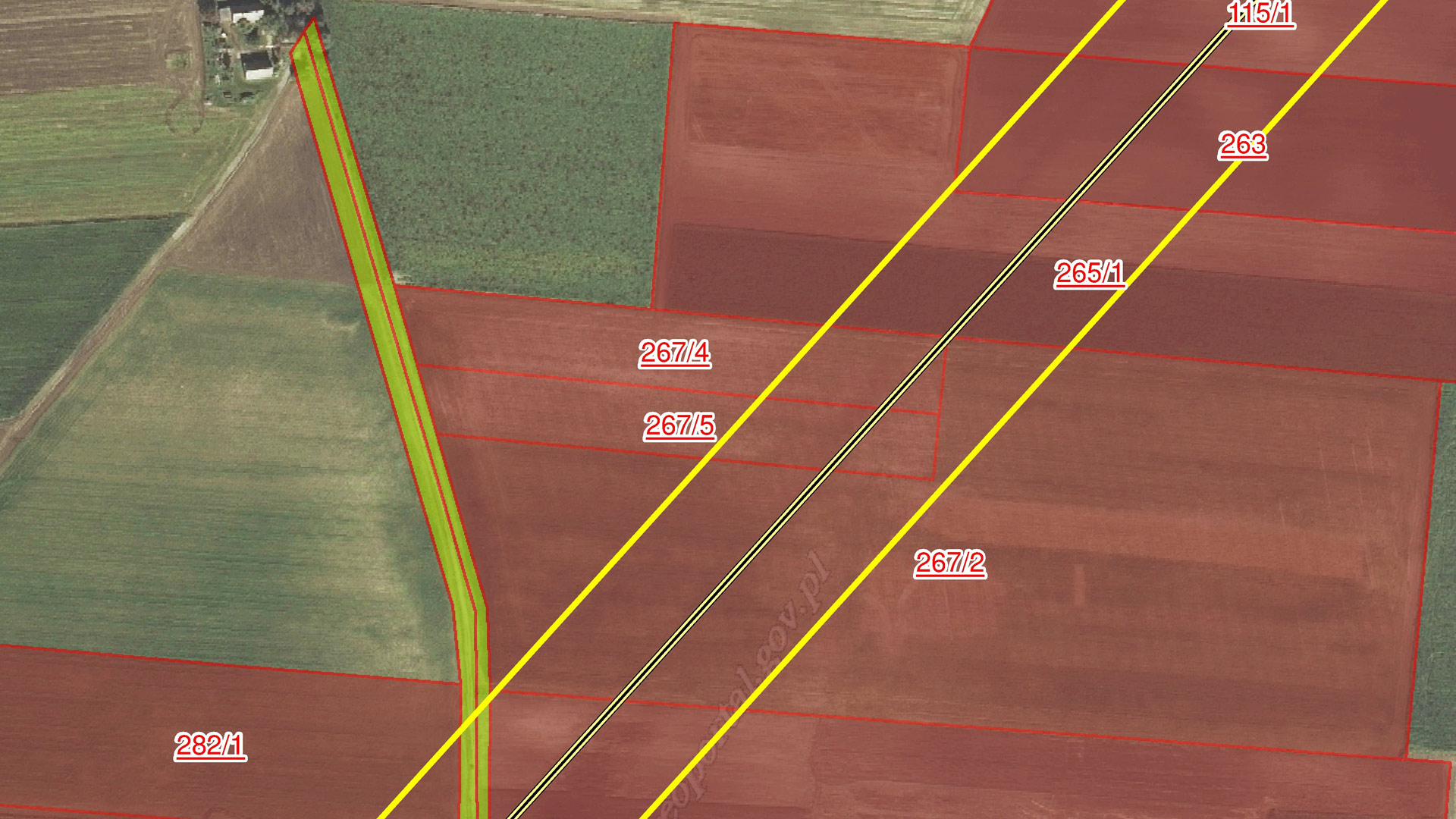
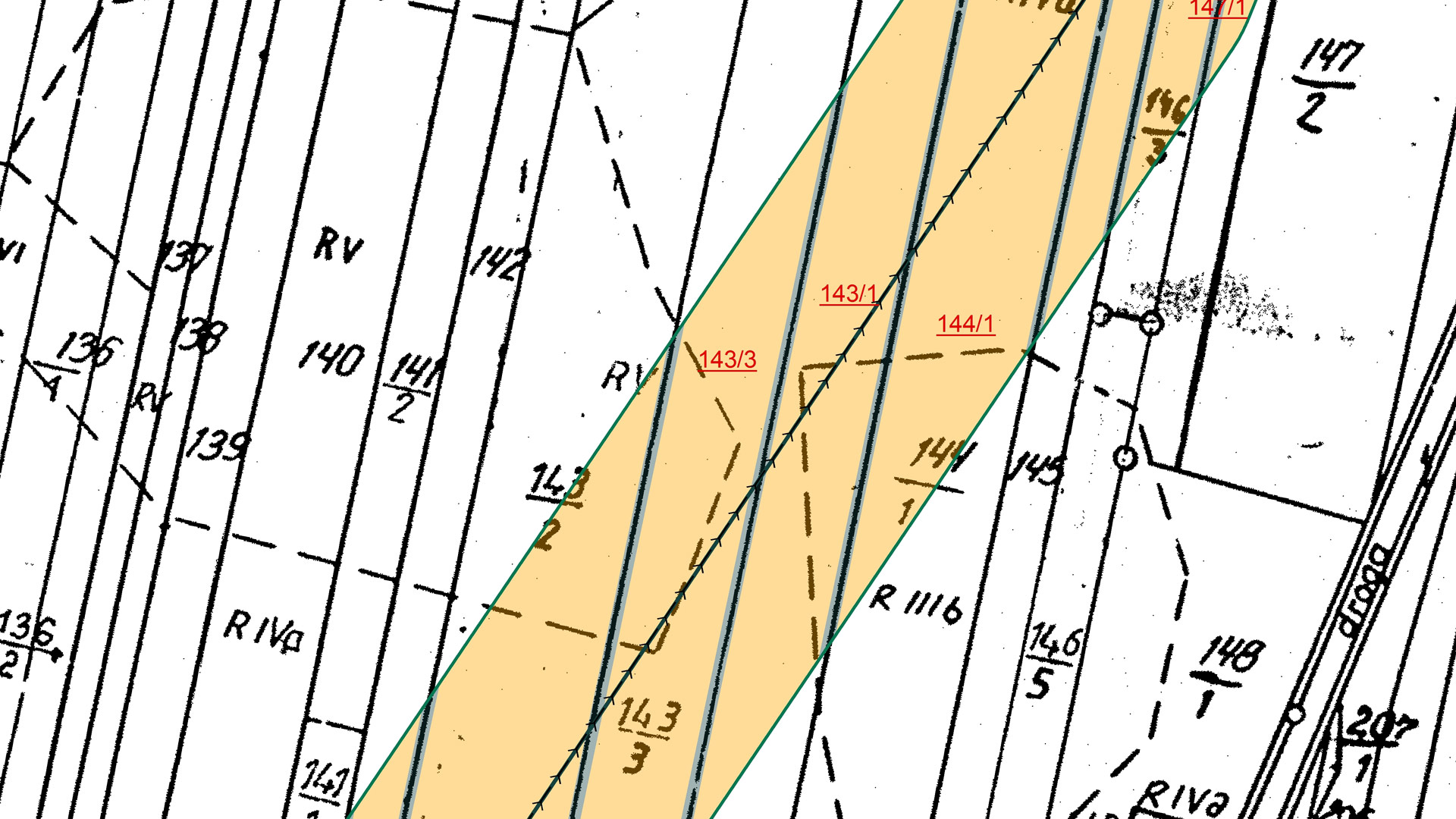
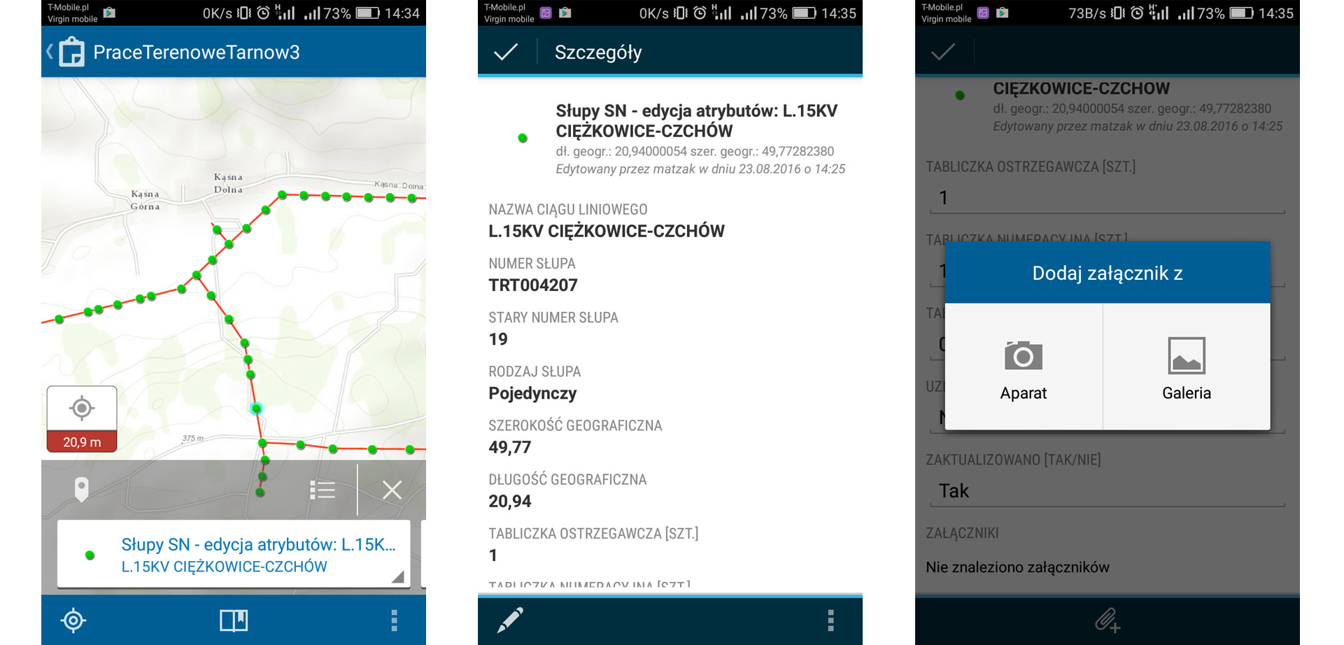
GISonLine was tasked to support a large scale network inventory project involving field data collections for the TAURON network of utility assets & resources. In addition, a core requirement was for TAURON to maintain critical business operations during the transition from a legacy asset management system to a modern geospatial mapping platform.

The Impact

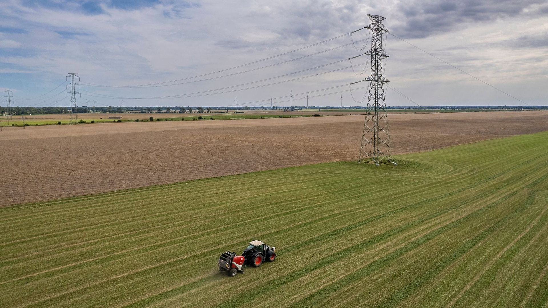
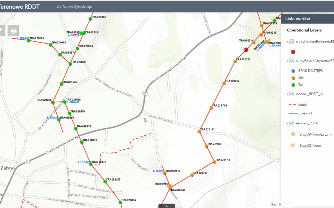
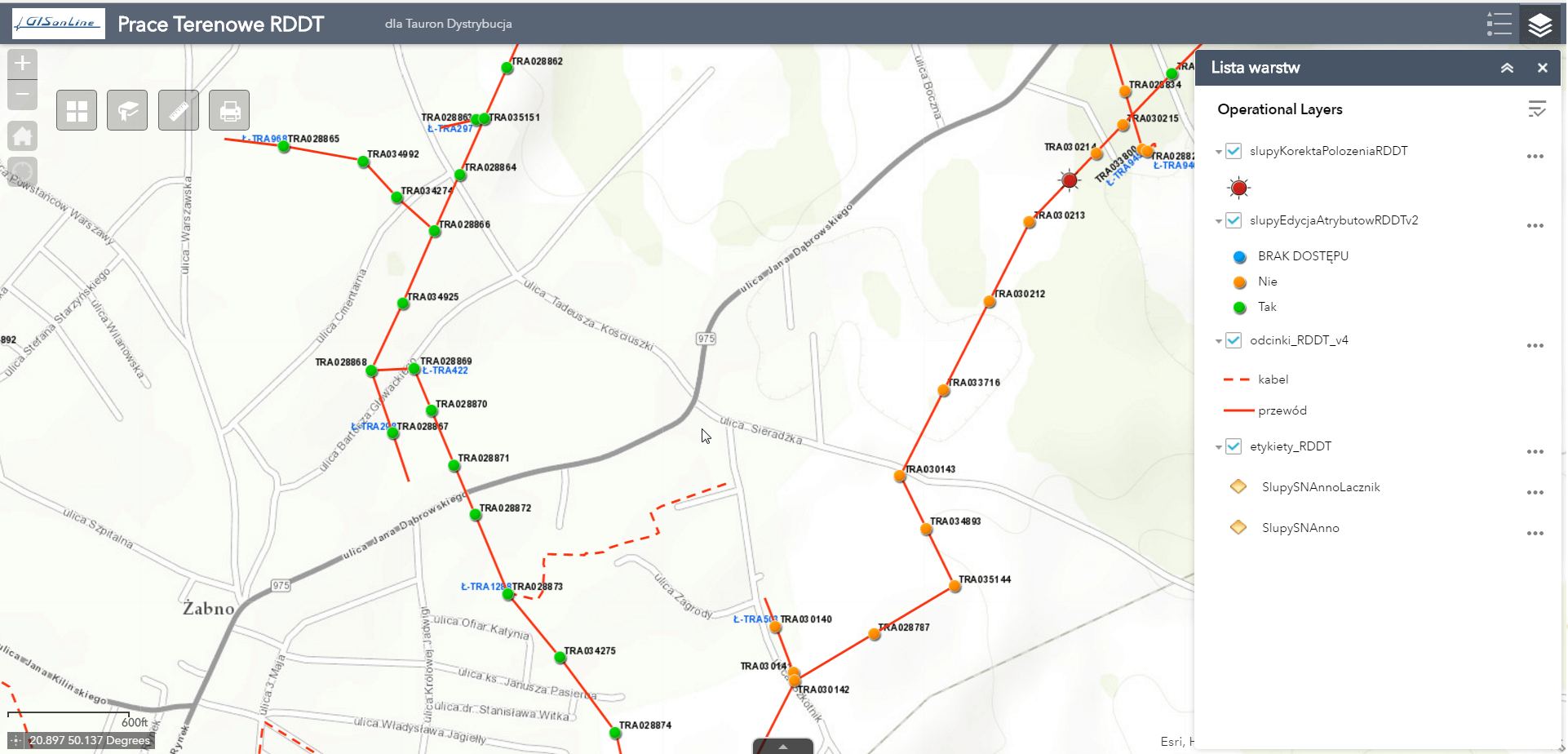
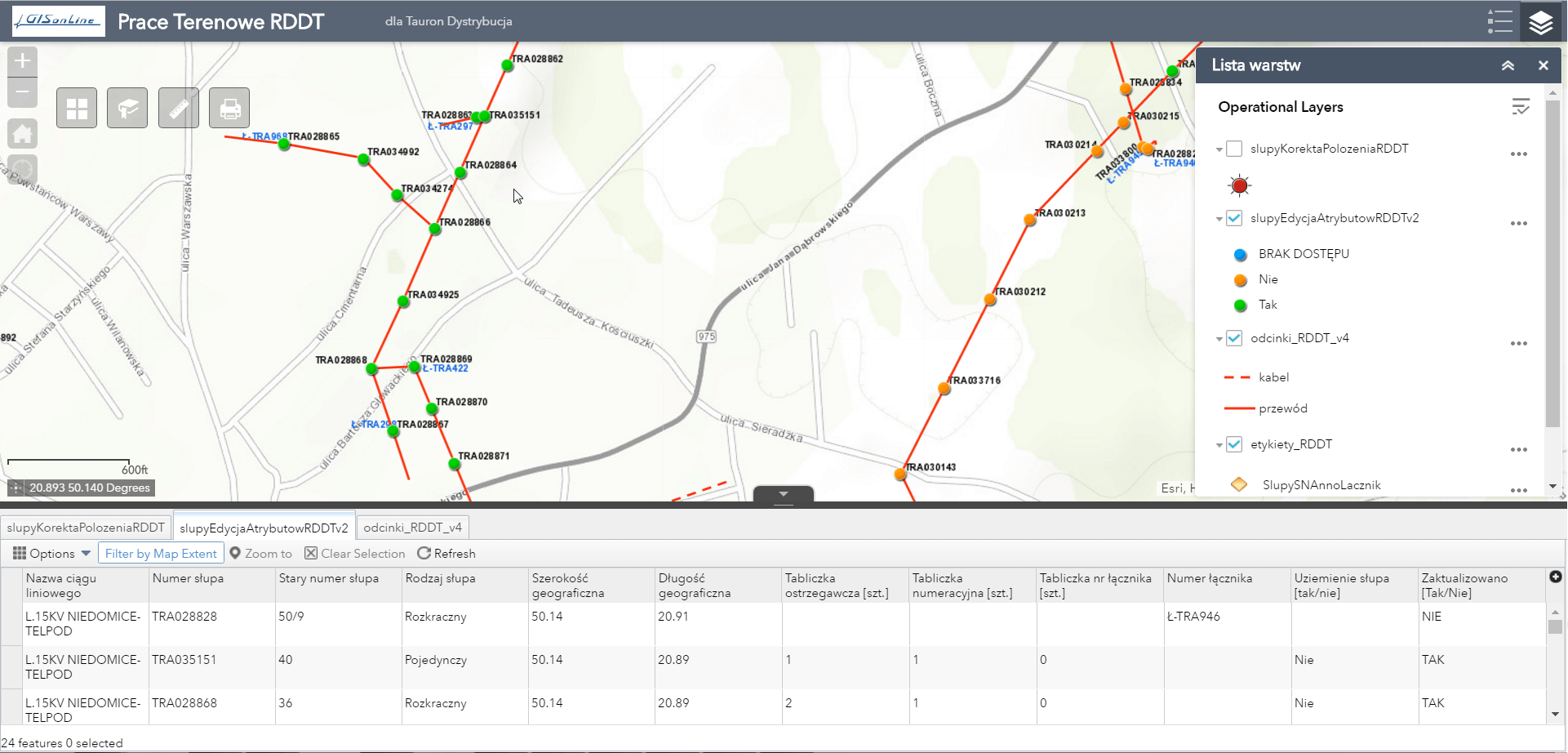
Integration of mobile geospatial technology allowed TAURON team-members the ability to collect and inventory core utility assets and attributes while operating in the field.  

Over 40 thousand electrical poles and substations were surveyed with detailed information collected regarding their spatial locations, condition and attributes, and documention via site photos.  

The outcome

GISonLine successfully implemented a custom mobile mapping solution that supports field crews during the data collection and inventory of utility assets. The mobile app supported workflow and data management tools designed to work with specifically with geospatial data.

The custom application included reporting dashboards allowing users to track project phases with required performance indicators and issue management. As a result of the mobile applications, TAURON was able to leverage up-to-date geospatial capabilities for managing and visualizing their enterprise utility network of assets.

See some things

we’ve worked on

Contact us

Looking for Location Intelligence?

15 + 5 =

Using Google Maps in support of the National Program of Telecom Infrastructure Inventory (UKE)

Using Google Maps in support of the National Program of Telecom Infrastructure Inventory (UKE)

Home 9 Project Category: App Development

Case studies

Using Google Maps in support of the National Program of Telecom Infrastructure Inventory (UKE)

Client

Industry

Telecommunications

Region

Europe

Technology

Google Maps API
PostgreSQL / PostGIS database platform
React/Redux
Entity Framework
WCF
.Net Core

Overview

The goal of the project was to establish a web-based platform that integrates telecommunication network inventory of geospatial data and allows users to query, visualize and analyze the location of telecom assets. In addition, the requirements included the ability for Users to report on the demand for telecom services in support of investment planning.

The Impact

The telecom inventory covered public and private telecommunications networks, telephone services, data transmission services for broadband Internet, and radio and television broadcasting services.

The outcome

GISonLine established a telecommunications web mapping solution that was based on a technology stack using Geoserver / Google Maps technology/ PostgreSQL / Postgis.

The implemented solution allowed clients to view and provide information on the availability of infrastructure and telecom services provided to the public.

Development of the telecom mapping portal incorporated the business needs and requirements to enable end users to:


  • Perform online searching of physical assets & services
  • Report on the demand for new services
  • Download telecommunications data packages
  • Connect to multiple spatial services for data analysis
  • Generate reports
  • Connect to external spatial data repositories

See some things

we’ve worked on

Contact us

Looking for Location Intelligence?

9 + 5 =

Custom Esri ArcGIS Portal For Viewing & Managing Landscape Park Assets (Świętokrzyskie Mountains, Poland)

Custom Esri ArcGIS Portal For Viewing & Managing Landscape Park Assets (Świętokrzyskie Mountains, Poland)

Home 9 Project Category: App Development

Case studies

Custom Esri ArcGIS Portal For Viewing & Managing Landscape Park Assets (Świętokrzyskie Mountains, Poland)

Client

Industry

Consumer Applications
Environmental Management

Region

Europe

Technology

Esri ArcGIS Server
ArcGIS Pro
SQL Server

The Challenge:

To provide employees of the Świętokrzyskie Mountains and Ponidzie landscape parks with a geospatial mapping capability that can inventory and spatially visualize the natural, ethnographic, historical, and cultural resources associated with the parks.

The Impact:

Implementation of geospatial capabilities to visualize, inventory, and manage landscape park assets and connect geospatial capabilities to data from disparate sources: imagery, park databases, and mapping data of the region. To utilize geospatial technology to support the goal of sustainable development and preserving and popularizing the natural, historical and cultural assets of the region.

The Outcome:

GISonLine successfully developed and implemented a web-based mapping application that connected to a centralized database and used commercially available imagery and data. The geospatial mapping capability enabled park employees to view, inventory, edit, and store landscape park assets. The mapping application also provided a public facing interface for site visitors to visualize the landscape region and its natural / historical features. Benefits of the solution included:


  • Providing landscape data to a wide audience
  • Access to multimedia data, photos, and imagery
  • Enterprise data editing via centralized database
  • Communication & presentation of park protection plans

See some things

we’ve worked on

Contact us

Looking for Location Intelligence?

9 + 15 =

Supporting Feasibility Studies For Newly Built 400 kV Power Lines (PSE -Polskie Sieci Energetyczne)

Supporting Feasibility Studies For Newly Built 400 kV Power Lines (PSE -Polskie Sieci Energetyczne)

Home 9 Project Category: App Development

Case studies

Supporting Feasibility Studies For Newly Built 400 kV Power Lines (PSE -Polskie Sieci Energetyczne)

Client

Industry

Energy & Utilities
Environmental Management

Region

Europe

Technology

Esri ArcGISONLINE
Javascript API

Overview

In support of the electrical transmission system operator PSE (Polskie Sieci Energetyczne), GISonLine provided geospatial support services that aided planning and decision support for the  feasibility studies associated with the planned placement of newly built 400 kV power lines. 

GISonLine obtained existing site surveys and land register maps and integrated the data into a single geospatial data model.  The site survey and land use data provided key information to combine with spatial data that provided the ability to perform spatial and statistical analysis in support of site feasibility studies and optimal placement of the electrical power line towers.

The Impact

For the feasibility studies, which included 241 kilometers of area, over 160 sheets of existing geodetic maps were obtained at various scales, as well as 35,000 feature extracts from the land and building register which were converted and stored in the newly designed digital database.

The Outcome

GISonLine successfully collated and integrated the site data obtained from the geodetic maps and land & building registry to form a single instance of a digital database.

Using the obtained data, GISonLine integrated the information into the Esri ArcGIS environment and performed a series of geo-statistical analysis, map visualizations, and created a set of spatial reports.

The spatial analysis and visualizations enabled the project contractors and stakeholders to visualize the number of plots through which the proposed power lines were planned to be developed. In addition, the spatial analysis provided key decision support to optimally design the final course and layout of the proposed high-voltage lines and towers.  

Deliverables and tasks under this project included:

  • Acquiring data from regional surveying centers
  • Conversion of data to spatial / vector formats
  • Construction of the spatial data model
  • Creating thematic maps using Esri ArcGIS
  • Performing spatial and statistical analysis

See some things

we’ve worked on

Contact us

Looking for Location Intelligence?

3 + 12 =

Local Government Ecological Initiatives Mapping Using Esri ArcGIS Online (Świętokrzyskie Region, Poland)

Local Government Ecological Initiatives Mapping Using Esri ArcGIS Online (Świętokrzyskie Region, Poland)

Home 9 Project Category: App Development

Case studies

Local Government Ecological Initiatives Mapping Using Esri ArcGIS Online (Świętokrzyskie Region, Poland)

Client

Industry

Local Government

Region

Europe

Technology

Esri ArcGIS Online
GML
ESRI ArcGIS Pro
FME

Overview

In support of the local government (Świętokrzyskie region in Poland) ecological initiatives and investments, GISonLine was tasked to establish geodatabases and a custom web mapping portal that displayed the thematic maps containing the local government’s investments in ecological projects.

The Impact

As part of the project data was obtained and organized from over 150 institutions and local government units from the Świętokrzyskie region. The data was then used to provide attribute and content information to feed the database and populate the local government web-based mapping platform.

The Outcome

GISonLine successfully collected and developed a set geospatial feature layers (with feature attribution) to establish the thematic database displaying spatially where the investments occured in support of ecological initiatives. The project included creation of a web-based mapping portal using Esri ArcGIS Online and supported the local government representatives and project stakeholders with investment decision support. Deliverables associated with the project included:

  • Design and creation of web-based portal using Esri ArcGIS Online
  • Packaging and delivery of Esri Shapefiles & GML formats
  • Map prints displaying ecological initiatives and their locations
  • Instructional training on ArcGIS portal


See some things

we’ve worked on

Contact us

Looking for Location Intelligence?

6 + 3 =