3D Modeling of Underground Utilities Near Norwegian Opera House (Oslo, Norway)
Case studies
3D Modeling of Underground Utilities Near Norwegian Opera House (Oslo, Norway)
Client

Industry
Energy & Utilities
Survey & Inspection
Region
Europe
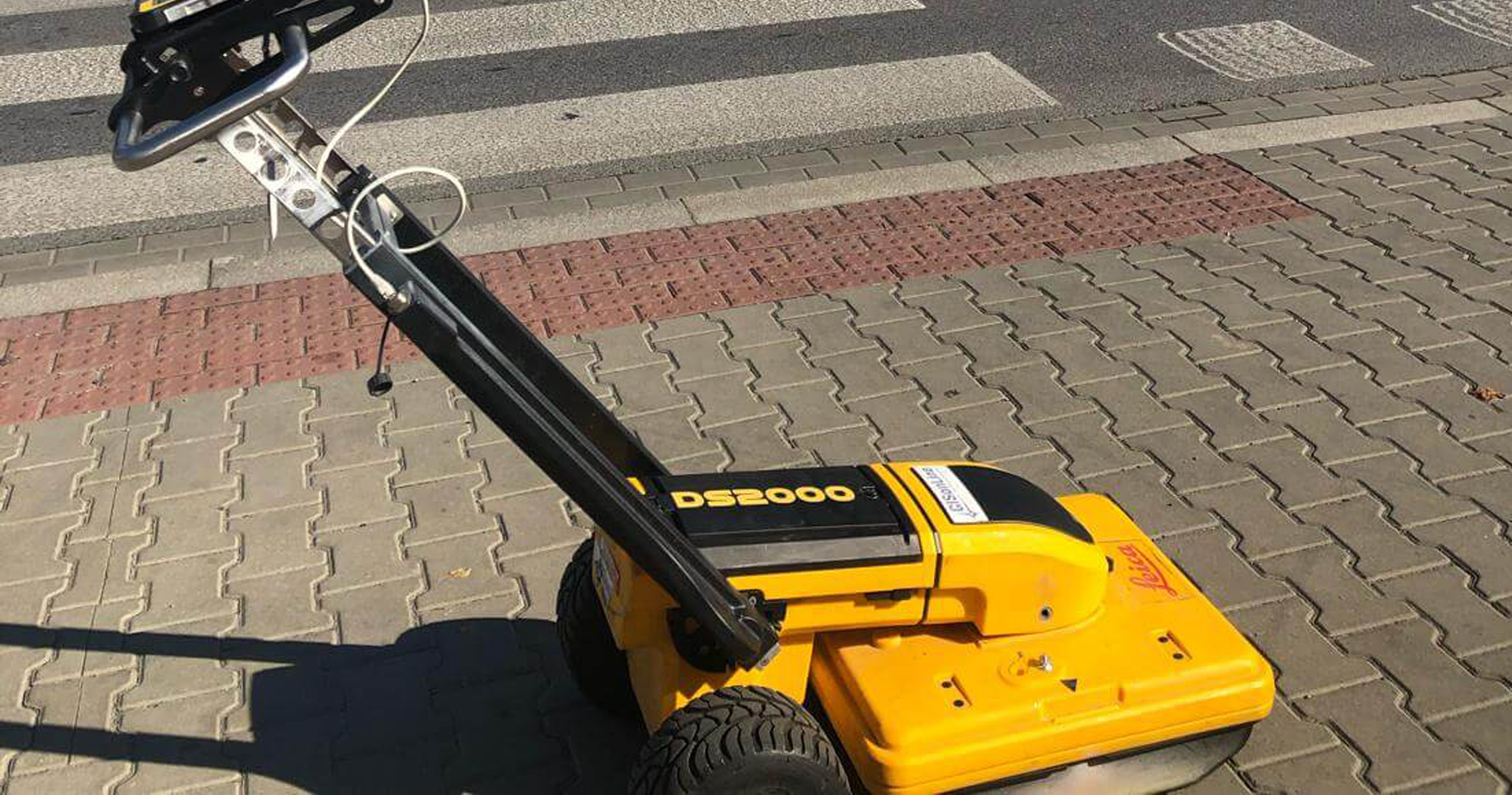
Technology
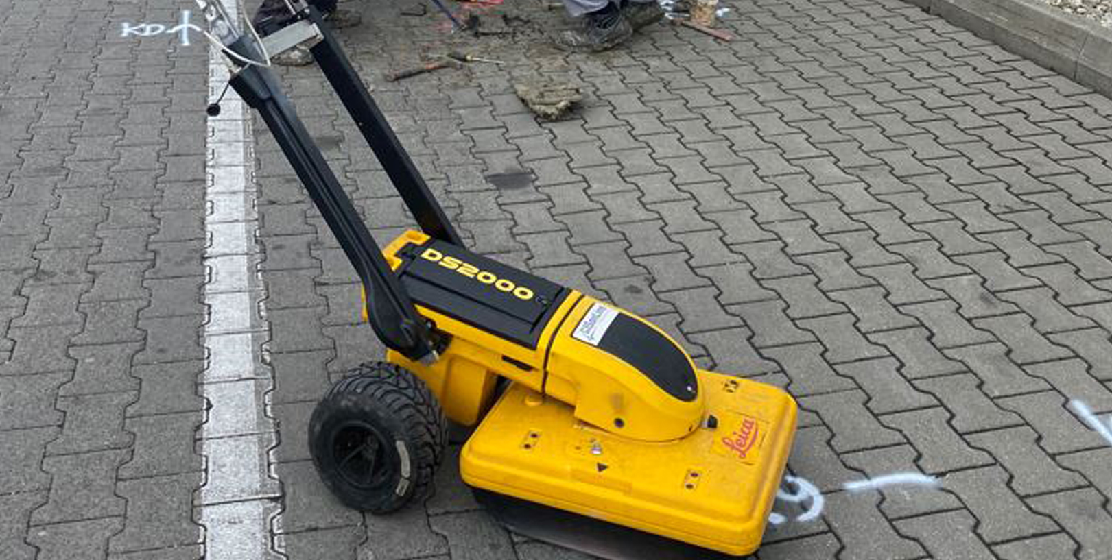
Detector – Leica Ultra Advanced
GNSS solution – Leica CS20/GS16
CAD and GPR software
Client: Exact
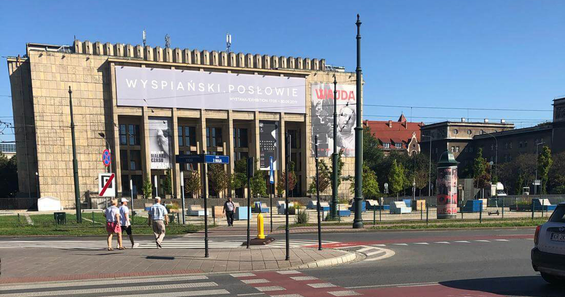
Location: Oslo, Norway
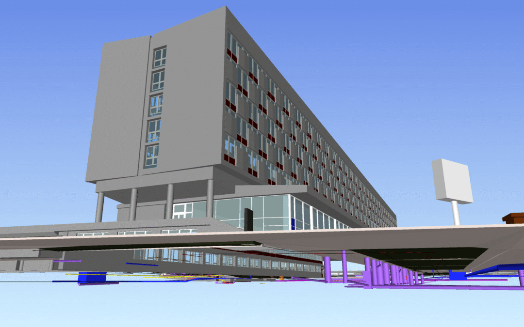
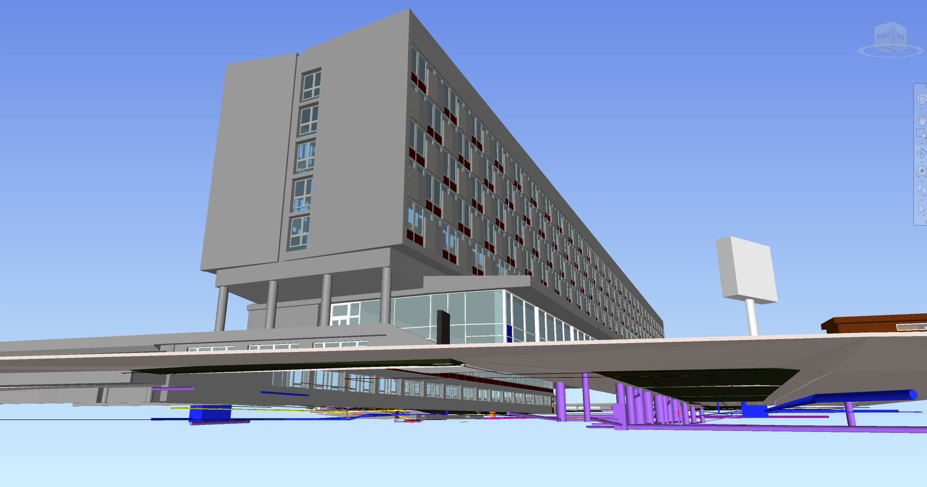
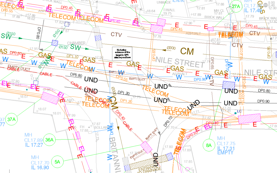
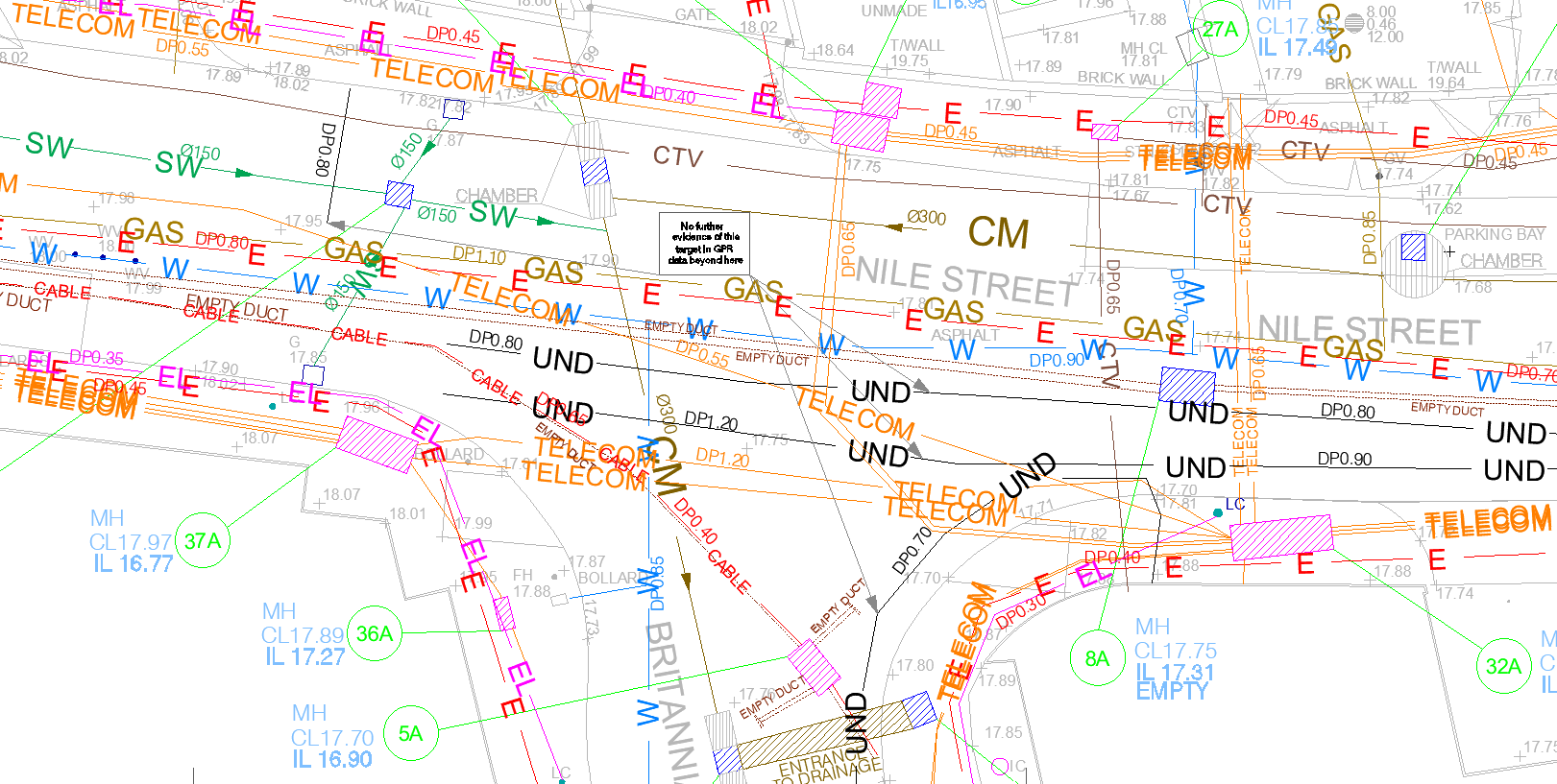
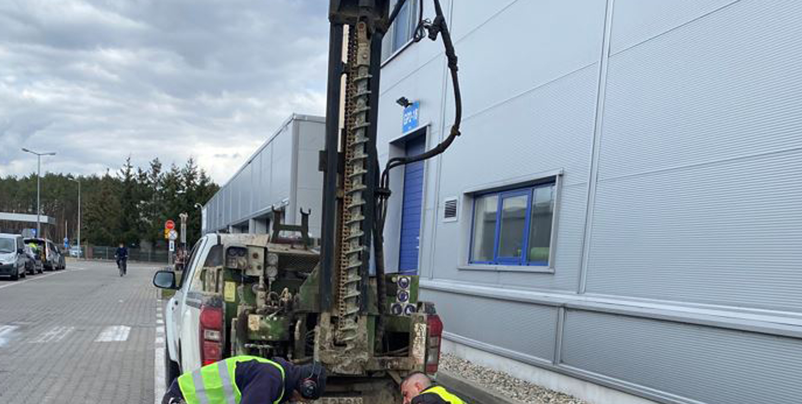
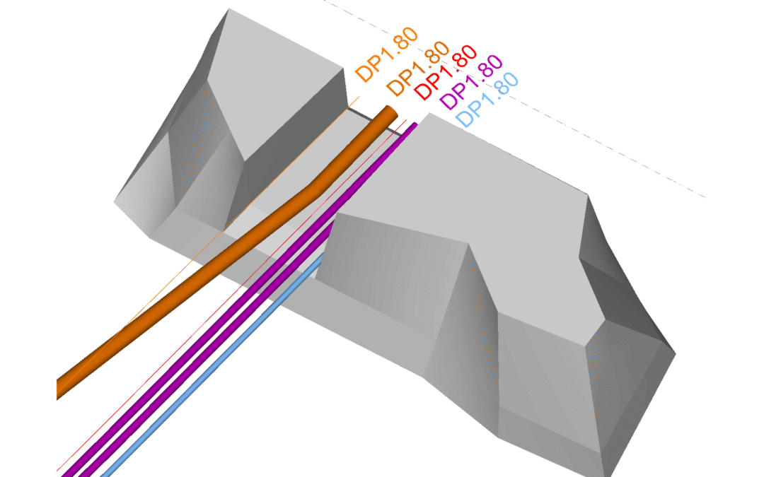
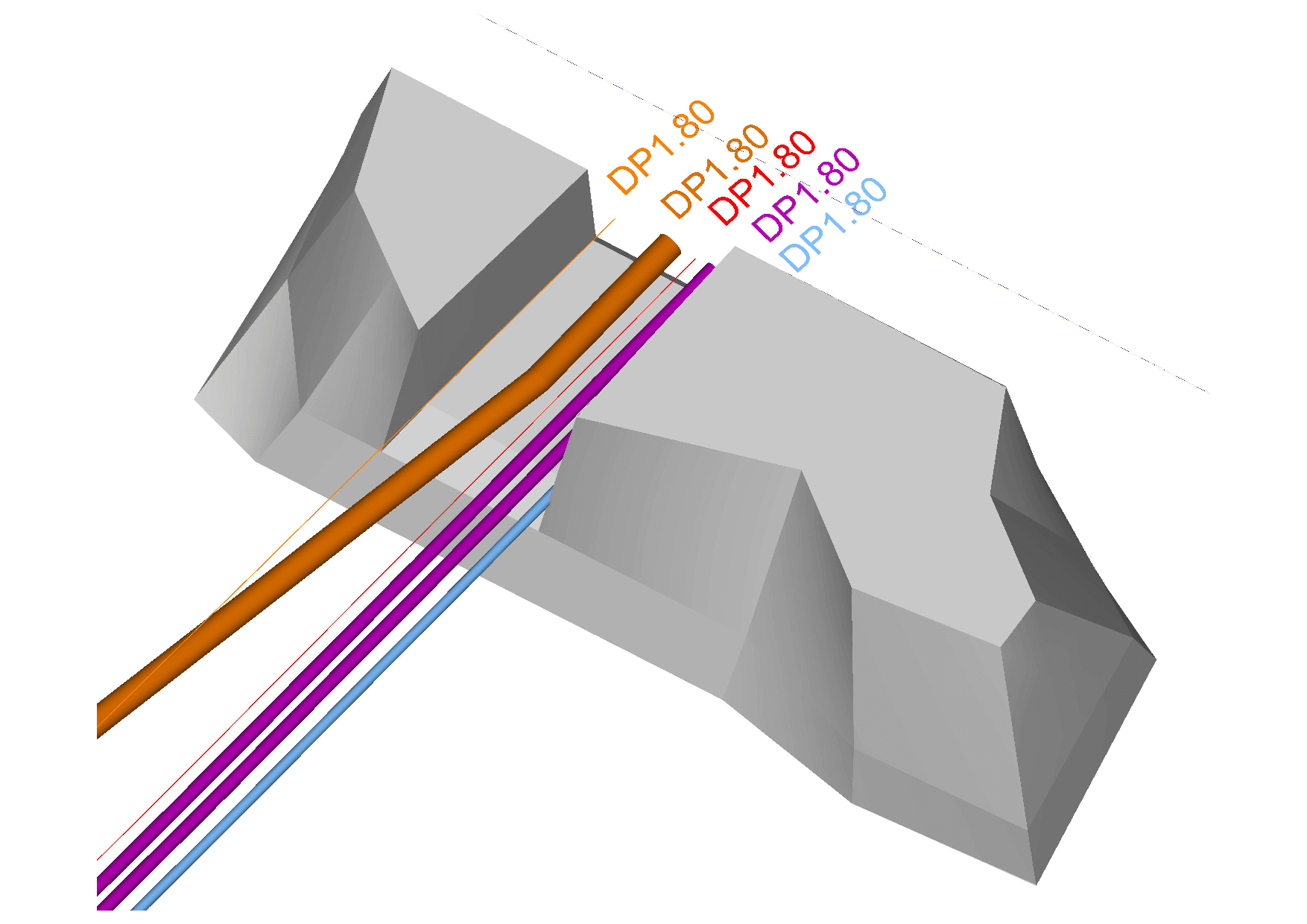
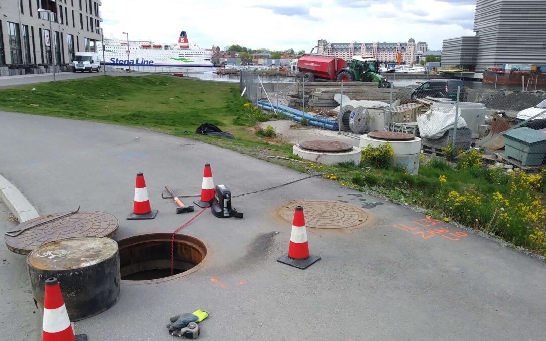
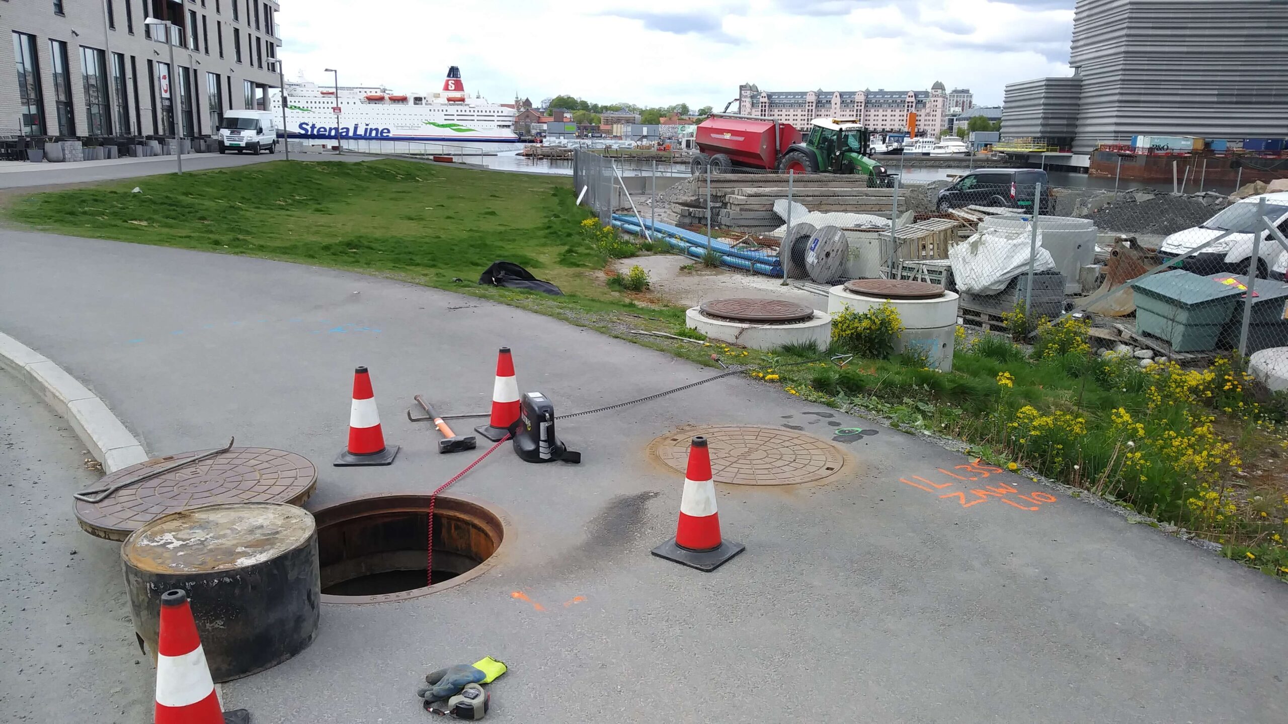
GISonLine carried out underground detection surveys near the Norwegian opera house in the center of Oslo. The purpose of the survey was to identify and map the underground utilities and assets in support of construction associated with a new apartment estate.
The Impact
Ground Penetrating Radar (GPR) technology was used for the sub-surface detection and identification of underground utilities. GISonLine performed post-processing of the GPR data to establish detailed 3D models of utility objects that were detected below the surface.
The Outcome
GISonLine successfully completed the underground detection surveys and provided key deliverables in the form of 2D maps, CAD drawings, and 3D models that supported the visualization on the type and location of underground utilities. The survey results and deliverables directly supported the planning, safety, and construction of the newly designed apartment estate.
See some things
we’ve worked on

Contact us
Looking for Location Intelligence?