Underground Detection, Laser Scanning and 3D Modelling Supporting Expansion of one of the Key Polish Medical Centers

Underground Detection, Laser Scanning and 3D Modelling Supporting Expansion of one of the Key Polish Medical Centers

Case studies

Underground Detection, Laser Scanning and 3D Modelling Supporting Expansion of one of the Key Polish Medical Centers

Client

Large public hospital

Industry

Survey & Inspection

Region

Wrocław – Polska / Europa

Technology

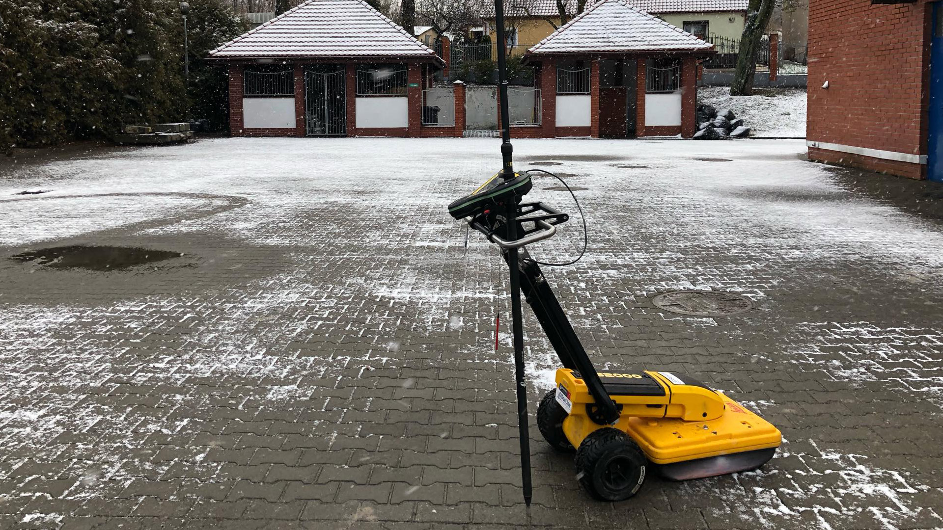
GPR (Ground-Penetrating Radar) Leica DS2000, EML, Lidar, PAS128 methodology – M4P type, Civil 3D, CAD

Overview

Client: Large public hospital

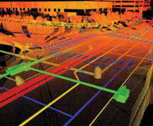
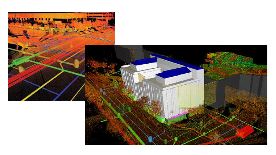
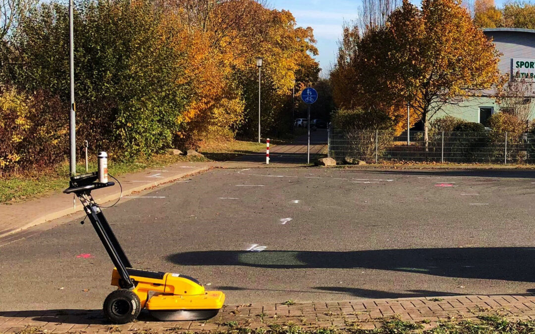
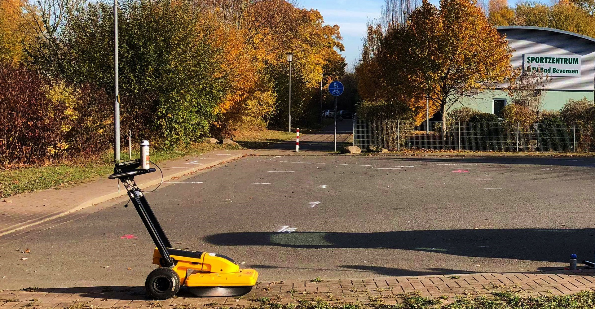
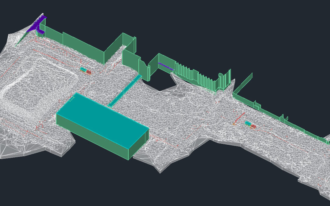
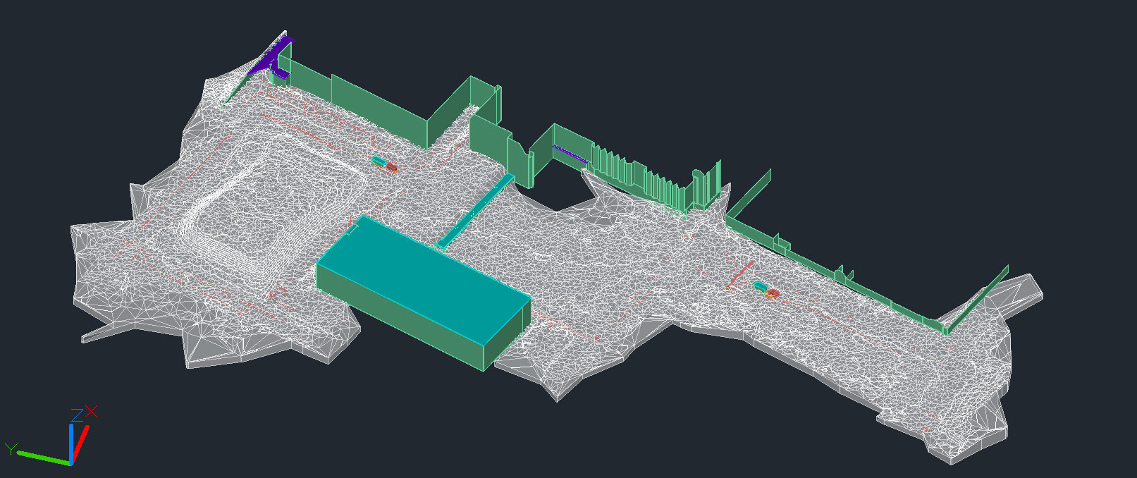
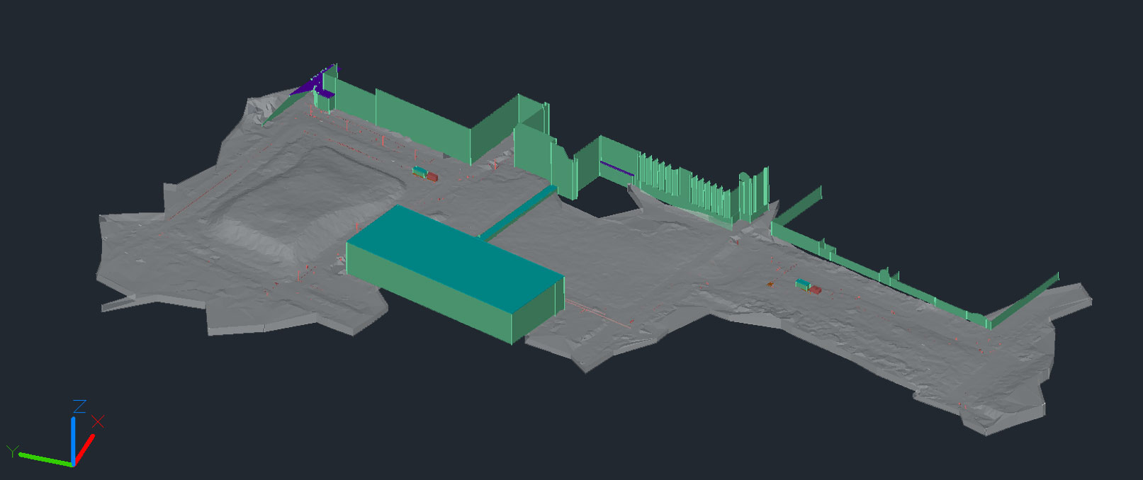
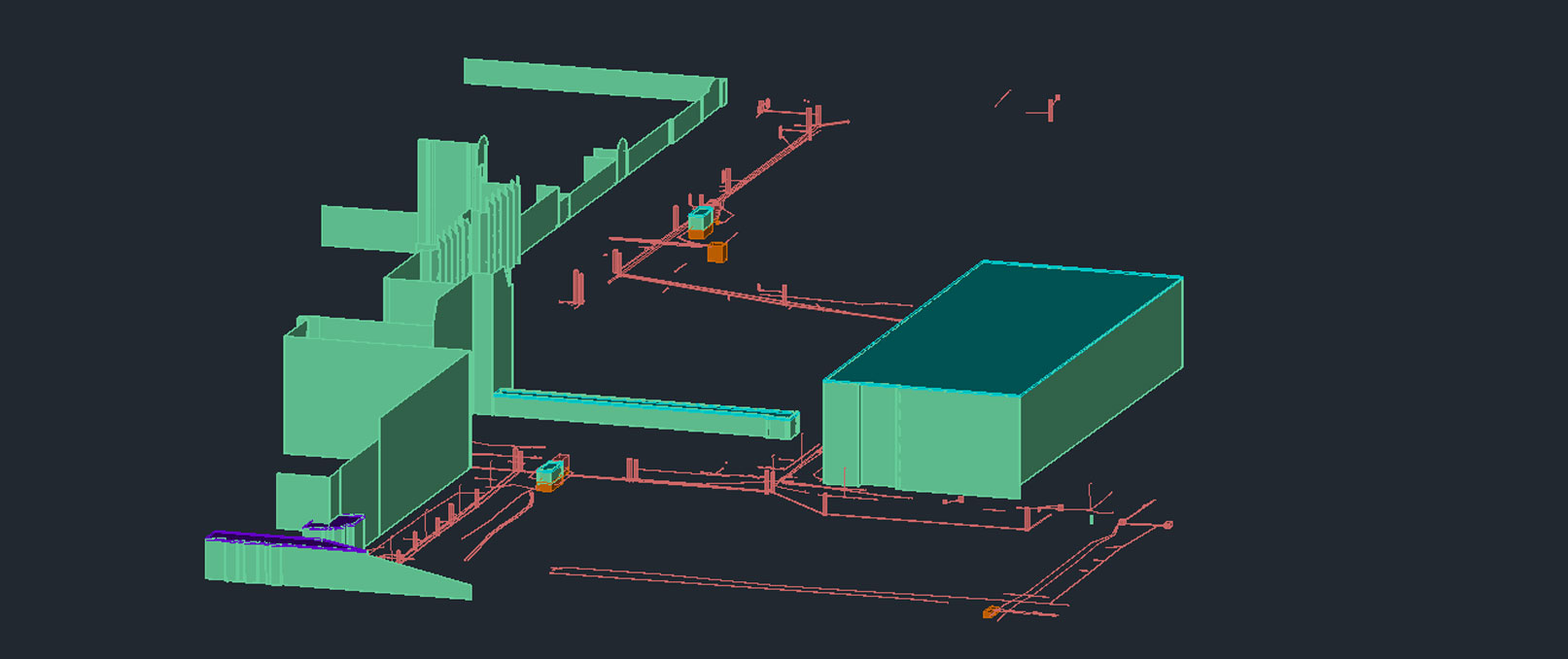
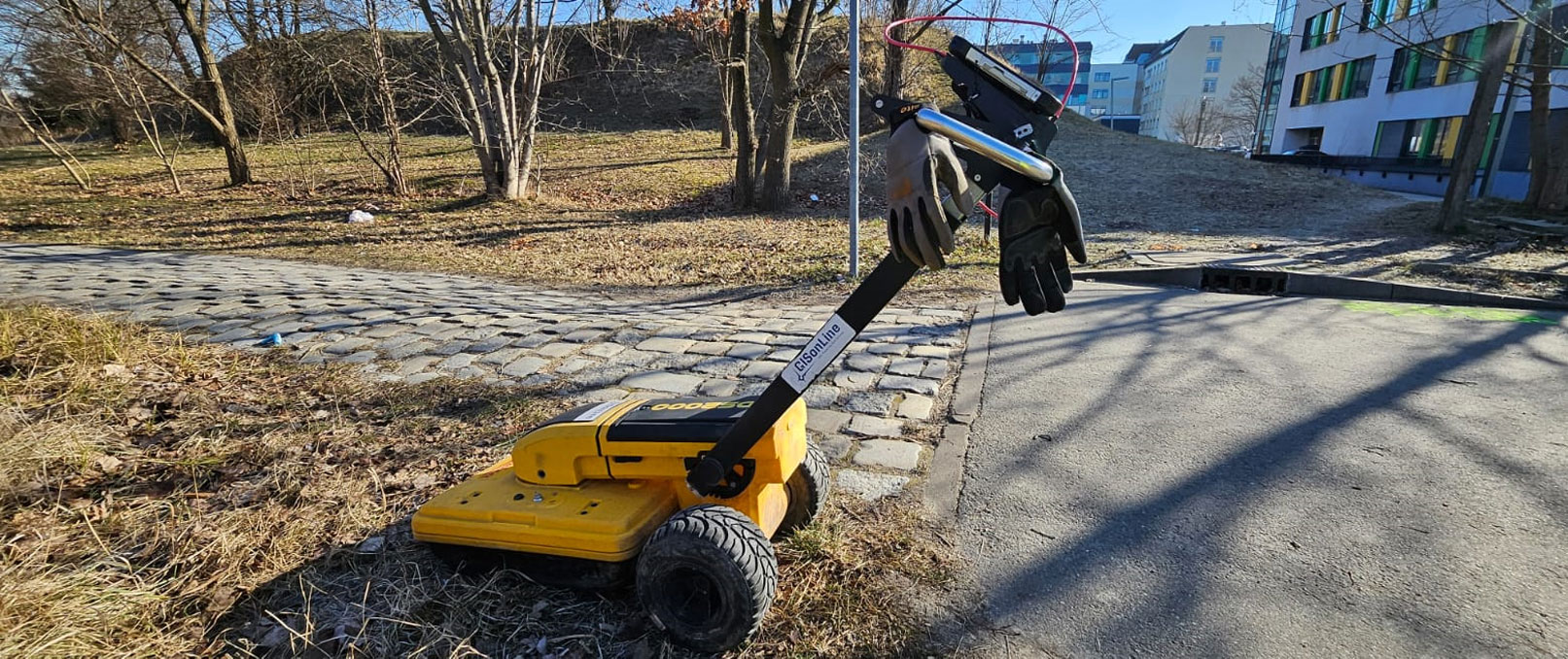
GISonLine supported an important project of expansion of one of large public hospitals located in Wrocław (Poland), by delivering a comprehensive service of underground utility detection, ground laser scanning and 3D modelling (Digital Twin / BIM).

The project framework covered:

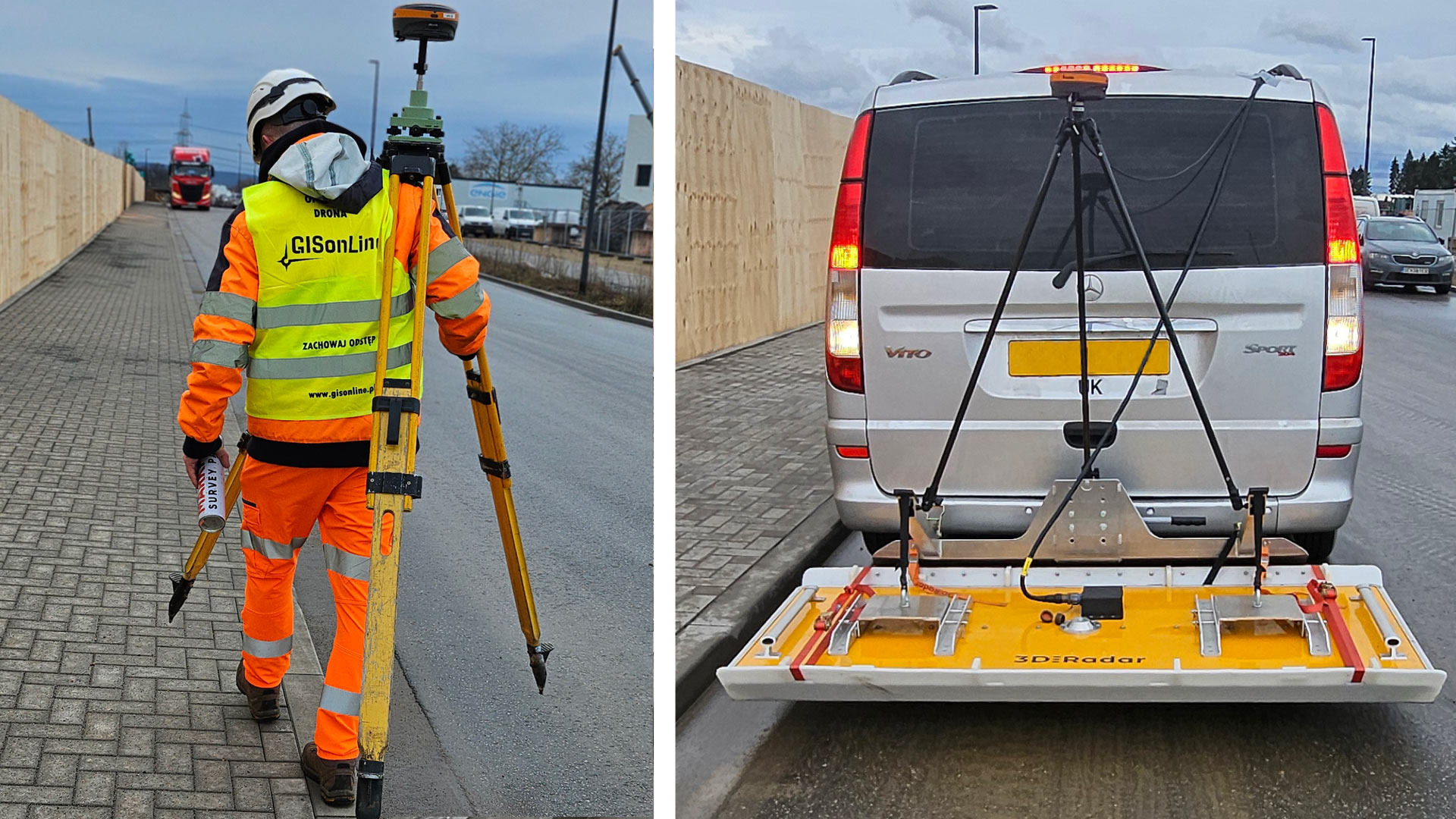
  • Fieldwork, including laser scanning of the site without entering any buildings;
  • Processing of laser scanning results in the form of a point cloud and a virtual walkthrough – 360° panoramas;
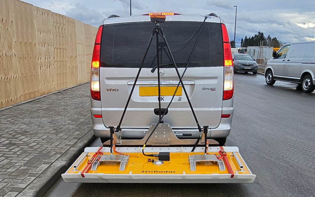
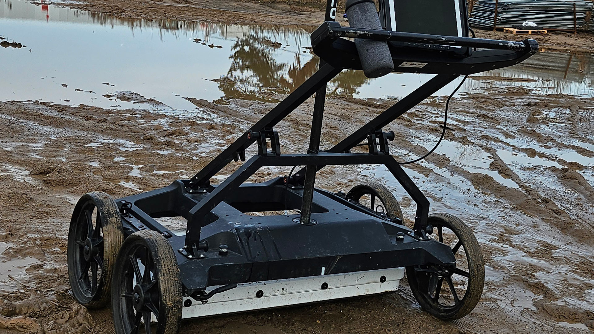
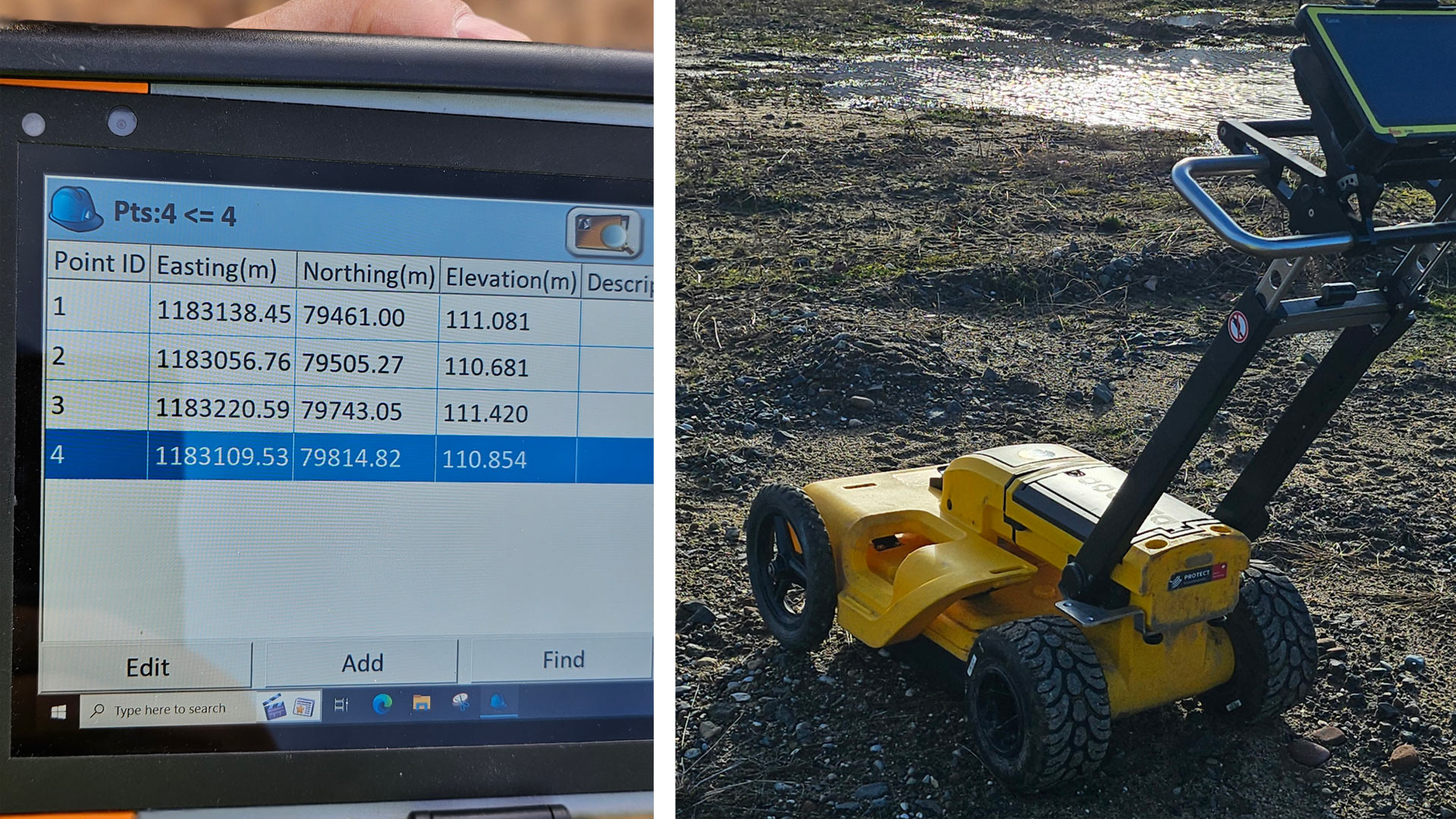
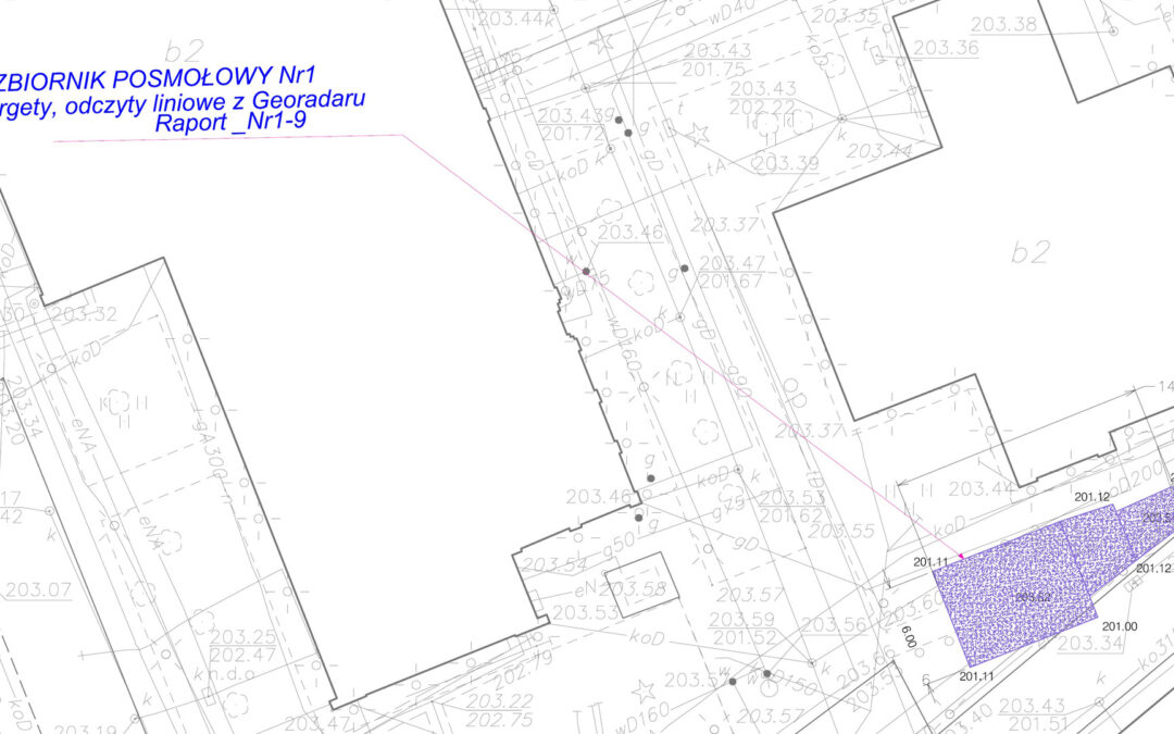
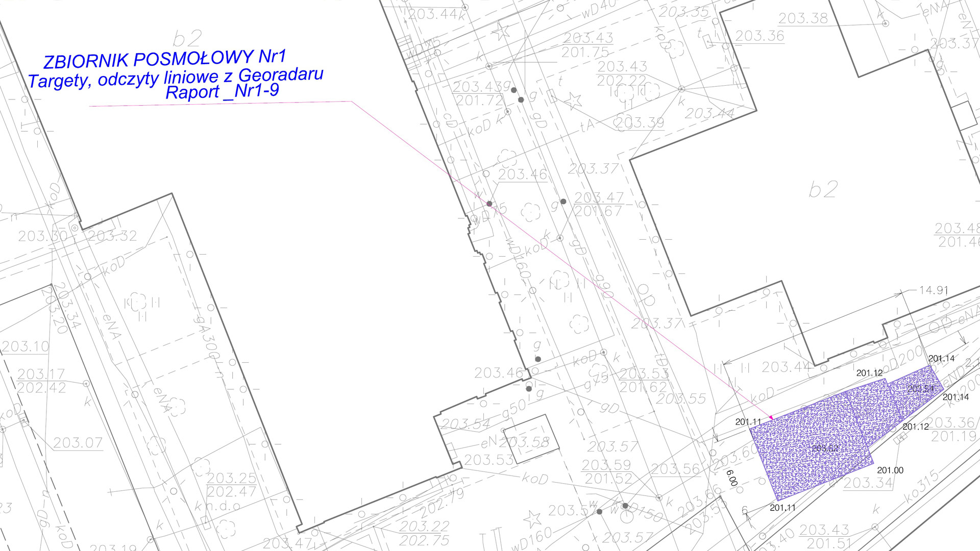
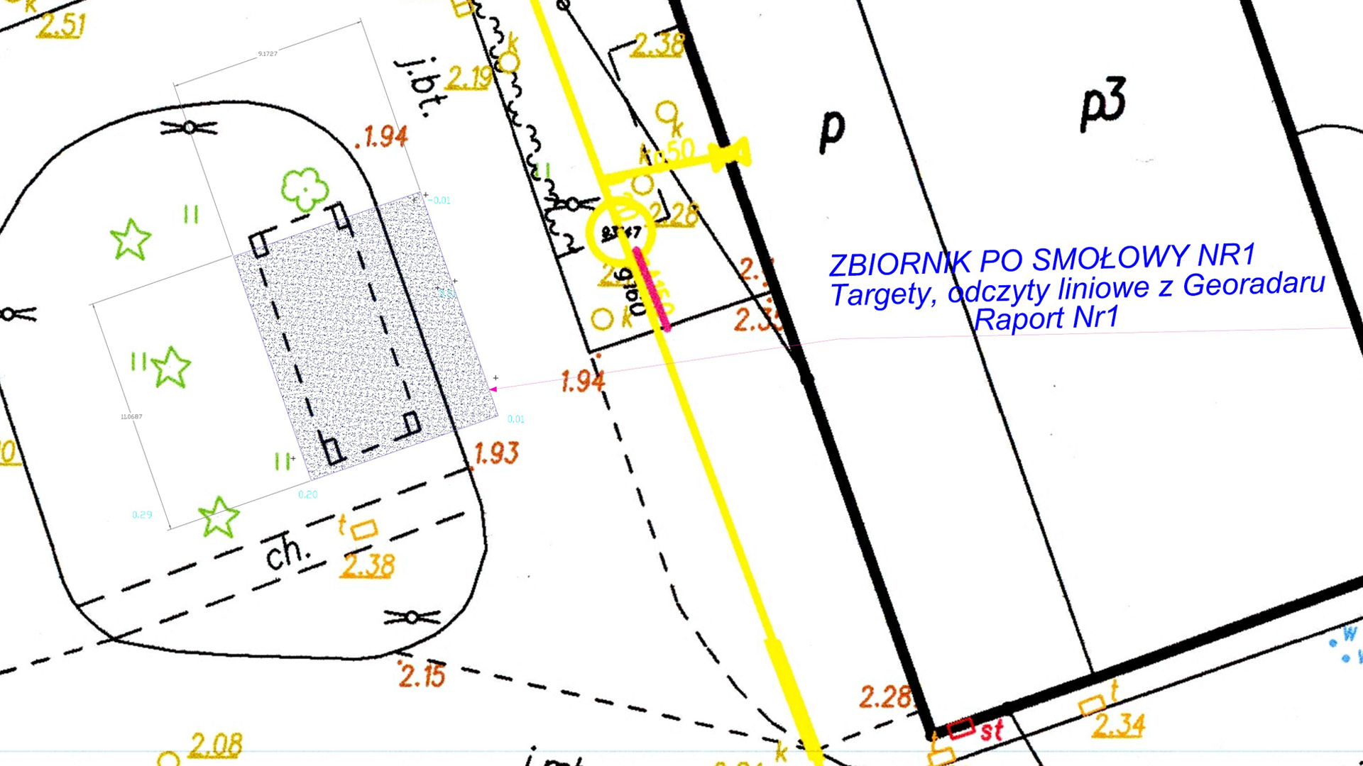
  • Underground utility detection, including ground-penetrating radar (GPR) surveys involving data acquisition and processing over an area of approximately 11,000 m²;
  • Interpretation, drafting, and reporting of underground utility detection results in compliance with PAS 128, M4P (the most advanced) type;
  • Correction of the existing infrastructure model (manholes, pipes, electrical cables) based on the point cloud and GPR survey results;
  • Modeling of field survey results (including GPR data) and development of a 3D underground infrastructure model in DWG format and a 3D model in Civil 3D software.

See some things

we’ve worked on

New Quality of Underground Detection Services – Case Study of a Project Delivered in Germany

New Quality of Underground Detection Services – Case Study of a Project Delivered in Germany

Case studies

New Quality of Underground Detection Services – Case Study of a Project Delivered in Germany

Client

Large European construction enterprise

Industry

Survey & Inspection

Region

Germany / Europe

Technology

Ground penetrating radars: Leica DS 2000, Stream DP multichannel GPR, Raptor – High Speed 3D Ground Penetrating Radar Array; Electromagnetic Locator device (EML); probes; PAS 128 methodology – M4P type

Overview

Client: large European construction enterprise

GISonLine delivered an extensive project of underground detection across a post-industrial site of an approximately 100,000 square metres, as a part of the works preparing a planned construction investment. The investigation covered a wide range of underground utilities such as: drainage, water and energy pipes, gas and all other types of underground service infrastructure, located up to 6 meters below the ground surface.

Outcome & Impact

Addressing the Client’s highest quality expectations, we performed the field investigation using three types of different detection devices: EML locators, probes and ground penetrating radars. Among the latter, we used the High Speed 3D Ground Penetrating Radar Array – Raptor which is a state-of-the-art high-speed 3D-GPR Array enabling the very fast collection of 3D GPR data, at speeds in excess of 130 km/hr (80 miles/hour), at 5 cm point intervals. Raptor is capable of survey speeds that eliminate the need for traffic control and safety vehicles. Conventional systems typically operate at no more than 30 km/hr, with similar settings. To the best of our knowledge, we are the Polish first company that offers this technology.

The project was carried out in full compliance with the PAS 128 methodology, an internationally recognized standard for conducting underground utility detection works. This methodology has been approved by the British Standards Institution (BSI), the world’s oldest organization for developing quality standards in engineering projects.

PAS 128 provides a comprehensive set of guidelines for the detection, mapping, and verification of underground infrastructure parameters, including specifications for the minimum required accuracy and quality of acquired data.

In this project, the works specified in PAS 128 were performed under the M4P type, which involves the most labor-intensive approach. It requires the highest density of the measurement grid defined by the standard, along with post-processing of Ground Penetrating Radar (GPR) data. This approach is applied in areas where a particularly high density of underground utilities is expected and/or where the client requires the highest possible measurement accuracy.

Thanks to the experience of the survey team and the use of specialized equipment, the project was successfully completed despite challenging conditions, including low temperatures (January) and muddy terrain (after a rainfall).

See some things

we’ve worked on

Improving Construction Site Visualization Using 3D Models of Above & Below Ground Infrastructure

Improving Construction Site Visualization Using 3D Models of Above & Below Ground Infrastructure

Home 9 Project Category: Underground Detection

Case studies

Improving Construction Site Visualization Using 3D Models of Above & Below Ground Infrastructure

Client

Industry

Energy & Utilities
Survey & Inspection

Region

Europe

Technology

3D Modeling
UAV
Laser Scanning
GPR Surveys
Revit
AutoCAD

Client: Exact
Location: Bad Bevensen, Germany

The objectives of this project were to create a comprehensive digital visualization using 3D models of the aboveground and belowground infrastructure covering an area of ​​planned construction of an industrial facility in Bad Bevensen, Germany.

The Impact:

The GISonLine Underground Detection Team acquired Ground Penetrating Radar (GPR) measurements and inspection data for the underground infrastructure survey covering an area of ​​more than 12,000 m². In addition, point-cloud data from the terrestrial laser scanner and imagery from the Unmanned Aerial Vehicle (UAV) were used to collect high-resolution data for the above ground structures.

The Outcome:

Together with our survey partner (EXACT), GISonLine successfully surveyed the project site using GPR underground detection methods. The underground detection data was used to establish a detailed 3D model of the underground assets.

The sub-surface data was then combined with the aboveground datasets collected from the laser scanning and UAV imagery to form a comprehensive 3D model and representation of the construction site.

Deliverables associated with this project included:

  • Inventory of underground infrastructure (GPR measurements)
  • Creation of digital maps of the above and below ground infrastructure
  • Development of 3D models
  • Delivery of the data obtained from the GPR, UAV, and laser scanning

See some things

we’ve worked on

Contact us

Looking for Location Intelligence?

2 + 12 =

Using Ground Penetrating Radar to Map & Visualize Underground Utility Networks (Bad Bevensen, Germany)

Using Ground Penetrating Radar to Map & Visualize Underground Utility Networks (Bad Bevensen, Germany)

Home 9 Project Category: Underground Detection

Case studies

Using Ground Penetrating Radar to Map & Visualize Underground Utility Networks (Bad Bevensen, Germany)

Client

Industry

Energy & Utilities
Survey & Inspection
Transportation

Region

Europe

Technology

Ground Penetrating Radar (GPR)
AutoCAD

Client: Exact
Location: Bad Bevensen, Germany

In support of its survey and inspection partnership, GISonline conducted an underground detection survey to create multi-disciplinary digital maps of the underground utilities network covering an area of ​​approximately 1 Kilometer in the Bad Bevensen region of Germany. The project included integrating data from a comprehensive soil surveys associated with sections of the project area for the visualization of buried utilities and soil types.

The Impact

The project had a significant impact on determining the course and the depth of the existing underground utility network using detection methods such as Ground Penetrating Radar (GPR).

The Outcome

GISonLine successfully conducted the underground detection survey of the project site and utility lines and produced key sets of deliverables:

  •  GRP survey detection of underground obstacles and objects
  • Preparation and delivery of underground utility maps
  • Integration of existing documentation related to the project site
  • Delivery of all CAD mapping data and files

See some things

we’ve worked on

Contact us

Looking for Location Intelligence?

13 + 14 =

Cleaning up the Environment by Detecting & Mapping Buried Storage Tanks (PG Kielce)

Cleaning up the Environment by Detecting & Mapping Buried Storage Tanks (PG Kielce)

Home 9 Project Category: Underground Detection

Case studies

Cleaning up the Environment by Detecting & Mapping Buried Storage Tanks (PG Kielce)

Client

Industry

Survey & Inspection

Region

Europe

Technology

Ground Penetrating Radar (GPR)
Geo-Radar Measurements
AutoCAD

Client: Przedsiębiorstwo Geologiczne Sp. z o.o.
Location: multiple cities in Poland

At the request of one of the largest Polish geological companies  (PG Kielce), GISonLine carried out an extensive underground detection survey to verify the location of tanks buried in the 20th century.

The Impact

Given the absence of archival documentation and the exact locations of the buried storage tanks, GISonLine was tasked with providing underground detection services to accurately identify and map the location, dimensions & thickness, buried depths, and construction materials used for the storage tanks.

The Outcome

GISonLine successfully conducted the underground surveys using Ground Penetrating Radar (GPR)  and geodetic measurements and completed the work in 15 Polish cities to include: Gdańsk, Gorzów Wielkopolski, Kraków, Łódź and Opole.   

The project included delivery of key underground detection survey products:

  • Geo-radar measurements confirming the location of the underground tanks
  • Detection of tank boundaries and determination of their depth
  • Data and attributes related to each tank’s thickness, detected depth, and other detected objects
  • Investigation of additional located objects found near the project sites
  • Custom maps displaying tank locations and surrounding environmental areas

See some things

we’ve worked on

Contact us

Looking for Location Intelligence?

8 + 1 =