Creating 3D Models to Visualize Above & Below Ground Assets On Marcinkowskiego Street (Poznań, Poland)

Creating 3D Models to Visualize Above & Below Ground Assets On Marcinkowskiego Street (Poznań, Poland)

Home 9 Project Category: Aerial Inspection & Analysis ( Page 2 )

Case studies

Creating 3D Models to Visualize Above & Below Ground Assets On Marcinkowskiego Street (Poznań, Poland)

Client

Industry

Survey & Inspection
Underground Utilities

Region

Europe

Technology

GPR – Lecia DS2000
Detector – Leica Ultra Advanced
GNSS solution – Leica CS20/GS16
Terrain Laser Scanner
Drone DJI – Phantom 4 Pro V2.0
CAD and 3D modeling software

Client: Poznań City Hall
Location: Poznań, Poland

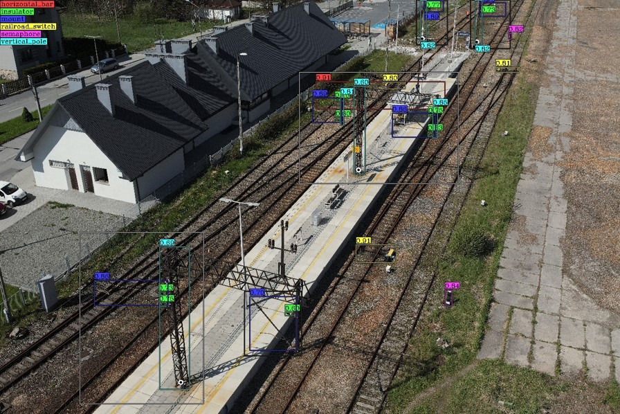
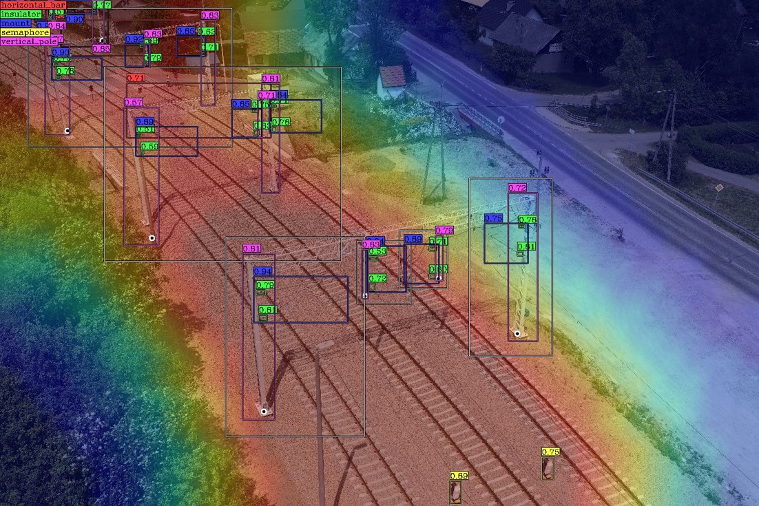
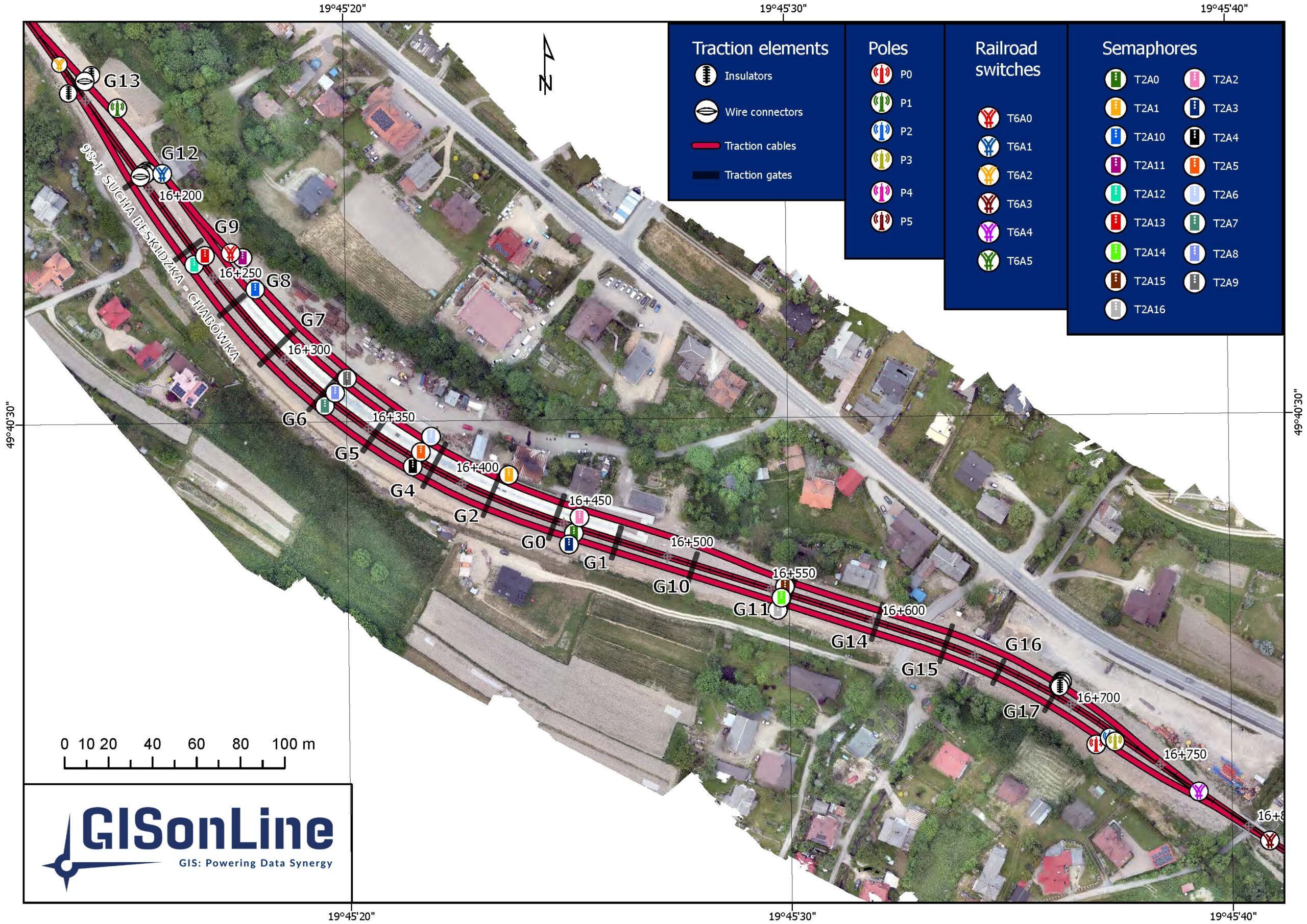
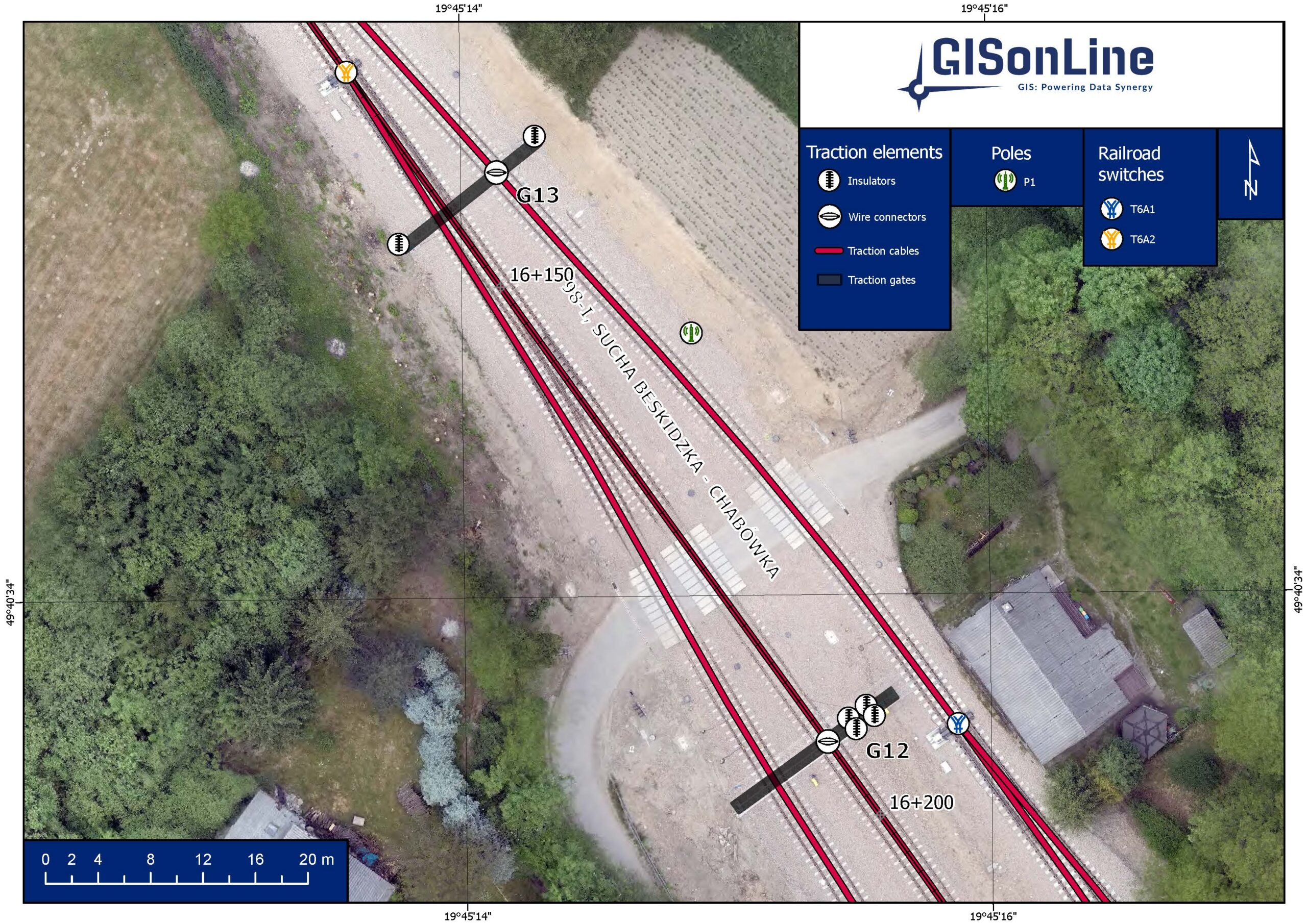
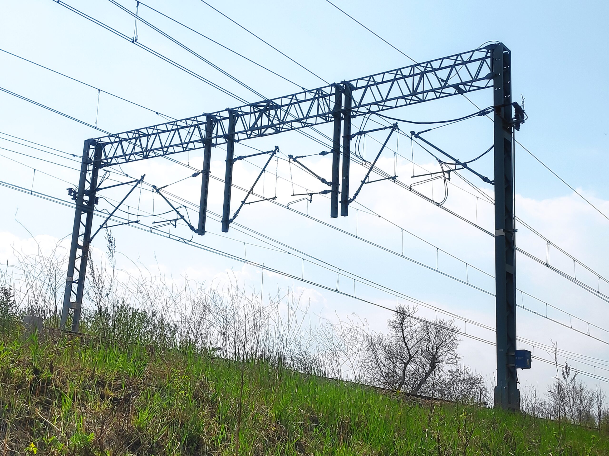
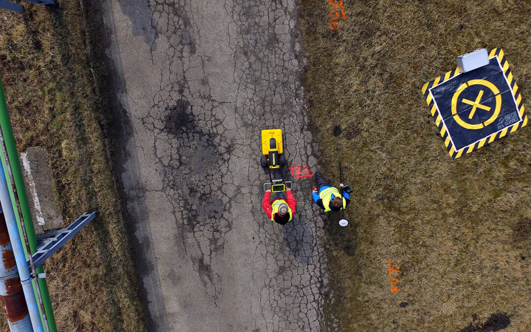
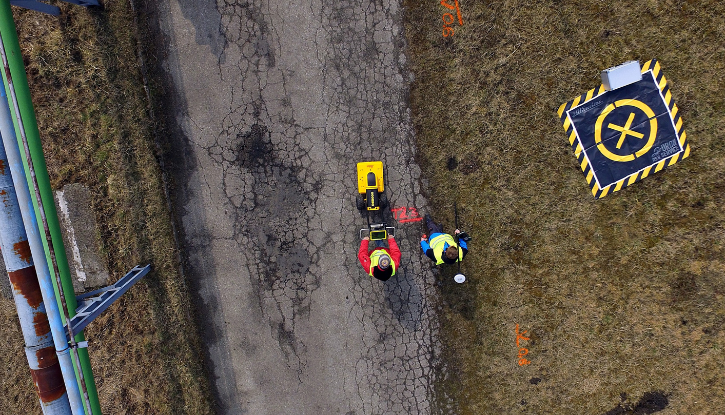
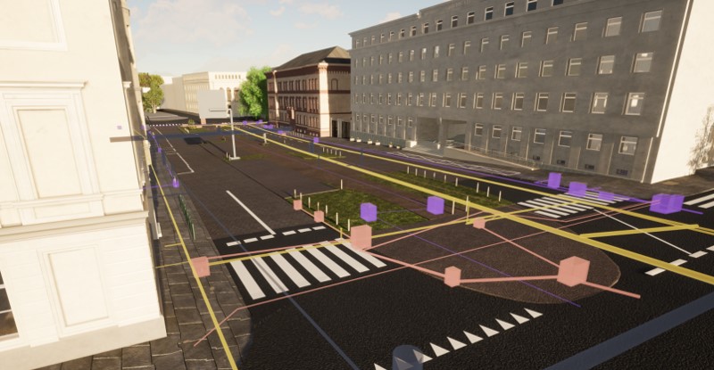
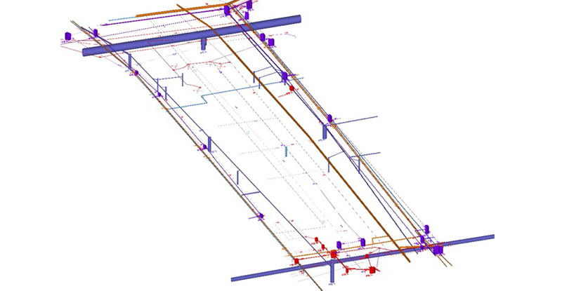
GISonLine was pleased to take part in a project that required the use of multiple sensors and data collection platforms designed to capture above ground infrastructure and identify below ground utilities, which allowed for the creation of complete 3D models and visualizations for the area of Marcinkowskiego street in Poznań, Poland.

The Impact

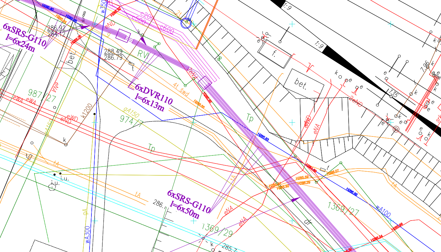
The use of multiple sensors for data collections included: terrain laser scanner, aerial drone, Ground Penetrating Radar (GPR) and Electromagnetic Induction (EMI) detection equipment to capture the above and below ground assets. Post processing of the data collected produced a comprehensive 3D model of measured area on Marcinkowskiego street.

The Outcome

GISonLine successfully completed the data collections and surveys to produce key deliverables that supported the 3D visualization of utility and infrastructure assets. Advanced capabilities and accuracy of technology, such as GPR, terrestrial lidar scanning, and GPS are being leveraged to produce full 3D models of above and below ground assets. The ability to visualize in high detail and accuracy increases safety on construction sites and excavation projects and aids in avoiding unnecessary utility relocations or outages.

See some things

we’ve worked on

Contact us

Looking for Location Intelligence?

2 + 1 =

AI and ML-based service for traction network inventory and monitoring

AI and ML-based service for traction network inventory and monitoring

Home 9 Project Category: Aerial Inspection & Analysis ( Page 2 )

Case studies

AI and ML-based service for traction network inventory and monitoring

Industry

Energy & Utilities
Survey & Inspection
Consumer Applications

Region

Worldwide

Technology

Artificial Intelligence

Purpose / Application


The AI (Artificial Intelligence) and ML (Machine Learning) -based traction network inventory and monitoring service is a comprehensive solution offered by GISonLine. The service includes conducting aerial surveys and processing data collected using unmanned aerial vehicles (UAV). It takes advantage of all the benefits of professional UAV systems without unnecessary risks and costs.

Artificial intelligence and machine learning methods enable the automation of processes for identifying and locating traction network components. This results in:

  • Reduced time for inspection/analysis
  • The ability to perform inspections/analyses remotely
  • Increased safety by reducing the number of “manual” inspections in trackside areas
  • Fewer failures thanks to early detection of damages

The method can also be used, for example, to estimate damage caused by transportation accidents in real time or to assess the quality of completed service works and renovations.

Innovative approach

During the pilot implementation an innovative approach to data preprocessing was developed in collaboration with researchers from Wrocław University of Science and Technology. In particular, heatmaps were used to identify spatial sequences with higher likelihood of encountering the desired traction elements. Group analysis based on object hierarchy was performed to detect small but important components of the traction network. This involved searching for small network elements (e.g. hangers or insulators) in a specific spatial relationship to larger, easier-to-identify objects (e.g. support structures). At GISonLine, we added to that an algorithm for automatically assigning geographic coordinates to the identified objects.

Performance of the method

The effectiveness of the AI-based traction network inventory and monitoring service depends on the quality of the data used during model training as well as the data collected from the aerial survey.

During test implementation, a high accuracy in object recognition was achieved. The total inference time was approximately 900 ms per image.

Further directions of the implementation and development of the method

The method applied can be enhanced and developed through the use of laser scanning data (Lidar) or by increasing the pool of objects used for training. Ultimately, full automation of the process is achievable.

In terms of thematic development, the method could also expand to address issues such as:

  • Location of wooden sleepers awaiting replacement with concrete ones
  • Assessment of railway ballast quality to determine the need for replacement
  • Assessment of the degree of wear of electric traction cables
  • Information on the precise routing of electric cables

Comprehensive service

GISonLine possesses its equipment, software, and copyrights for the developed method. Through the pilot project, our team has acquired the necessary skills in applying machine learning tools. Combined with our previous experience in network industry implementations, this prepares us to handle the entire process of service delivery.

Need a fresh but reliable solution for supporting management of your network assets? 

See some things

we’ve worked on

Contact us

Looking for Location Intelligence?

14 + 13 =

Avoiding Utility Line Collisions Along the Trzebinia Railway Line (Trzebinia, Poland)

Avoiding Utility Line Collisions Along the Trzebinia Railway Line (Trzebinia, Poland)

Home 9 Project Category: Aerial Inspection & Analysis ( Page 2 )

Case studies

Avoiding Utility Line Collisions Along the Trzebinia Railway Line (Trzebinia, Poland)

Client

Industry

Survey & Inspection
Energy & Utilities

Region

Europe

Technology

GPR – Lecia DS2000
Detector – Leica Ultra Advanced
GNSS solution – Leica CS20/GS16
Drone DJI – Phantom 4 Pro V2.0
CAD, GPR and Pix4D software

Overview

Client: PKP Energetyka
Location: Trzebinia, Poland

The railway station in Trzebinia has a long history and was first opened in October 1847. The main station building still exists today supporting multiple routes from the Trzebinia station.

As part of modernization & maintenance efforts there are continued infrastructure updates and reconstruction projects taking place along the Trzebinia rail transportation networks. GISonLine was pleased to support PKP Energetyka with underground detection surveys for the planning and placement (routing) of newly proposed utility lines near the Trzebinia railway.

The Impact

A primary goal of the underground detection surveys was to check and ensure the planned routing of the new power cables would not collide with existing utility networks. Of specific concern was safety and prevention of utility damages and outages in places where ground drillings were planned.

The Outcome

GISonLine successfully completed the underground detection surveys using ground penetrating radar to produce accurate 2D mapping representations on the location of existing (below ground) utility lines. In addition, high resolution imagery was captured using aerial drone data collections for above ground site surveys and mapping.

Based on the underground detection surveys, multiple collisions were identified where the proposed cable routing would collide or interfere with existing utilities. As a result, the routing of the proposed cables was changed and incorporated the data from the underground survey analysis and mapping products to determine optimal locations.

See some things

we’ve worked on

Contact us

Looking for Location Intelligence?

15 + 12 =