Improving Construction Site Visualization Using 3D Models of Above & Below Ground Infrastructure

Improving Construction Site Visualization Using 3D Models of Above & Below Ground Infrastructure

Home 9 Project Category: Aerial Inspection & Analysis

Case studies

Improving Construction Site Visualization Using 3D Models of Above & Below Ground Infrastructure

Client

Industry

Energy & Utilities
Survey & Inspection

Region

Europe

Technology

3D Modeling
UAV
Laser Scanning
GPR Surveys
Revit
AutoCAD

Client: Exact
Location: Bad Bevensen, Germany

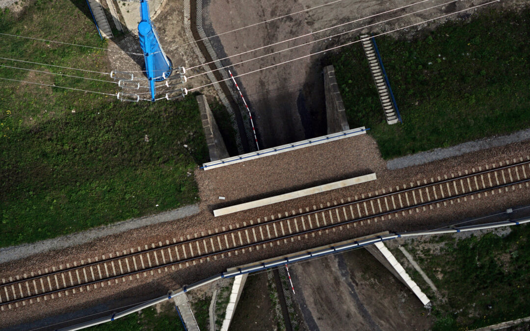
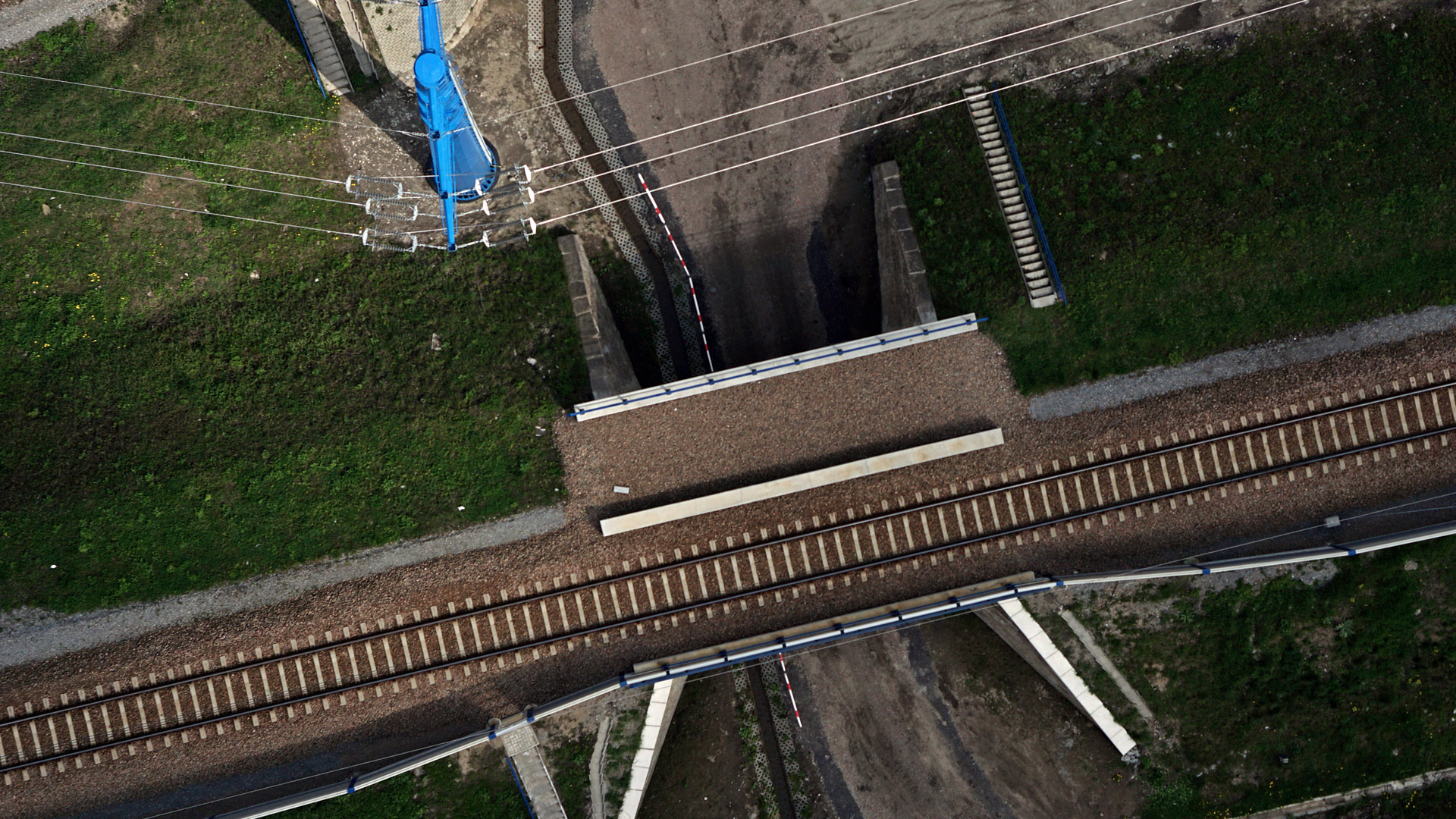
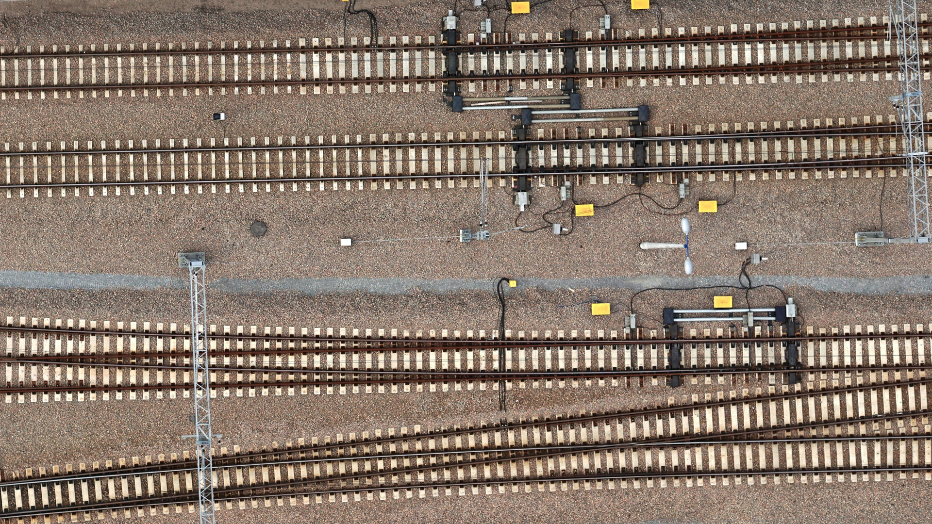
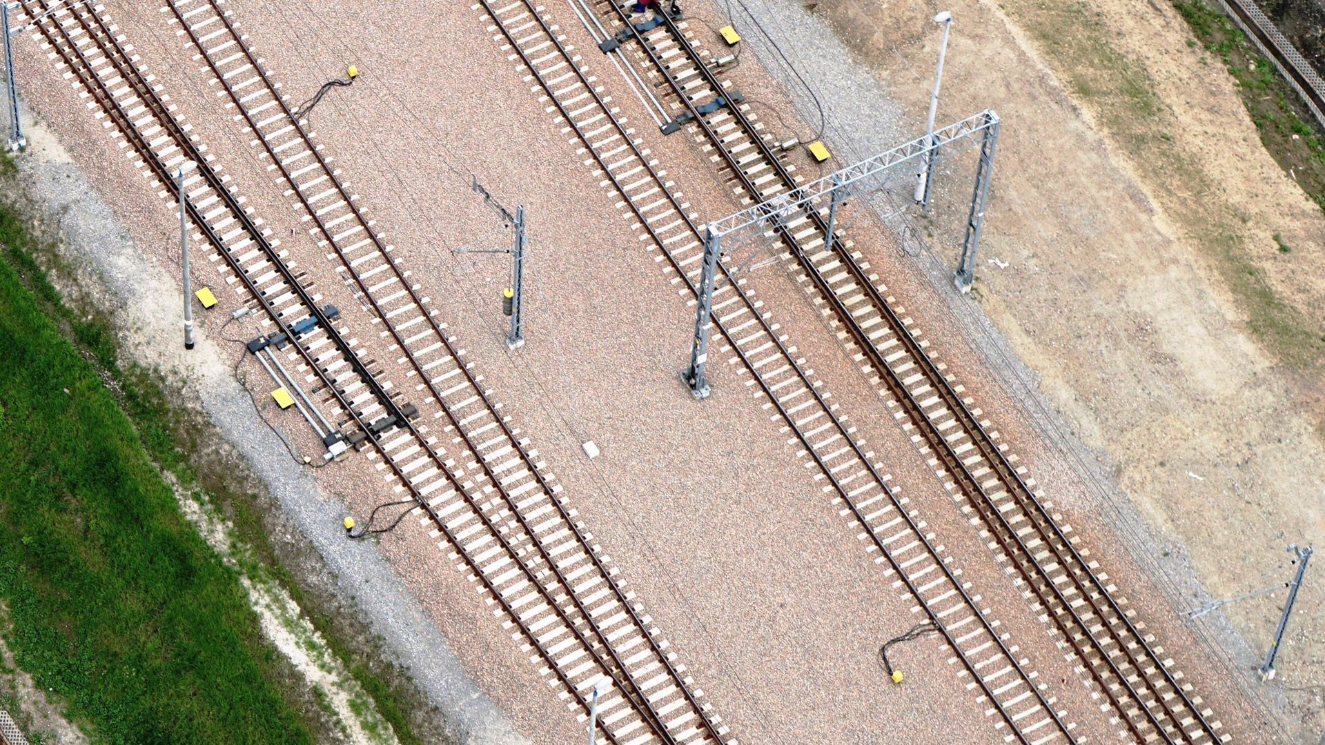
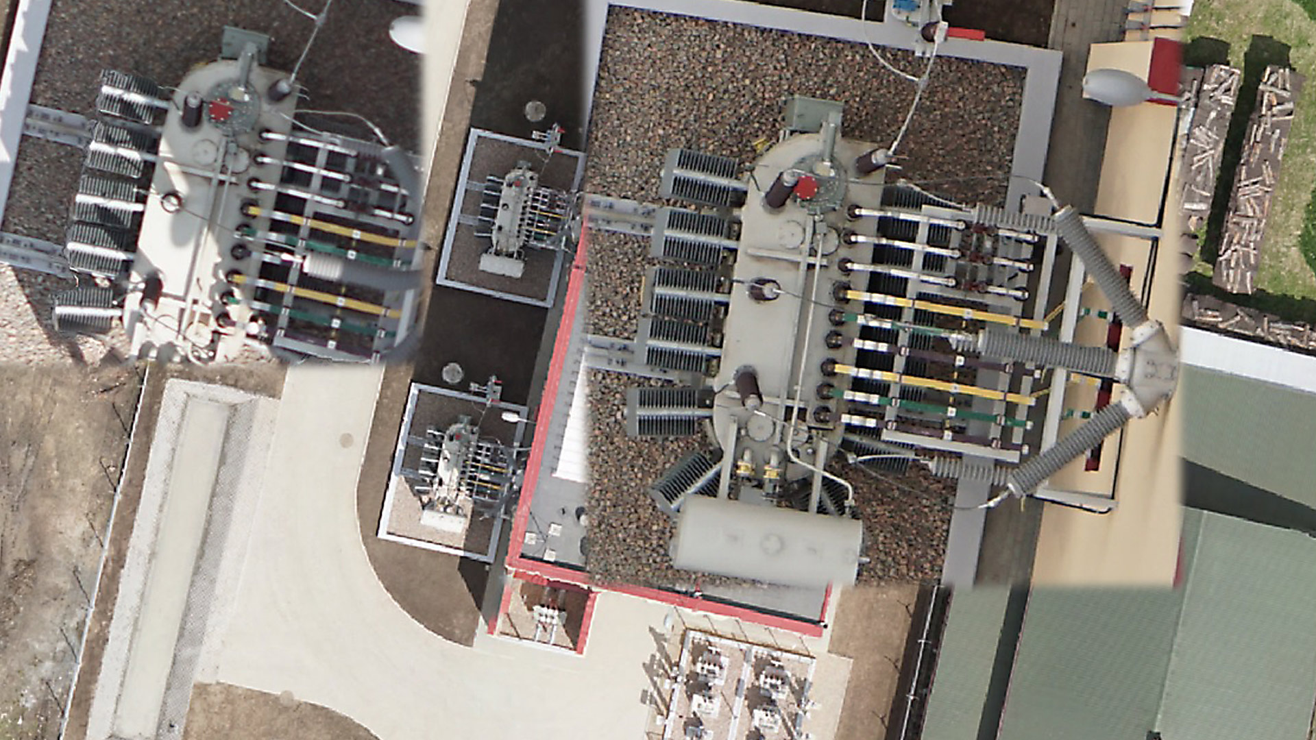
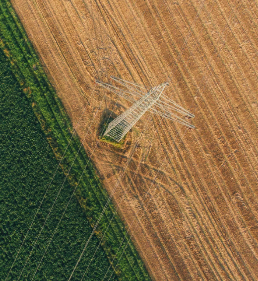
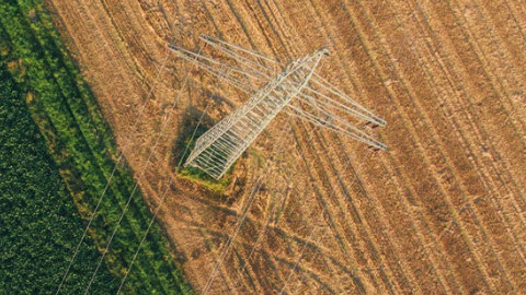
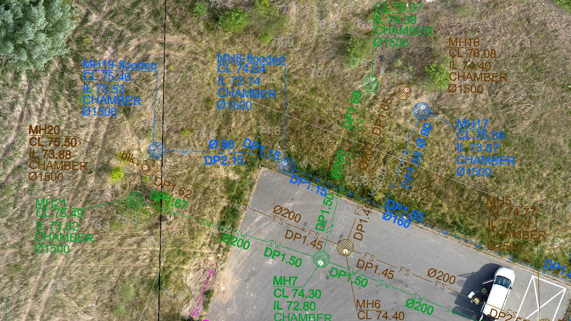
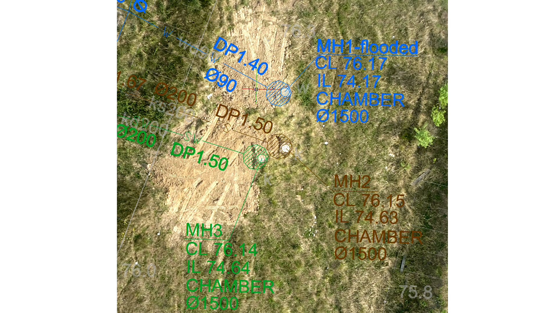
The objectives of this project were to create a comprehensive digital visualization using 3D models of the aboveground and belowground infrastructure covering an area of ​​planned construction of an industrial facility in Bad Bevensen, Germany.

The Impact:

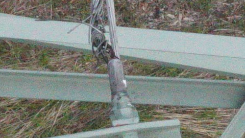
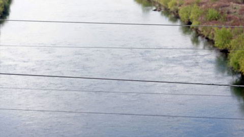
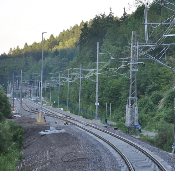
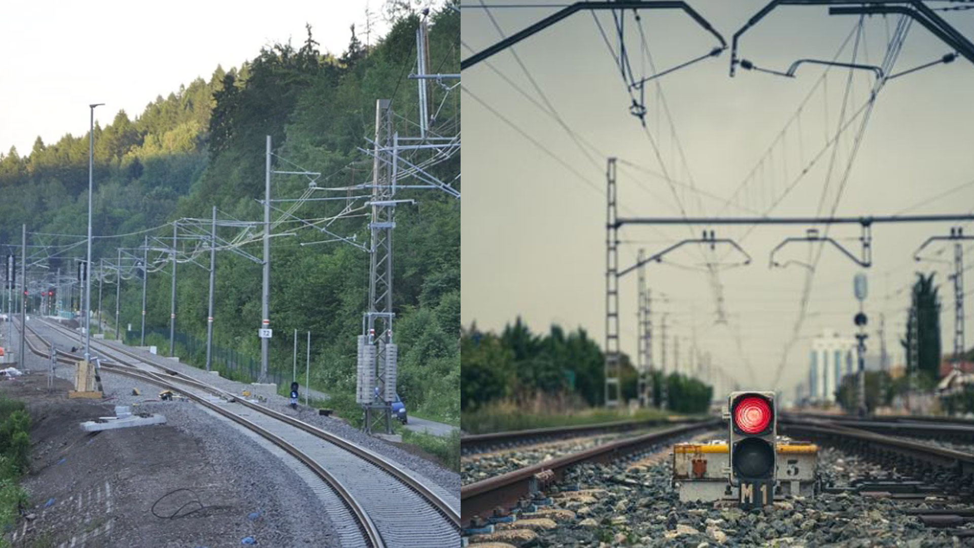
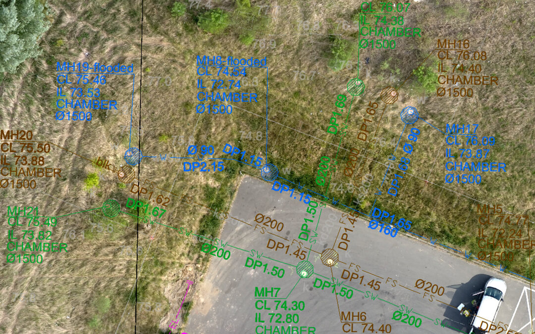
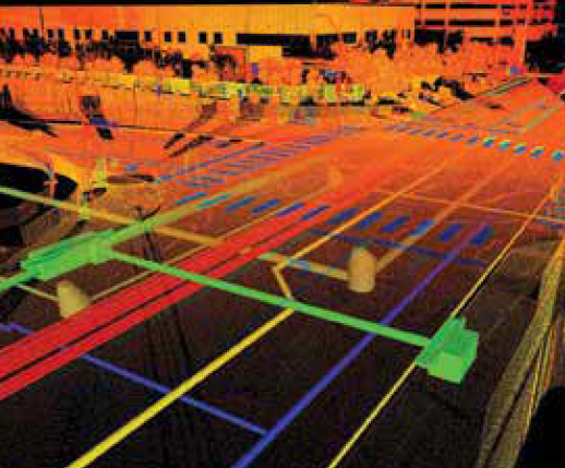
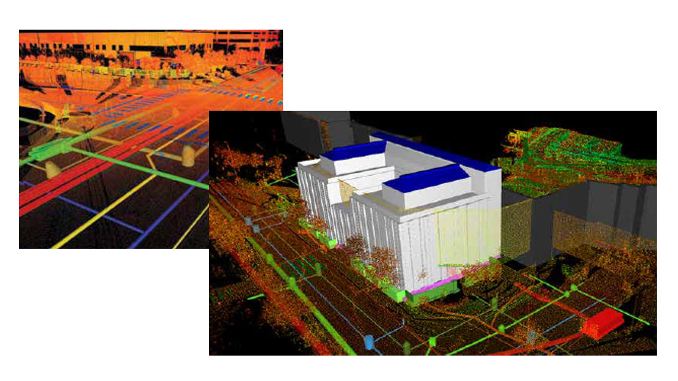
The GISonLine Underground Detection Team acquired Ground Penetrating Radar (GPR) measurements and inspection data for the underground infrastructure survey covering an area of ​​more than 12,000 m². In addition, point-cloud data from the terrestrial laser scanner and imagery from the Unmanned Aerial Vehicle (UAV) were used to collect high-resolution data for the above ground structures.

The Outcome:

Together with our survey partner (EXACT), GISonLine successfully surveyed the project site using GPR underground detection methods. The underground detection data was used to establish a detailed 3D model of the underground assets.

The sub-surface data was then combined with the aboveground datasets collected from the laser scanning and UAV imagery to form a comprehensive 3D model and representation of the construction site.

Deliverables associated with this project included:

  • Inventory of underground infrastructure (GPR measurements)
  • Creation of digital maps of the above and below ground infrastructure
  • Development of 3D models
  • Delivery of the data obtained from the GPR, UAV, and laser scanning

See some things

we’ve worked on

Contact us

Looking for Location Intelligence?

15 + 14 =

Using Drone Data Collections To Identify Medium Voltage (MV) Railway Assets (PKP Energetyka)

Using Drone Data Collections To Identify Medium Voltage (MV) Railway Assets (PKP Energetyka)

Home 9 Project Category: Aerial Inspection & Analysis

Case studies

Using Drone Data Collections To Identify Medium Voltage (MV) Railway Assets (PKP Energetyka)

Client

Industry

Energy & Utilities
Survey & Inspection
Transportation

Region

Europe

Technology

Phoenix Unmanned Aerial Vehicle (UAV)
Griffin multi-Rotor Unmanned Aerial Vehicle (UAV)
ESRI ArcGIS

Client:  PKP Energetyka
Location: Podłęże-Bochnia, Poland

GISonLine completed a research and development project in support of PKP Energetyka’s Medium Voltage (MV) utility networks by conducting an asset inventory using drone data captures for the newly renovated section (20 km) of the Podłęże-Bochnia railway line. 

Successful results of the research and data capture efforts supported PKP Energetyka interests in the topic of using drones for the inventory and inspection processes associated with utilities enterprise asset management.

The Impact 

Based on the drone identification and inventory of electrical utility assets, the newly renovated section of railway line was captured using two different types of UAV’s: the Phoenix UAV and the Griffin multi-Rotor platforms.

Both drone systems were equipped with high-resolution cameras producing high quality images and videos to support the production of orthophoto maps with a resolution of 1 cm / pixel, a numerical model of land cover, and point cloud data for the visualization of the area in a 3D environment.  

The Outcome

GISonLine successfully conducted the aerial data capture covering the 20 kilometers area of railway electrical networks and provided to PKP Energetyka core deliverables:

  • High-resolution orthophoto maps
  • Point Cloud Data
  • 3D Models
  • High-resolution images & video of utility network assets
  • Geodatabase of utility  objects
  • Comprehensive report on the use of drones for inspecting utility networks

See some things

we’ve worked on

Contact us

Looking for Location Intelligence?

10 + 8 =

Reducing Power Outages Using Drones to Detect Faults in High Voltage Power Lines (Tauron Dystrybucja SA)

Reducing Power Outages Using Drones to Detect Faults in High Voltage Power Lines (Tauron Dystrybucja SA)

Home 9 Project Category: Aerial Inspection & Analysis

Case studies

Reducing Power Outages Using Drones to Detect Faults in High Voltage Power Lines (Tauron Dystrybucja SA)

Client

Industry

Survey & Inspection
Energy & Utilities

Region

Europe

Technology

UAV
High Resolution Image Capture

Client: Tauron Dystrybucja SA
Location: Poland

GISonLine performed a series of inspections on the technical condition and state of the high-voltage (HV) power lines and network objects using aerial drone inspections in support of Tauron Dystrybucja SA utility provider.

The Impact  

The high-voltage power lines were surveyed using two different UAV’s equipped with high-resolution digital cameras that made possible the identification of asset damages and fault issues. The work was carried out in remote and difficult terrain conditions where access was only possible using UAV platforms. Targeted objects for inspection included:

  • Phase Lines
  • Overhead Lines
  • Support structures
  • Network distribution objects (circuit bridges, insulators)

The Outcome

GISonLine successfully conducted the aerial inspection and captured high resolution images and videos detailing the power line networks and assets.

Due to the high resolution and quality of the photos and videos obtained, it was possible to identify and flag areas of damage and concerns associated with the power line sections and network distribution objects.  While analyzing the results of the survey, GISonLine identified and documented a number of feature issues (faults) which had a significant impact on the proper functioning of the network such as:

  • Lightning protection wires unbraiding
  • Wear and discoloration of wire braids
  • Damaged and unbraiding of vibration dampers and protective cables 
  • Damage to electrical insulators

See some things

we’ve worked on

Contact us

Looking for Location Intelligence?

7 + 8 =

Using Artificial Intelligence to Automate Utilities Asset Inspection & Inventory

Using Artificial Intelligence to Automate Utilities Asset Inspection & Inventory

Home 9 Project Category: Aerial Inspection & Analysis

Case studies

Using Artificial Intelligence to Automate Utilities Asset Inspection & Inventory

Client

Industry

Energy & Utilities
Survey & Inspection
Consumer Applications

Region

Worldwide

Technology

Artificial Intelligence

Overview

GISonLine, in partnership with the Wrocław University of Technology, are working closely on a project designed to use Artificial Intelligence (AI) and machine learning to process and analyze high resolution imagery to automate utility inspection and asset management workflows.

Integrating AI into the inspection & asset management processes has the potential for significant costs savings and benefits. By using AI and machine learning techniques, utility asset managers and inspectors have the ability to automate the process of identifying and inventorying utility objects and to use the AI algorithms to flag assets recognized as having visible defects or faults.

The Impact

GISonLine is specifically focusing on creating AI algorithms and image pattern recognition for the processing of digital images of railway traction lines obtained from drone and UAV platforms. Traction lines and their connected utility objects are used in support of overhead contact lines associated with electrical power distribution for railway networks.

The formalized process will utilize machine learning techniques to detect and identify the railway traction lines and connected network objects. A primary goal is to train the system for pattern recognition to detect and flag visible defects (faults) found along the traction lines and to automatically alert personnel and inspectors of the issues and maintenance needed.

The Outcome

GISonLine’s objective is to integrate the AI and machine learning technology into its INSPECTonLine cloud-based application.

The INSPECTonLine product will enable asset managers and inspectors with the ability to automate the processes associated with utility asset inventories & inspections and provide a formalized method for detecting and alerting personnel of utility defects that require closer inspection.

Phases of the project include:

1. Analysis of source data and materials (drone & aerial platform data)
2. Definition & characteristics of utility objects to be analyzed
3. Development of traction line recognition algorithms
4. Pattern recognition and feature/fault identification
5. Analysis of the solution for maintaining railway overhead contact lines
6. Integration of the algorithms into the INSPECTonline application


See some things

we’ve worked on

Contact us

Looking for Location Intelligence?

11 + 4 =

Supporting the Expansion of Amazon’s Fulfillment Centers with Aerial & Underground Detection Mapping

Supporting the Expansion of Amazon’s Fulfillment Centers with Aerial & Underground Detection Mapping

Home 9 Project Category: Aerial Inspection & Analysis

Case studies

Supporting the Expansion of Amazon’s Fulfillment Centers with Aerial & Underground Detection Mapping

Client

Industry

Energy & Utilities
Survey & Inspection

Region

Europe

Technology

GPR – Lecia DS2000
Detector – Leica Ultra Advanced
GNSS solution – Leica CS20/GS16
Drone DJI – Phantom 4 Pro V2.0
CAD, GPR and Pix4D software

Client: Amazon
Location: Krosno Odrzańskie, Poland

An Amazon fulfillment center is a logistics warehouse where incoming orders are received, stored, packed, and shipped out to customers. Planning for the expansion and construction of a fulfillment center requires comprehensive preparation and understanding of site conditions, underground assets, and environmental factors. Understanding exactly what lies beneath the ground prior to any construction and excavation is a key component to planning and safety.

GISonLine was pleased to participate in the project for underground detection and mapping surveys in support of future investments by Amazon. The surveys were carried out to update cartographic maps , perform geodetic measurements of the topography, and detection and mapping of underground utility lines.

The Impact

To provide a thorough understanding of the area, which encompassed 5 hectares (approximately 12 acres), GISonLine collected aerial photogrammetry pictures using drone platforms with a 4K high-resolution camera. Orthophoto maps of the entire area were established producing a 1.5cm terrain model representing land surface elevations to visualize relief. An underground detection survey was carried out using Ground Penetrating Radar (GPR) to establish a set of 2D maps identifying the underground utilities within the targeted areas of interests.

The Outcome

GISonLine successfully completed the underground detection surveys and site mapping delivering to Amazon a comprehensive and up-to-date model of the type and location of sub-surface utilities (ex: electrical, water, gas) and detailed mapping and imagery of site assets to support Amazon’s planning and expansion of fulfillment centers. The project deliverables included:

  • High Resolution Aerial Imagery
  • Orthophoto Maps
  • Digital Terrain Model
  • 2D maps outlining the type and location of underground utilities


See some things

we’ve worked on

Contact us

Looking for Location Intelligence?

12 + 15 =