Creating 3D Visualizations in Support of the Planned Expansion of the National Museum (Kraków, Poland)
Case studies
Creating 3D Visualizations in Support of the Planned Expansion of the National Museum (Kraków, Poland)
Client
Industry
Survey & Inspection
Energy & Utilities
Region
Europe
Technology
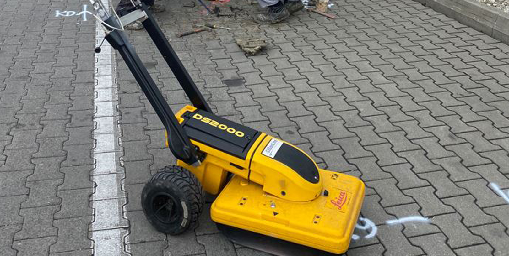
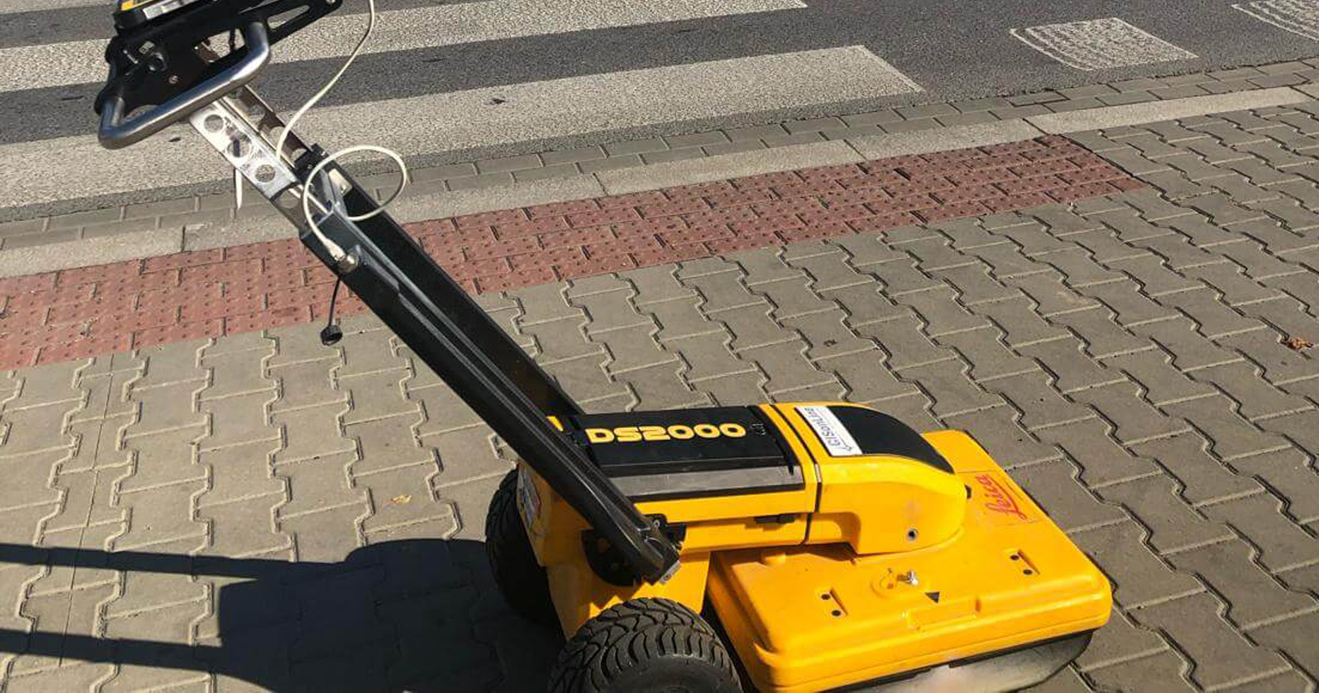
Ground Penetrating Radar (GPR) – Lecia DS2000
Detector – Leica Ultra Advanced
GNSS solution – Leica CS20/GS16
Terrain Laser Scanner
CAD, GPR and 3D modeling software
Overview:
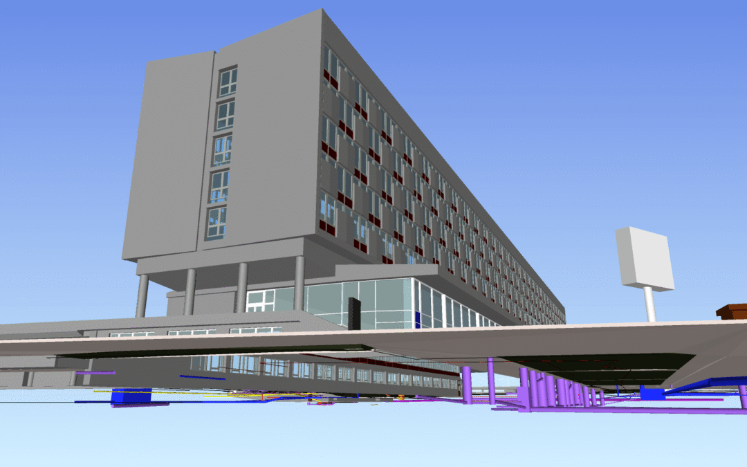
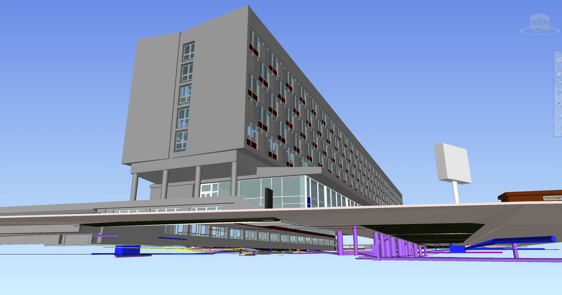
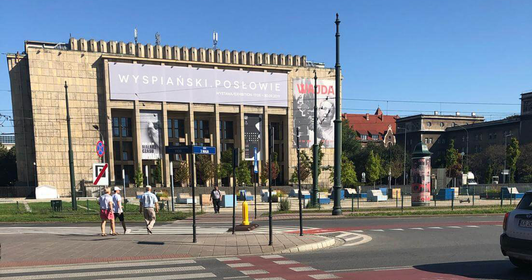
The former Cracovia Hotel, that was originally built in the 1960’s sits across the street from the National Museum in Kraków (MNK) and is slated to become the new Museum of Architecture and Design. Poland’s culture minister has unveiled plans that outline the transformation of the old hotel (now abandoned) into a modern museum under the direction of the NMK.
GISonLine was pleased to be involved in supporting MNK with the planning and analysis for the transformation of the Cracovia hotel by conducting underground utilities detection and above ground terrain scanning to produce 3D models and digital representations of the project areas.
The Impact:
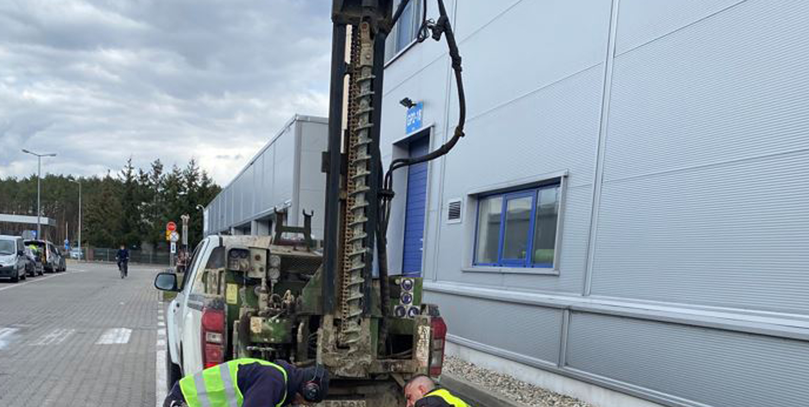
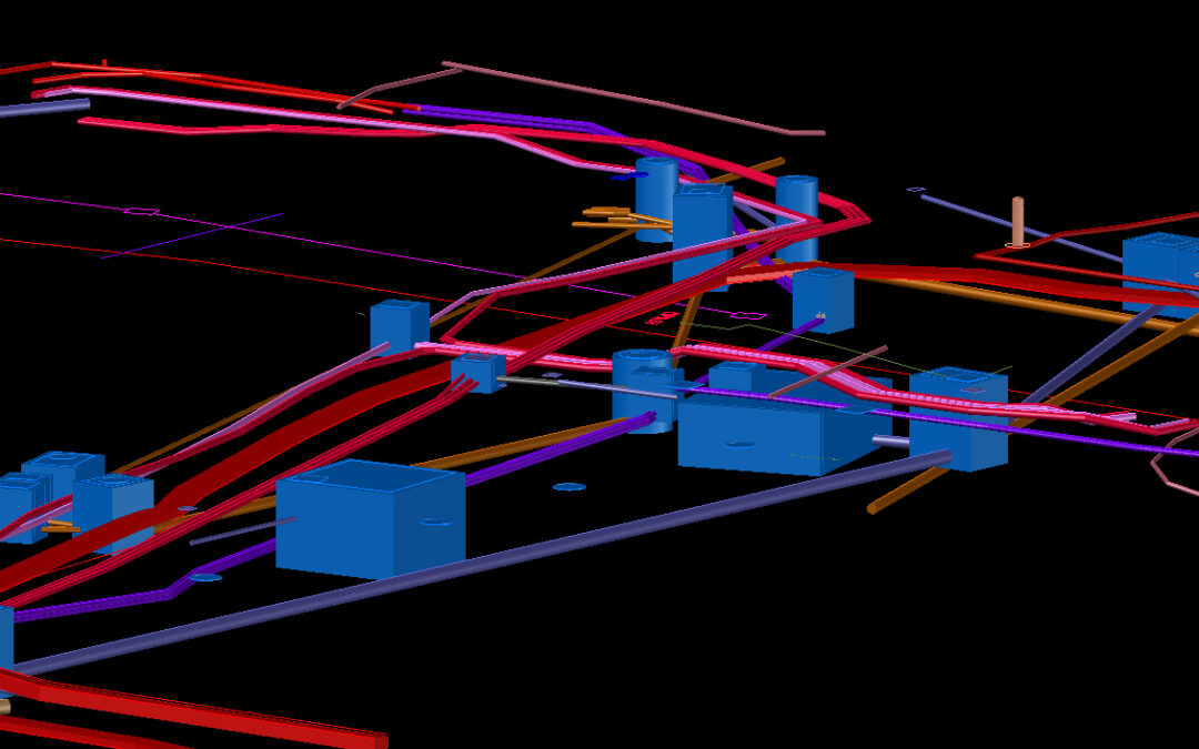
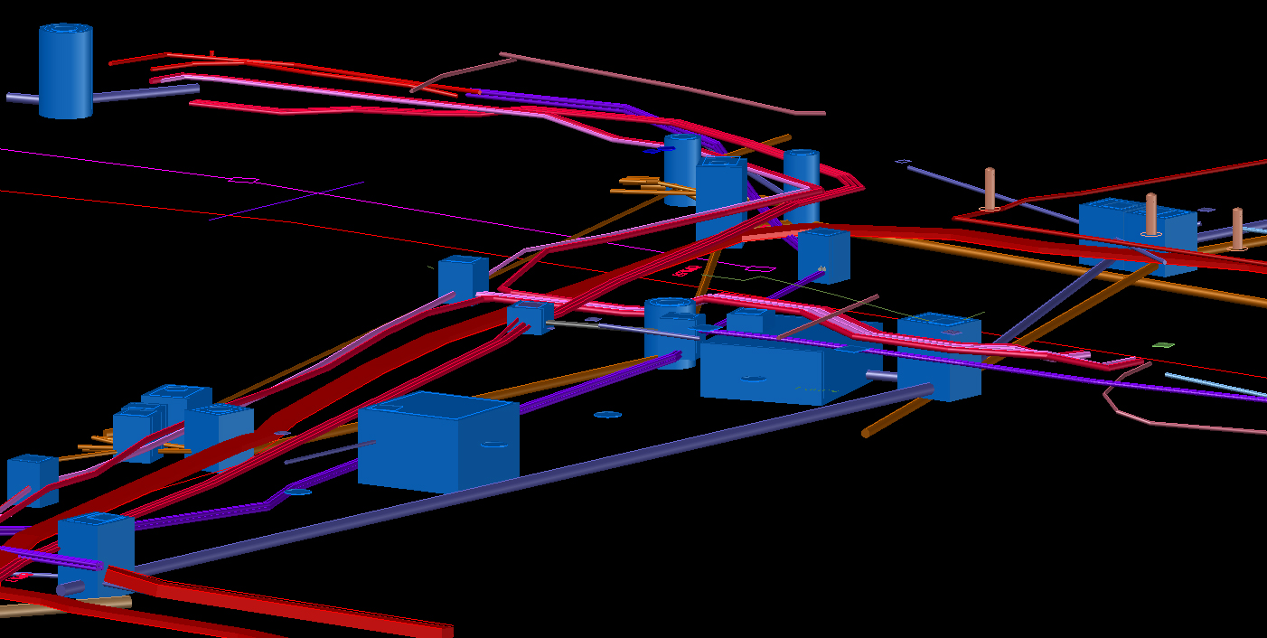
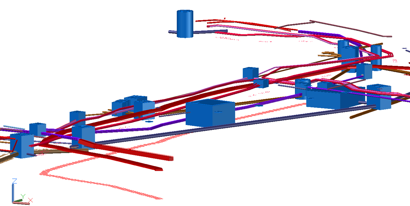
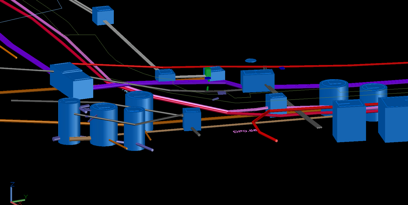
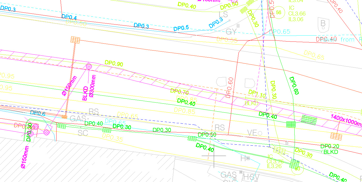
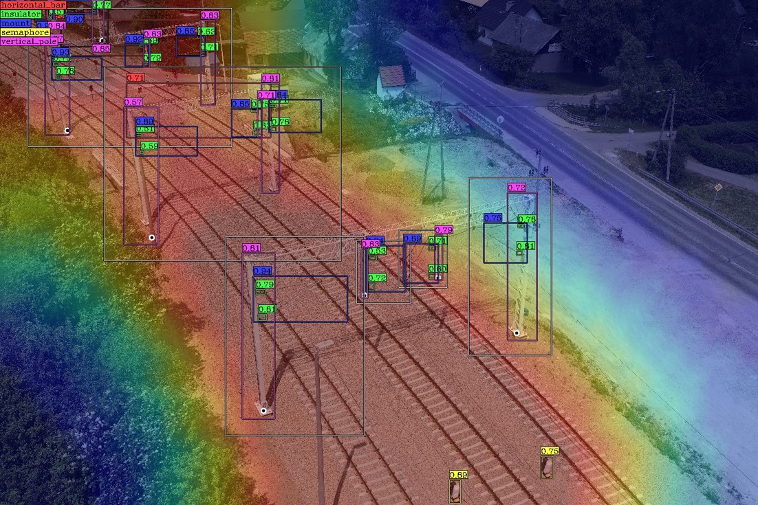
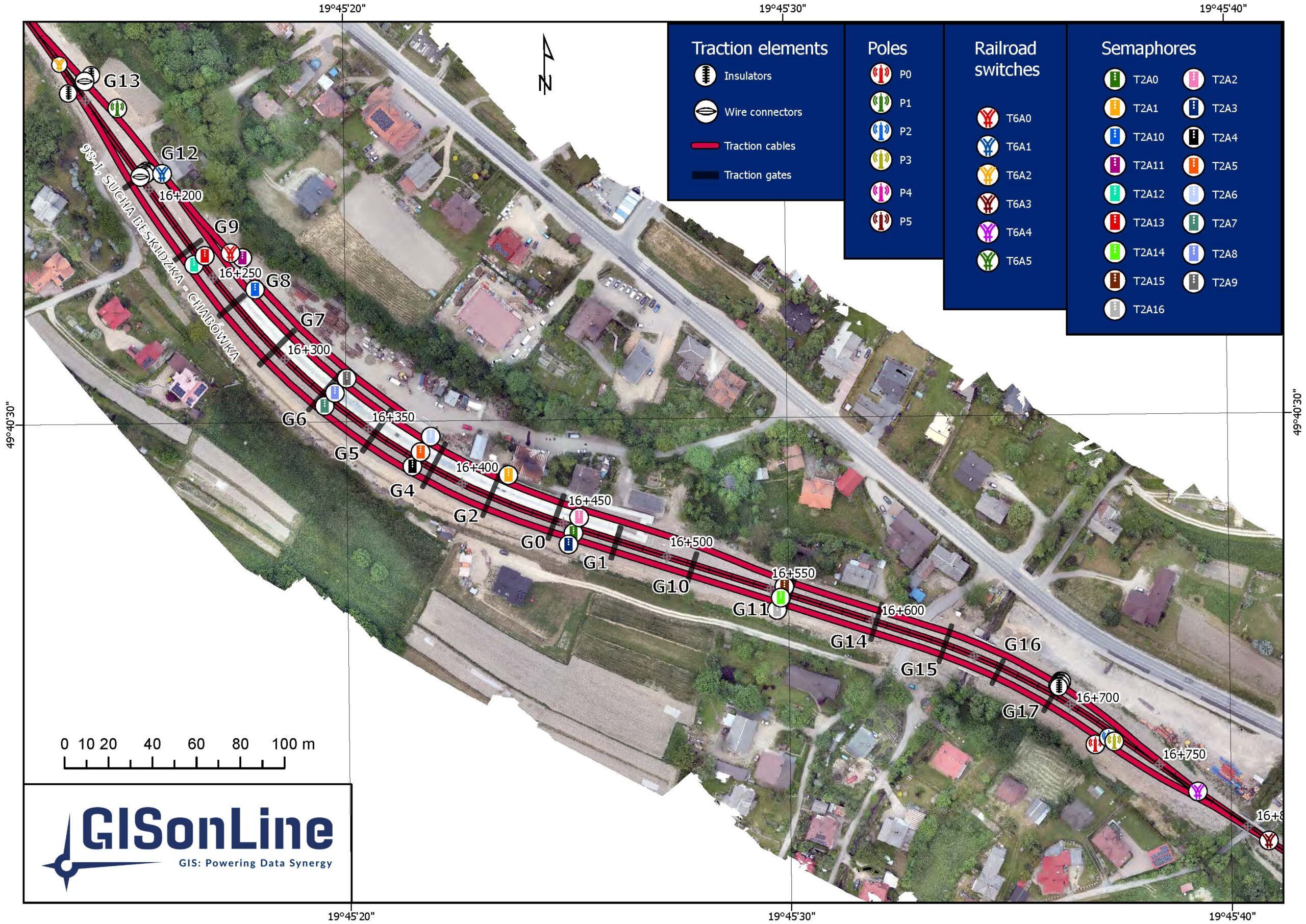
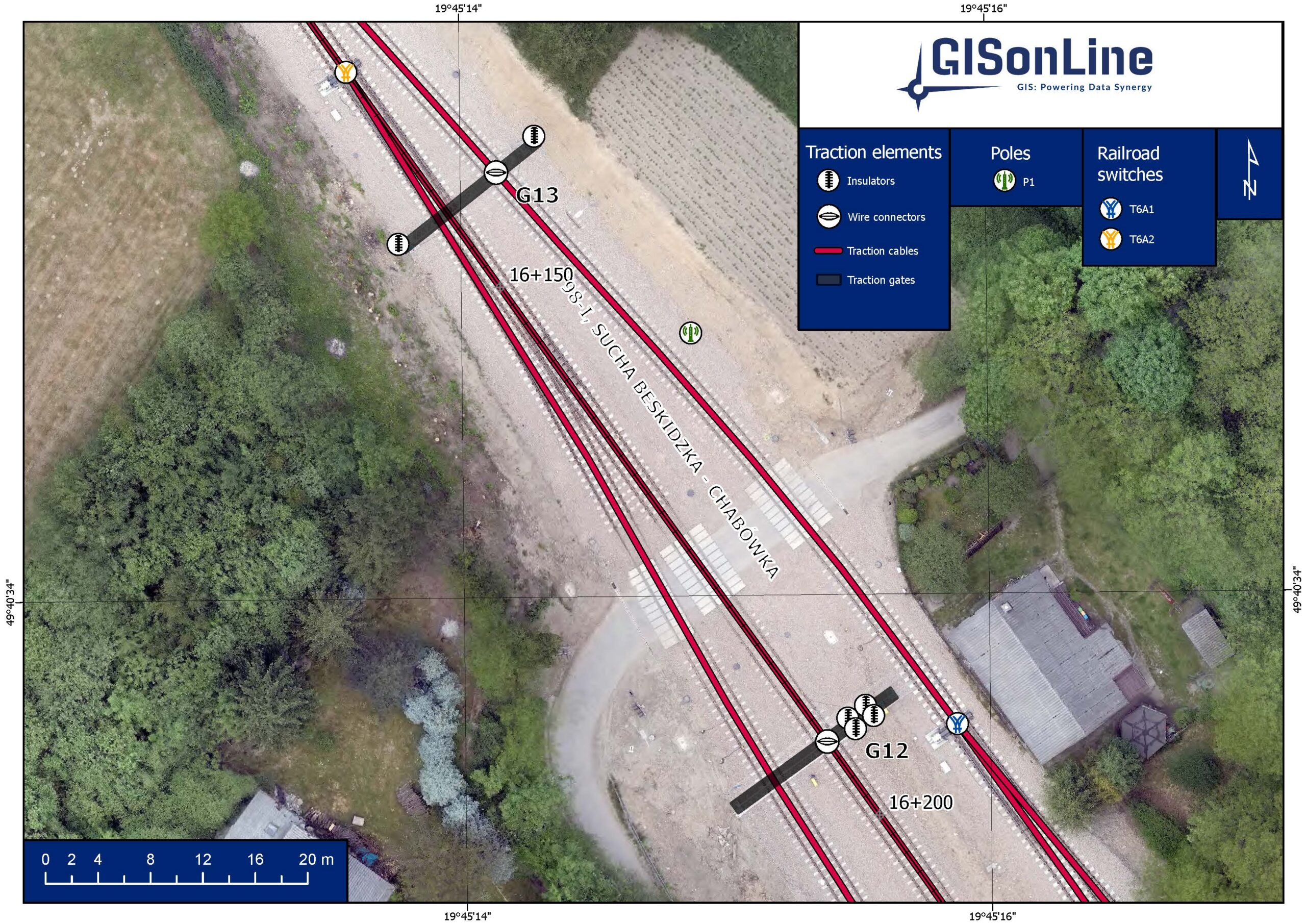
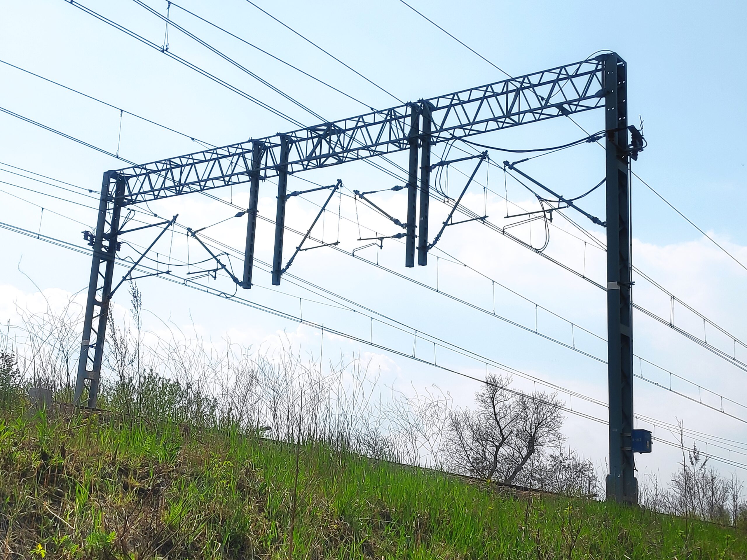
GISonLine collected and processed data from multiple scanning platforms and sensors to obtain accurate measurements and data in support of the planning and analysis of the museum expansions and the safety of construction crews. Data collections included:
- Terrain Laser Scanner (3D models)
- High-resolution photos using Drones
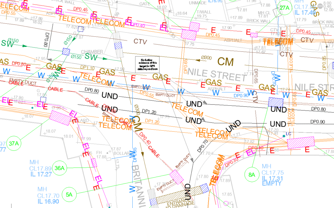
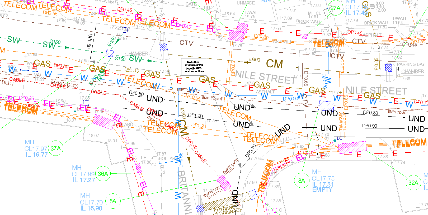
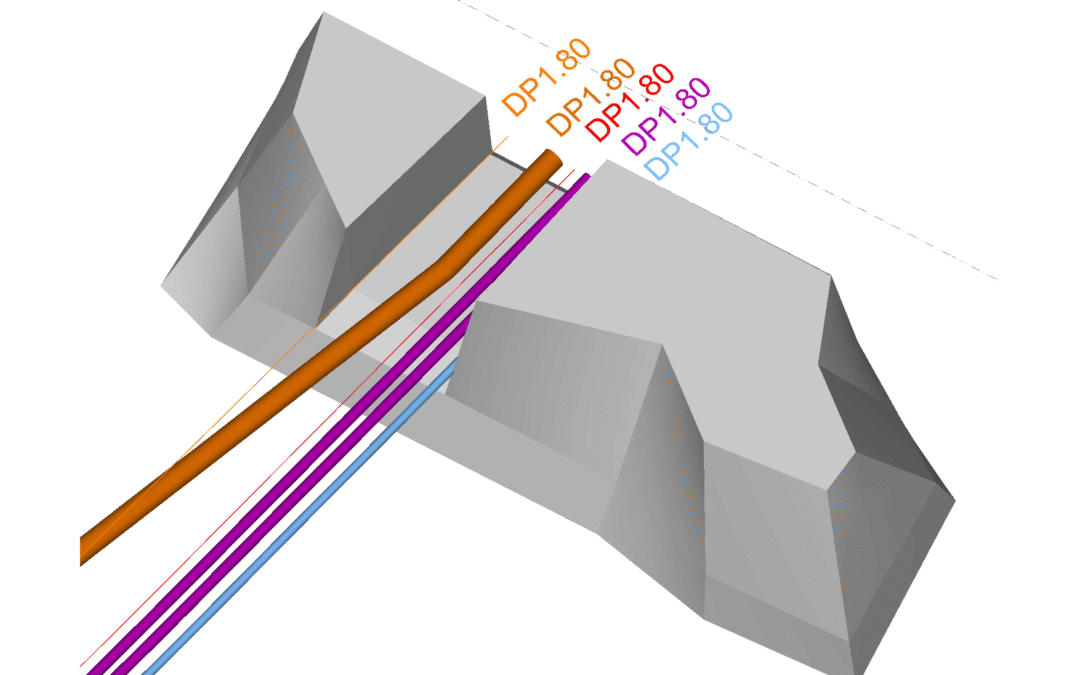
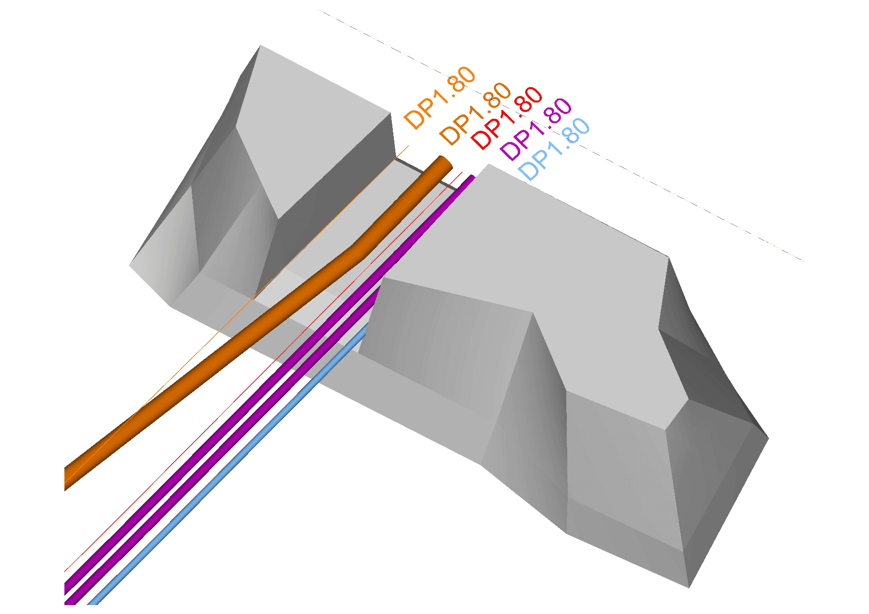
- Ground Penetrating Radar (GPR)
- Advanced sub-surface detectors
The Outcome:
GISonLine successfully completed the project surveys and scanning to produce highly accurate 2D maps and 3D models showing the underground utilities that exist between the existing National Museum complex and the old Cracovia hotel. GISonLine processed the terrain laser scanning data using CAD and 3D modeling software to generate a digital representation & 3D model of the old cracovian hotel for analysis and site visualization.
See some things
we’ve worked on

Contact us
Looking for Location Intelligence?