Case studies
New Quality of Underground Detection Services – Case Study of a Project Delivered in Germany
Client
Industry
Survey & Inspection
Region
Technology
Overview
Client: large European construction enterprise
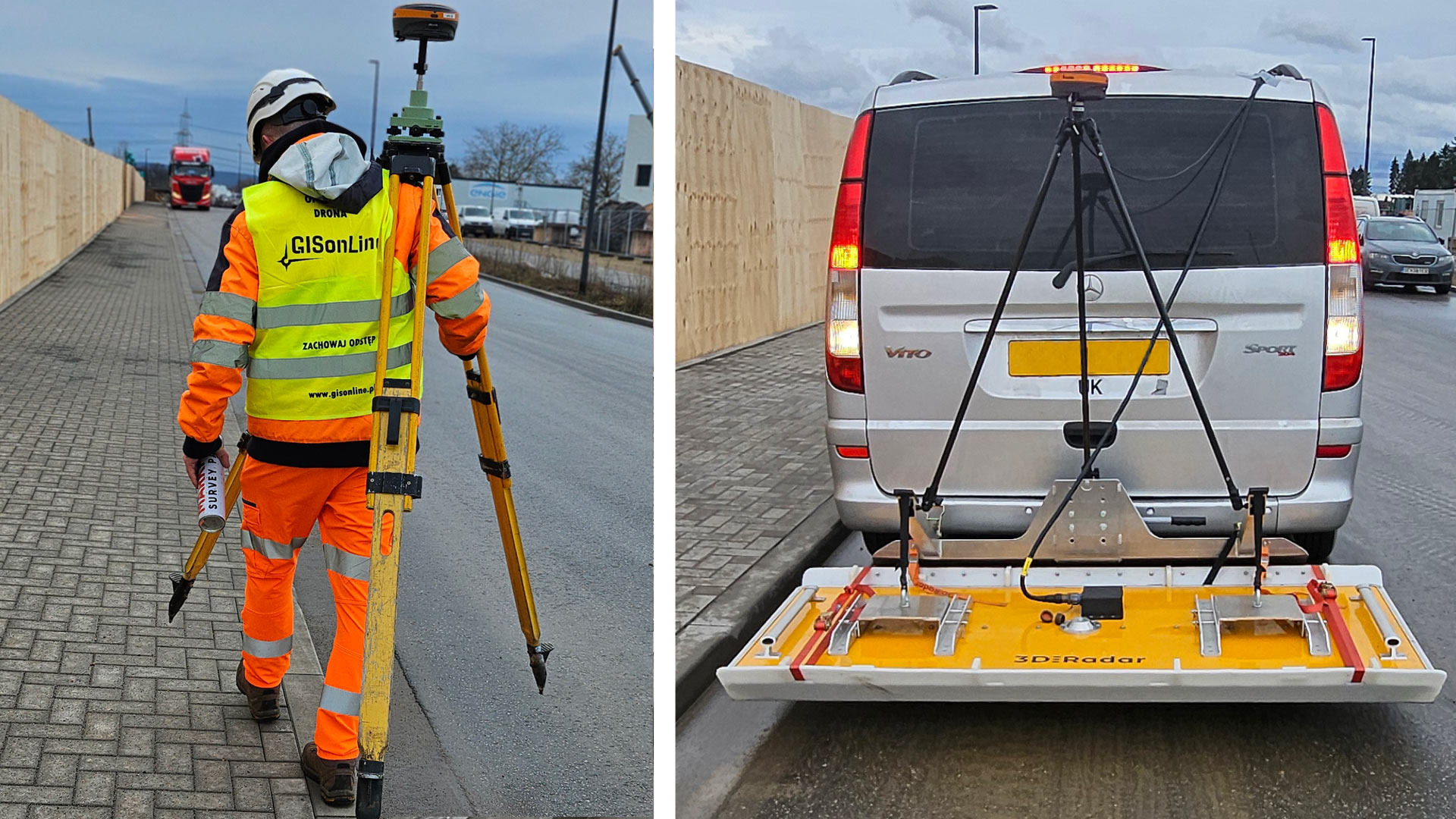
GISonLine delivered an extensive project of underground detection across a post-industrial site of an approximately 100,000 square metres, as a part of the works preparing a planned construction investment. The investigation covered a wide range of underground utilities such as: drainage, water and energy pipes, gas and all other types of underground service infrastructure, located up to 6 meters below the ground surface.
Outcome & Impact
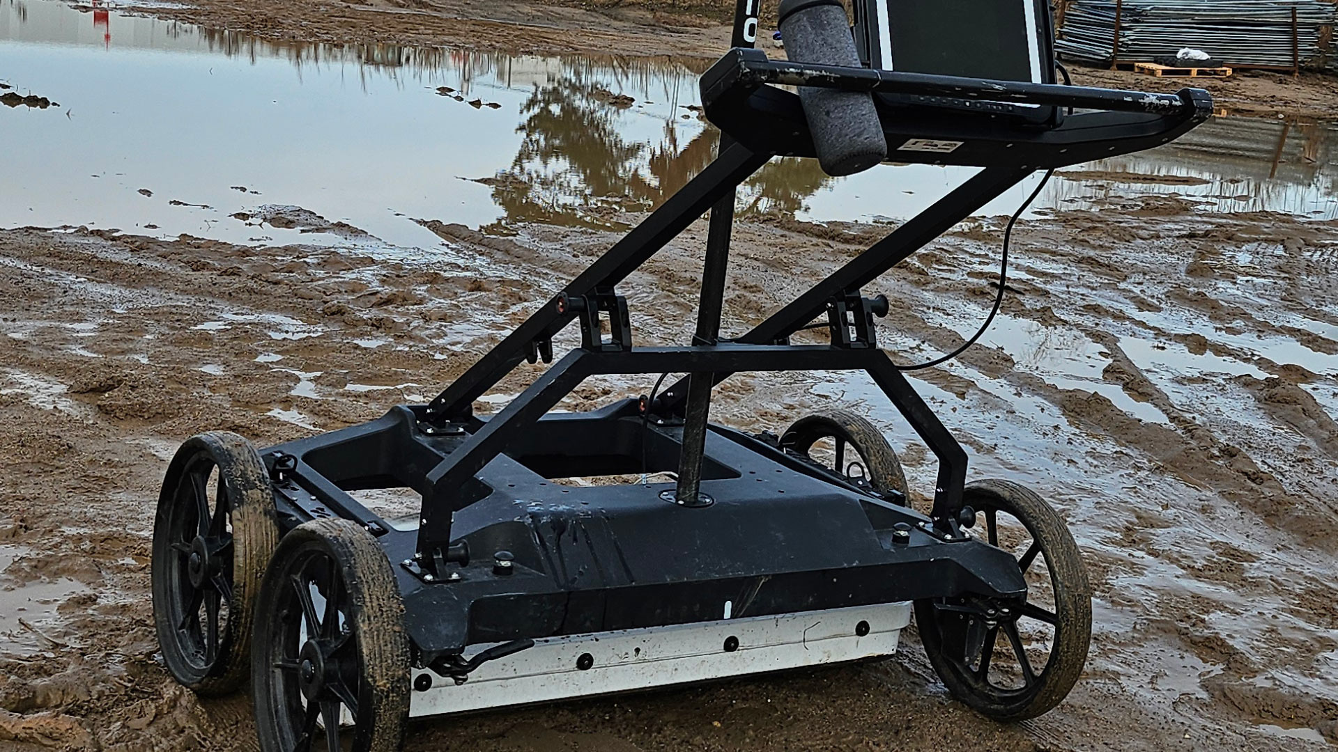
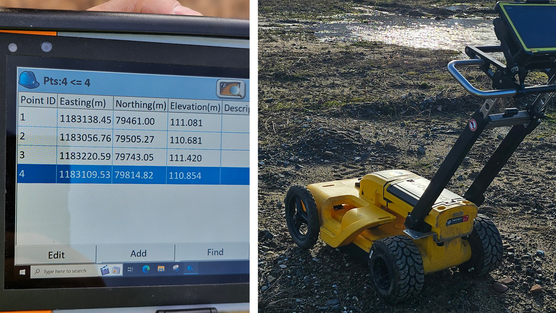
Addressing the Client’s highest quality expectations, we performed the field investigation using three types of different detection devices: EML locators, probes and ground penetrating radars. Among the latter, we used the High Speed 3D Ground Penetrating Radar Array – Raptor which is a state-of-the-art high-speed 3D-GPR Array enabling the very fast collection of 3D GPR data, at speeds in excess of 130 km/hr (80 miles/hour), at 5 cm point intervals. Raptor is capable of survey speeds that eliminate the need for traffic control and safety vehicles. Conventional systems typically operate at no more than 30 km/hr, with similar settings. To the best of our knowledge, we are the Polish first company that offers this technology.
The project was carried out in full compliance with the PAS 128 methodology, an internationally recognized standard for conducting underground utility detection works. This methodology has been approved by the British Standards Institution (BSI), the world’s oldest organization for developing quality standards in engineering projects.
PAS 128 provides a comprehensive set of guidelines for the detection, mapping, and verification of underground infrastructure parameters, including specifications for the minimum required accuracy and quality of acquired data.
In this project, the works specified in PAS 128 were performed under the M4P type, which involves the most labor-intensive approach. It requires the highest density of the measurement grid defined by the standard, along with post-processing of Ground Penetrating Radar (GPR) data. This approach is applied in areas where a particularly high density of underground utilities is expected and/or where the client requires the highest possible measurement accuracy.
Thanks to the experience of the survey team and the use of specialized equipment, the project was successfully completed despite challenging conditions, including low temperatures (January) and muddy terrain (after a rainfall).
