Case studies
Implementation of the GIS system within the Landslide Counteracting System
Client

Industry
Science/Research
Region
Technology
Overview
Client: Polish Geological Institute – National Research Institute
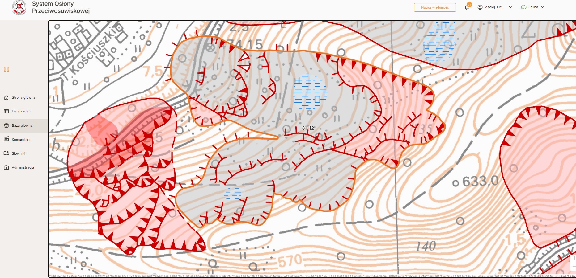
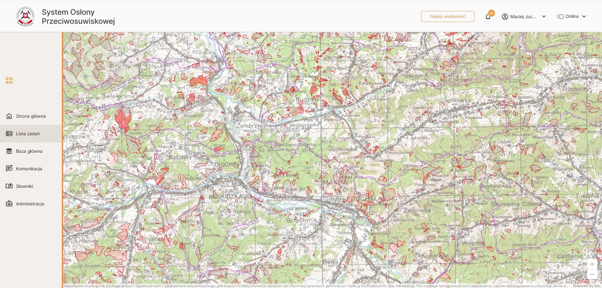
The estimated number of landslides and areas at mass wasting risk in Poland exceeds 100,000, covering considerable areas especially in the southern Poland. GISonLine designed and implemented a comprehensive GIS system used by the National Geological Service for mapping and monitoring landslides, to warn endangered populations and protect private and public property.
The project was carried out by a consortium of companies, GISonLine Sp. z o.o. and Esri Polska Sp. z o.o. GISonLine was responsible for the modernization and development of the system’s functionality using the client’s GIS technology and architecture, as well as implementing technological upgrades. As a result, the client received a webmap application for mapping and monitoring landslides and areas at risk, combining the highest level of data security with a broad range of functionalities. The application is fully compatible with the legal guidelines for reporting upon the landslide risk and is flexible – tailored to the needs of users with different levels of access permissions. It also maintains many of its functionalities in the offline mode, which makes it suitable for use during fieldwork. As a part of the implementation, a three-day training session was conducted, and the entire system was covered by technical support.
The project was delivered in 2024.
Challenges
- High complexity of the network’s architecture and a wide range of application use cases
- Data security requirements, including an architecture based on services with multi-level access authorization and extensive configuration of network areas
- High availability (HA) architecture – the system’s availability and reliability requirements necessitated that every component be redundant. The implementation of HA solutions makes the system more resilient to failures and facilitates the maintenance of up-to-date components
- Client’s expectations for the automation of the form-filling process
- Required modes of operation: both online and offline
- Client’s expectations for a high degree of flexibility for the administrator in assigning user permissions
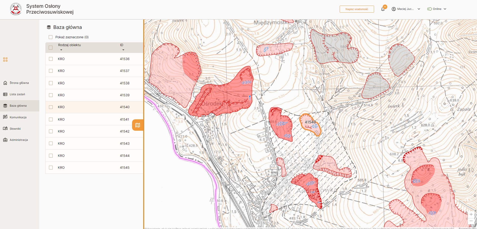
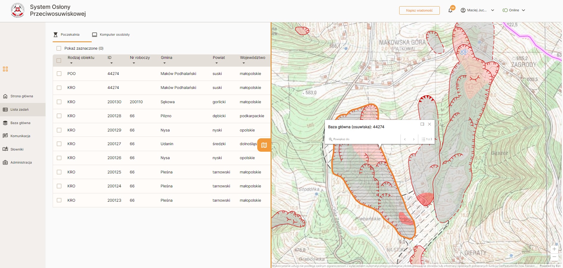
- Comprehensive and immutable (legally defined) scope of registration forms for objects (landslides and areas at risk), with a multi-step process for entering them into the system
- Introduction of a map component displaying the current status of objects
The Outcome
A modern, comprehensive, user-friendly, functional, and secure webmap application (created with HA-class architecture) featuring forms for inventorying new and updating data on existing landslides and areas at risk. Available to users in both online and offline modes, adapted for fieldwork without internet access.
Main strengths:
- wide-ranging automation of the process of filling out registration forms for landslides/areas at risk, compatible with the legally-defined catalog of landslides’ features to be reported.
- approximately 40 attributes (features) generated automatically, based on a dozen spatial analyses of data from multiple sources/services (meeting high expectations of the client in terms of network security, as well as the application’s stability/reliability).
- numerous validation rules applied to ensure the correctness of the data entered.
