Case studies
Local Government Ecological Initiatives Mapping Using Esri ArcGIS Online (Świętokrzyskie Region, Poland)
Client
Industry
Local Government
Region
Europe
Technology
Esri ArcGIS Online
GML
ESRI ArcGIS Pro
FME
Overview
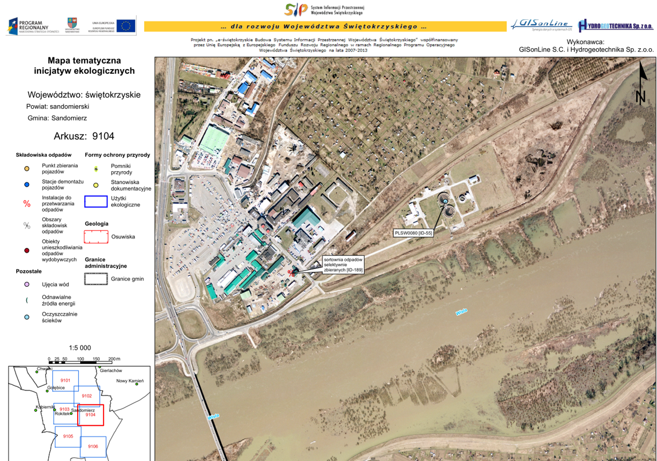
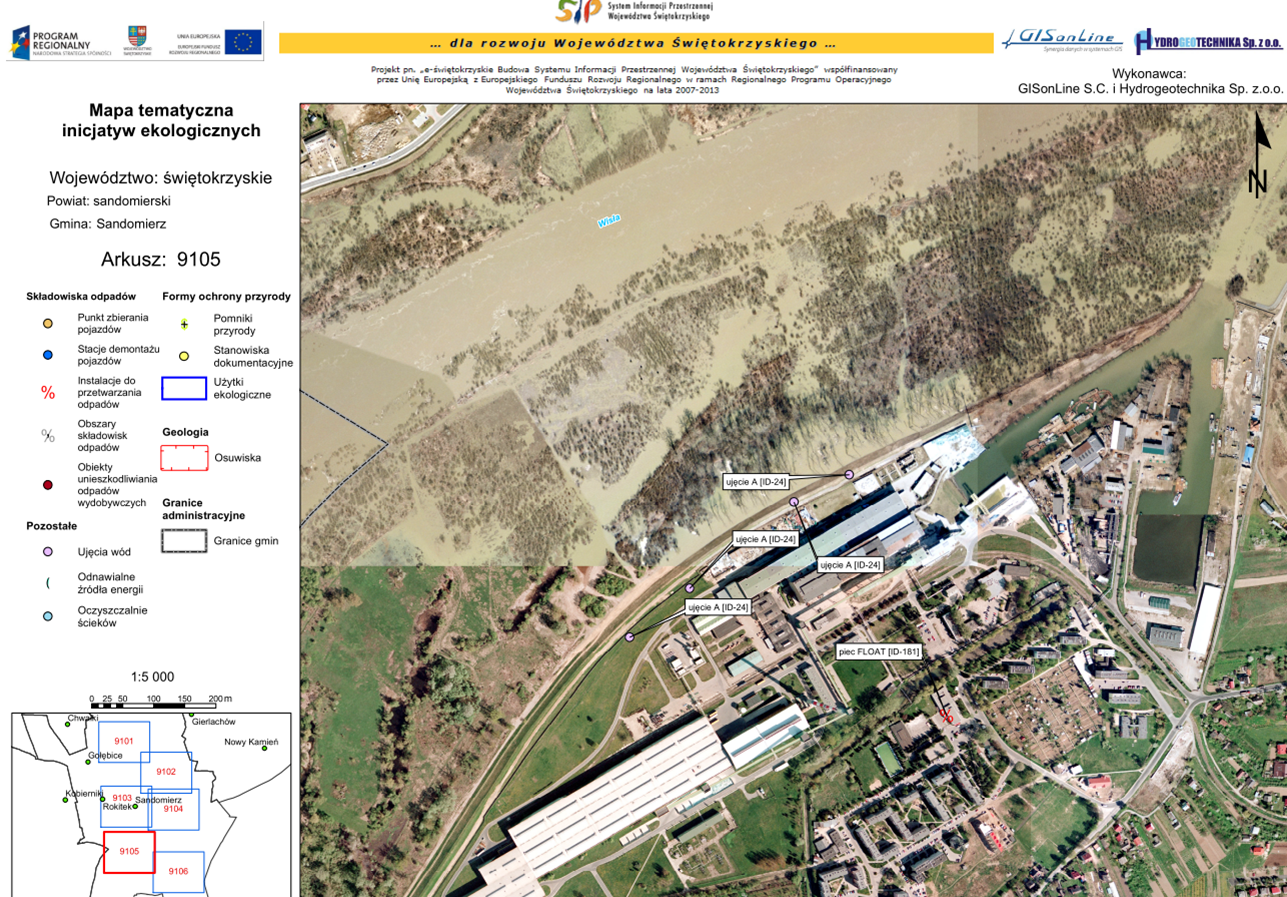
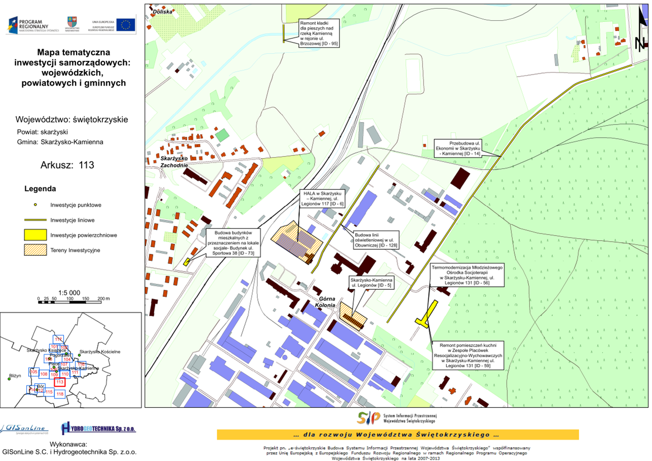
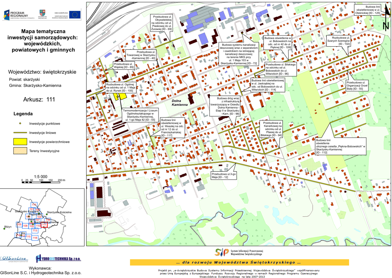
In support of the local government (Świętokrzyskie region in Poland) ecological initiatives and investments, GISonLine was tasked to establish geodatabases and a custom web mapping portal that displayed the thematic maps containing the local government’s investments in ecological projects.
The Impact
As part of the project data was obtained and organized from over 150 institutions and local government units from the Świętokrzyskie region. The data was then used to provide attribute and content information to feed the database and populate the local government web-based mapping platform.
The Outcome
GISonLine successfully collected and developed a set geospatial feature layers (with feature attribution) to establish the thematic database displaying spatially where the investments occured in support of ecological initiatives. The project included creation of a web-based mapping portal using Esri ArcGIS Online and supported the local government representatives and project stakeholders with investment decision support. Deliverables associated with the project included:
- Design and creation of web-based portal using Esri ArcGIS Online
- Packaging and delivery of Esri Shapefiles & GML formats
- Map prints displaying ecological initiatives and their locations
- Instructional training on ArcGIS portal
See some things
we’ve worked on

Contact us
Looking for Location Intelligence?