Case studies
Supporting the Expansion of Amazon’s Fulfillment Centers with Aerial & Underground Detection Mapping
Client
Industry
Energy & Utilities
Survey & Inspection
Region
Europe
Technology
GPR – Lecia DS2000
Detector – Leica Ultra Advanced
GNSS solution – Leica CS20/GS16
Drone DJI – Phantom 4 Pro V2.0
CAD, GPR and Pix4D software
Client: Amazon
Location: Krosno Odrzańskie, Poland
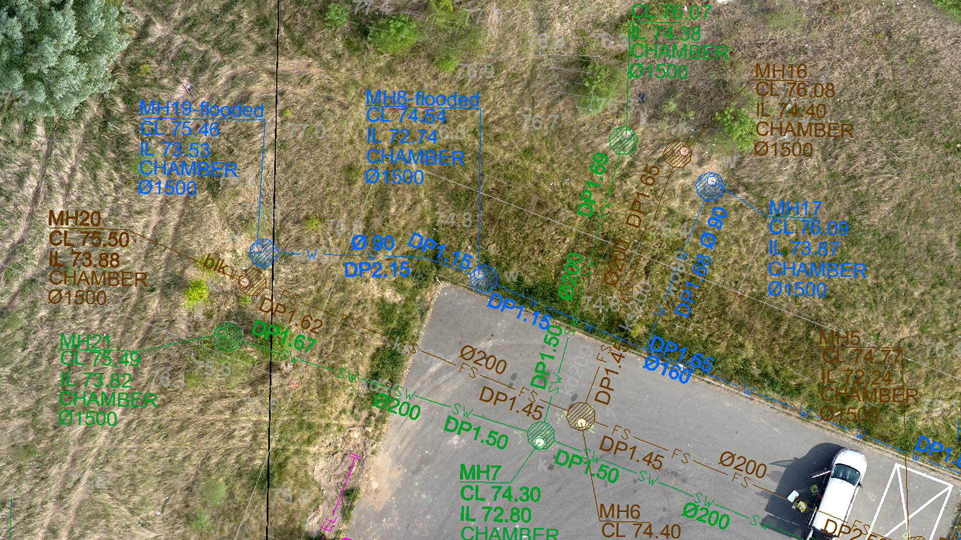
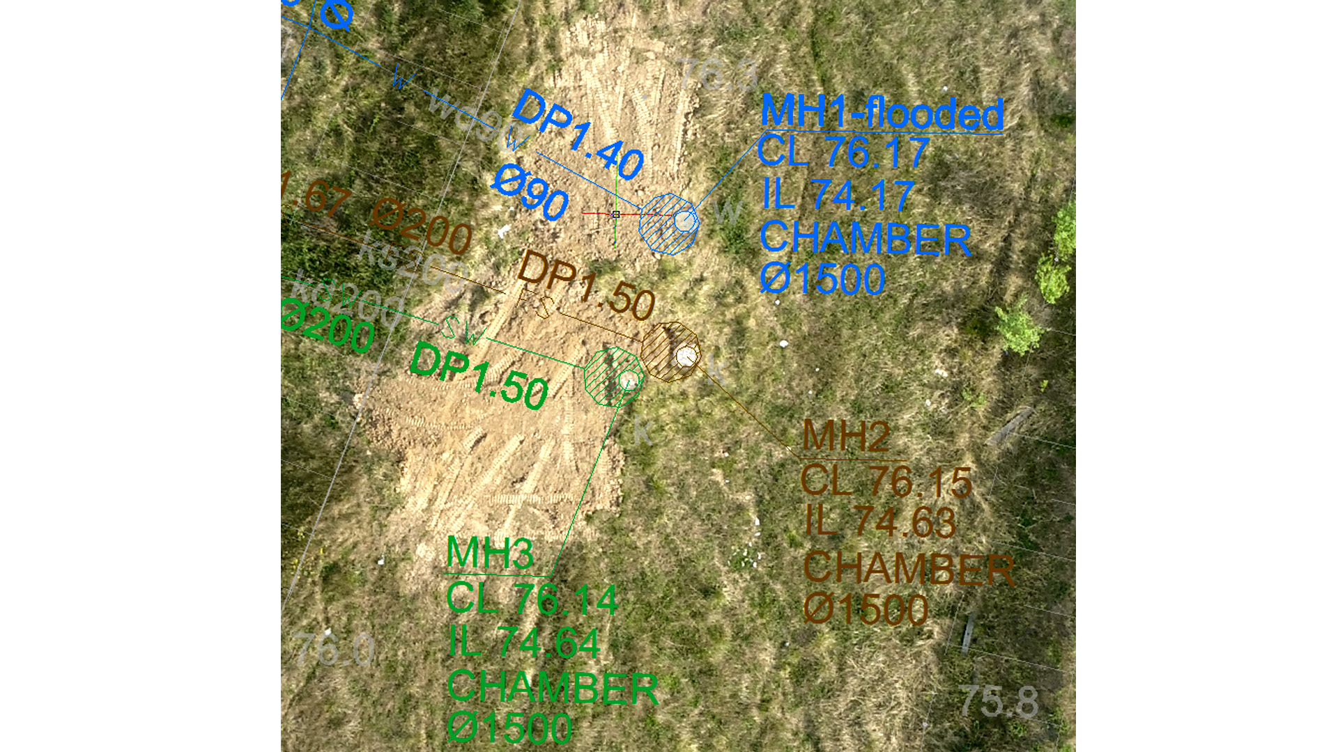
An Amazon fulfillment center is a logistics warehouse where incoming orders are received, stored, packed, and shipped out to customers. Planning for the expansion and construction of a fulfillment center requires comprehensive preparation and understanding of site conditions, underground assets, and environmental factors. Understanding exactly what lies beneath the ground prior to any construction and excavation is a key component to planning and safety.
GISonLine was pleased to participate in the project for underground detection and mapping surveys in support of future investments by Amazon. The surveys were carried out to update cartographic maps , perform geodetic measurements of the topography, and detection and mapping of underground utility lines.
The Impact
To provide a thorough understanding of the area, which encompassed 5 hectares (approximately 12 acres), GISonLine collected aerial photogrammetry pictures using drone platforms with a 4K high-resolution camera. Orthophoto maps of the entire area were established producing a 1.5cm terrain model representing land surface elevations to visualize relief. An underground detection survey was carried out using Ground Penetrating Radar (GPR) to establish a set of 2D maps identifying the underground utilities within the targeted areas of interests.
The Outcome
GISonLine successfully completed the underground detection surveys and site mapping delivering to Amazon a comprehensive and up-to-date model of the type and location of sub-surface utilities (ex: electrical, water, gas) and detailed mapping and imagery of site assets to support Amazon’s planning and expansion of fulfillment centers. The project deliverables included:
- High Resolution Aerial Imagery
- Orthophoto Maps
- Digital Terrain Model
- 2D maps outlining the type and location of underground utilities
See some things
we’ve worked on

Contact us
Looking for Location Intelligence?